 MineArchive
Rampgill Mine
| Location | Nenthead, Alston Moor, Cumbria — 54.7873, -2.3253 (approximate) |
|---|---|
| Commodities | Lead, Zinc |
| Type | Metal |
| Worked | 1690 (Rampgill Vein discovered)–1949 |
| Operators | London Lead Company (1737–1882), Nenthead and Tynedale Zinc Company (1882–1896), Vieille Montagne Zinc Company (1896–1949) |
Overview
Rampgill, at Nenthead on Alston Moor, was one of the most extensive and productive mines in a district once responsible for a remarkable share of Britain's lead and zinc — worked in turn by a pioneering Quaker company and then a Belgian zinc-smelting firm, whose purpose-built mill here processed 60% of the entire country's zinc ore output at its peak.
History
The Rampgill Vein was discovered in 1690, and Rampgill became one of the principal mines of the London Lead Company's Nenthead operations from the mid-18th century, worked initially for lead, with production peaking in the 1820s before entering a gradual decline; the London Lead Company gave up its last Nenthead leases in 1882. The leases passed to the Nenthead and Tynedale Zinc Company, who worked the ground for its zinc content, and were in turn succeeded in 1896 by the Belgian Vieille Montagne Zinc Company, who found the mines productive enough that they were soon accounting for around 60% of Britain's entire zinc-ore output. A fire destroyed Nenthead's old central ore-dressing mill in 1905, and Vieille Montagne used the opportunity to build an entirely new mill at Rampgill itself, completed and in full production by 1910 at a cost of over £42,000; the finished lead and zinc concentrate was sorted, crushed and cleaned there before being shipped by road, rail and sea to the company's parent smelting works in Belgium. Vieille Montagne finally sold its Nenthead leases, plant and equipment in 1949, after 53 years working the district, and the mine has been disused since, though a 2013 exploratory drilling programme by a Canadian company confirmed significant zinc deposits remain around 150 metres below the surface, too deep to reach with the old workings. The Rampgill Horse Level was begun by the Greenwich Hospital in 1736, following the Scaleburn Moss Vein until it met the Fairhill Vein and then the Rampgill Vein itself. The lease was sold to the London Lead Company in 1745, which developed the mine quickly and found Rampgill Vein and its neighbours exceptionally rich. By the end of the nineteenth century most of the Rampgill Vein above the water table had been worked out. Between 1899 and 1921 the Vieille Montagne Zinc Company reworked veins here and at Coalcleugh for zinc, using the Rampgill Horse Level to reach the Coalcleugh workings, and the same level served as a haulage way for the eastern workings of the Middlecleugh and Longcleugh veins in Smallcleugh Mine.
Geology
Rampgill is a vein mine on the Alston Moor orefield, worked for lead and later for zinc. The Rampgill Vein was the main working, met by way of the Scaleburn Moss and Fairhill veins, and the mine's levels also reached the Middlecleugh and Longcleugh veins. Most of the Rampgill Vein above the water table was exhausted by the end of the nineteenth century, which is what turned the later companies to zinc in the veins below and beside it. A 2013 drilling programme confirmed significant zinc remaining around the workings.
Geological setting: Hydrothermal Deposits (well documented example), Veins and Lodes (well documented example)
Workings
The mine is reached by the Rampgill Horse Level, a long stone-arched and rock-cut haulage level driven from 1736 which became the trunk route for a system running to Coalcleugh in one direction and to the Smallcleugh veins in the other. Above and below it the veins were worked in stopes that in places run up out of sight, and haulage within the mine was worked by horse gin as well as by the level's tub tracks. The Rampgill Mill, completed in 1910, dressed the ore at surface.
Closure
Vieille Montagne sold its Nenthead leases and plant in 1949, ending large-scale working; some smaller-scale activity continued in the district into the 1960s, but Rampgill itself has been disused since, its horse level partly collapsed until partial restoration work in 2006.
What remains
The mine is dry in parts and standing in water elsewhere: an account of March to May 2016 found water at boot depth along the horse level, dropping away in the Scaleburn workings, with the original tub tracks still in place, carefully built stonework alongside rough-hewn rock, ochre staining, and stopes opening through the roof. Several roof collapses along the level have been partly dug through. The remains of an old horse gin survive in the Low Borehole Sump chamber. The Top Sills level above is in very poor strata with unstable slabby roof. An account of October 2012 noted that where the original builders used concrete they lined the shuttering with newspaper to help it strip, and scraps of that paper are still stuck to the ceiling a century later.
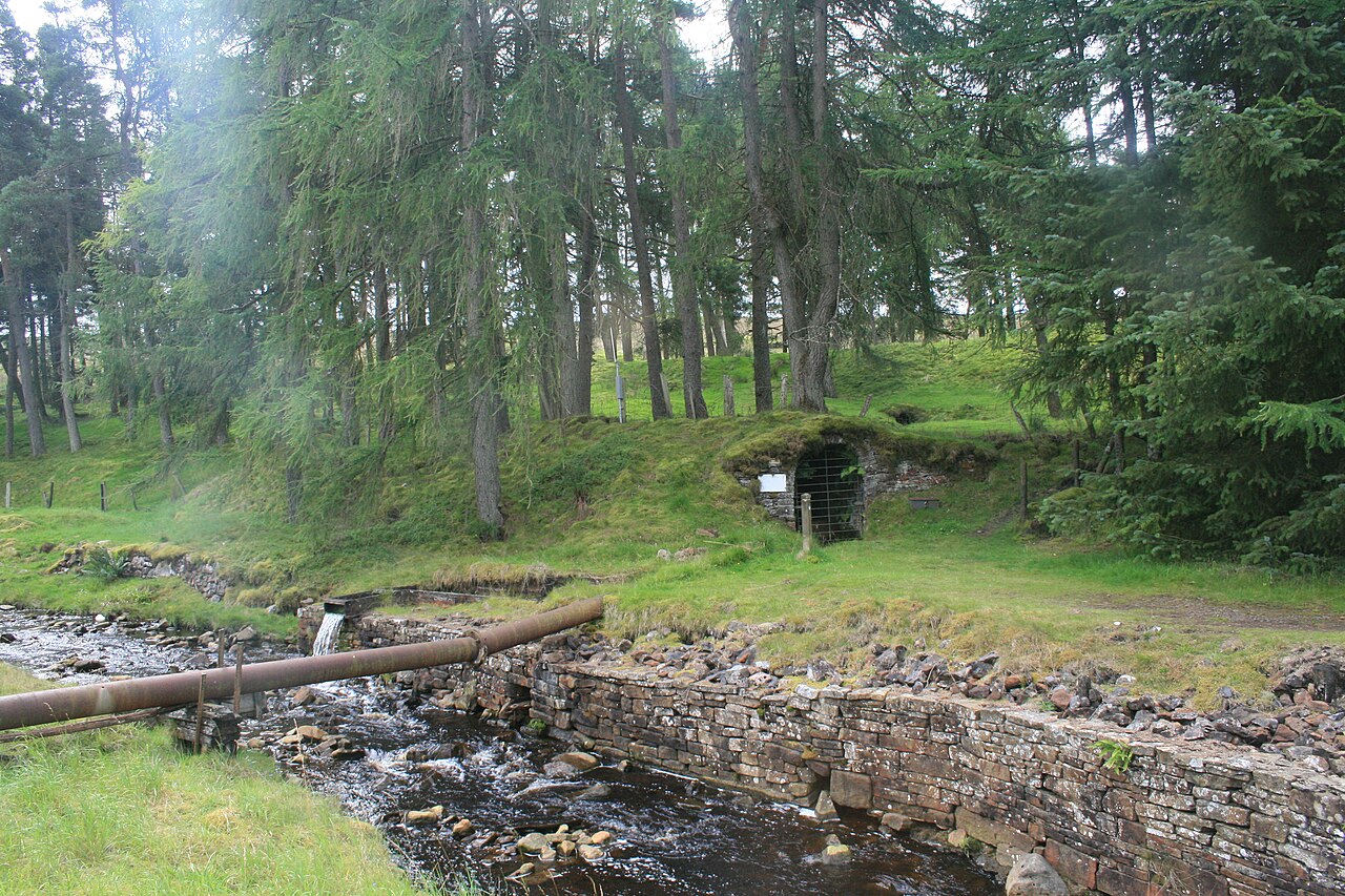
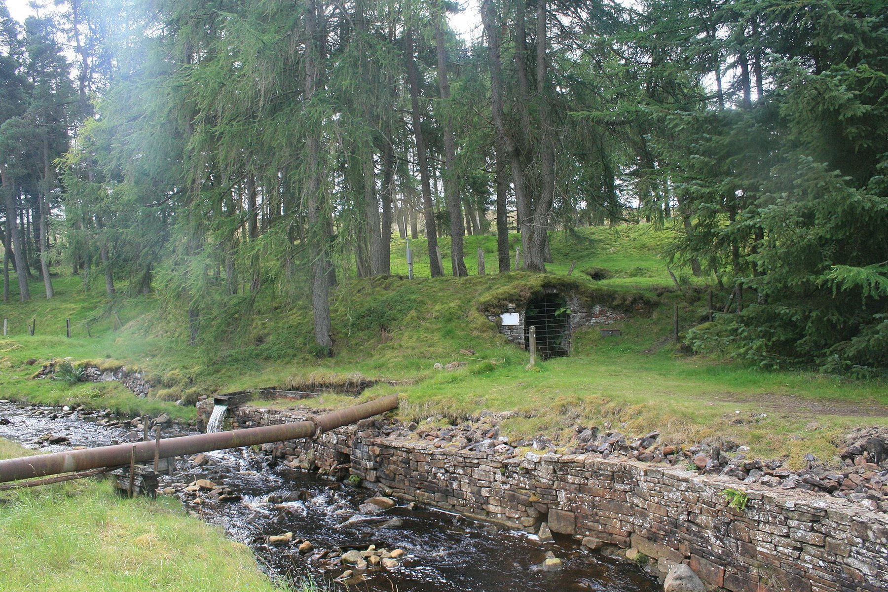
The gated stone archway of the Rampgill Level survives at Nenthead and is the mine's public face, photographed in August 2023. The dressing floor and the site of the 1910 mill lie around it within the Nenthead mines complex.
Related mines
- Carrs Mine — Carrs follows the Rampgill Hangingshaw branch level and its horse level drains through sumps down into Rampgill beneath.
- Carshield Mine — The Barneycraig Vein connects with Rampgill Mine and the Whitewood Vein is the continuation of the Rampgill Vein; Vieille Montagne drove from Rampgill Shaft to join the Barneycraig Level and took every ton of this ground's ore out through the Rampgill portal.
- Coalcleugh — Both were worked by the same operator, the Vieille Montagne Zinc Company.
- Longcleugh Mine — The Longcleugh Vein's eastern workings were hauled out through the Rampgill Horse Level.
- Nent Force Level — Brewery Shaft at Nenthead, 3.6 metres in diameter and concrete lined, goes down to both the Nent Force Level and Rampgill, which is the Nenthead end the level was driven towards.
- Smallcleugh Mine — The Rampgill Horse Level served as the haulage way, by the Hanginshaw Branch Level, for the eastern workings of the Middlecleugh and Longcleugh veins in Smallcleugh.
Nearby mines
- Longcleugh Mine — 0.4 miles (0.6 km) W
- Nentsbury Mine — 0.4 miles (0.6 km) SW
- Dowgang Mine — 0.4 miles (0.7 km) W
- Carrs Mine — 0.5 miles (0.8 km) SW
- Middlecleugh Mine — 0.6 miles (1.0 km) S
Straight-line distance, within 9 miles (15 km). Show on the map.
Recorded claims
Individual factual claims, each attached to the source(s) that support it below. Where sources disagree, both are kept.
- The Rampgill Mill, completed in 1910 at a cost of over £42,000, had an annual output of around 2,000 tons of lead and 10,000 tons of zinc blende — around 60% of the total zinc ore raised in the whole United Kingdom at the time. 1
- A 2013 exploratory drilling programme by a Canadian mining company confirmed significant zinc deposits around 150 metres below the surface, too deep to reach with the historic workings. 2
- The Rampgill Horse Level was begun by the Greenwich Hospital in 1736, following the Scaleburn Moss Vein until it reached the Fairhill Vein and then the Rampgill Vein. The lease was sold to the London Lead Company in 1745. 3
- By the end of the nineteenth century most of the Rampgill Vein above the water table had been worked out. 3
- Between 1899 and 1921 the Vieille Montagne Zinc Company reworked veins in Rampgill and at Coalcleugh for zinc ore, the Rampgill Horse Level serving the Coalcleugh workings; the same level was a haulage way, by the Hanginshaw Branch Level, for the eastern workings of the Middlecleugh and Longcleugh veins in Smallcleugh Mine. 3
- An account of March to May 2016 describes water at boot depth along the horse level, original tub tracks still in place, dressed stonework beside rough-hewn rock, stopes opening up through the roof, several partly dug-out collapses, the remains of a horse gin in the Low Borehole Sump chamber, and the Top Sills level above standing in very poor, unstable strata. 4
- Where the mine's builders used concrete they lined the shuttering with newspaper so it would strip cleanly; an account of October 2012 records scraps of that newspaper still adhering to the ceiling. 3
Photographs & further reading
A dated underground photographic record of one vein working, with the tub tracks, stonework, stopes, collapses and the surviving horse gin.
View sourceA dated underground record with the mine's history from 1736 and the newspaper still stuck to its century-old concrete.
View sourceSources
- (secondary) Vieille Montagne History — Alston Moor Historical Society
- (secondary) Rampghill mine — Wikipedia
- (observational) Rampgill Lead/Zinc mine, Cumbria, October 2012 — 28DaysLater
- (observational) Scaleburn Vein, Rampgill Mine, Nenthead (March-May 2016) — 28DaysLater
- (primary) BGS/Mining Remediation Authority mine plans — longitudinal section of Rampgill, Barneycraig and Swinhope workings — British Geological Survey / Mining Remediation Authority
- (primary) Rampgill Mine Plan (BGS Mine Plans Catalogue) — British Geological Survey
Record created: 22 August 2026 · Last researched: 23 September 2026