 MineArchive
Nent Force Level
| Also known as | Nentforce Level, Smeaton's Folly |
|---|---|
| Location | Nent valley, Alston Moor, Cumbria — 54.8152, -2.4371 (approximate) |
| Commodity | Lead |
| Type | Metal |
| Worked | 1776–c.1810 |
| Maximum depth | Unknown. |
| Operators | Greenwich Hospital (1776–?) |
Overview
A four-mile drainage level driven under Alston Moor to dewater the Nent Valley's lead mines, designed by the engineer John Smeaton and built, in fits and starts, over 66 years. It never achieved its goal of finding new ore, and became known instead as a Victorian tourist attraction, offering underground boat trips through some of the largest man-made passages in the northern Pennine orefield.
History
Nent Force Level was designed by the civil engineer John Smeaton, already famous for the Eddystone Lighthouse, and driven from an entrance near Alston under the course of the River Nent toward Nenthead. Construction began on 10 June 1776, funded by the Commissioners of Greenwich Hospital - who administered the mineral rights of the Greenwich Hospital estate on Alston Moor - at a cost that eventually reached around £80,000. The level's dual purpose was to drain the lead mines of the Nent valley to allow deeper working, and to explore for new mineral veins along its course.
Progress was slow and intermittent: sixty-six years in all. It was first driven only three feet six inches wide, and in 1777 enlarged to eight feet square so that it could serve as a canal and float waste rock out of the mines it cut. Many stretches went larger still, sixteen to twenty feet, and the whole reached just over four miles. The first section was cut along the dead line to Nentsbury, about three miles from the entrance, where a ventilating shaft was sunk and connected to it; a second section of about a mile and a half carried on from the Nentsbury shaft to the Wellgill shaft. Funding repeatedly ran out before the level reached Nenthead as intended; it is usually described as substantially complete by around 1810, with further work continuing into the 1840s. Contemporary observers were struck by its scale: the mining writer Westgarth Forster (1821) and the engineer Thomas Sopwith (1833) both described it as a 'great' or 'stupendous aqueduct'.
Commercially, the level was judged a disappointment: it found no significant new mineral veins along its course, and by 1890 it was being called a 'total failure' as a prospecting tool, earning the nickname 'Smeaton's Folly'. Its drainage function was later superseded by hydraulic pumps. What it did become, through the first half of the 19th century, was a genuine visitor attraction: local inns arranged underground boat trips in thirty-foot boats, propelled by sticks projecting from the sides of the level, so that daytrippers could be rowed through the passages to view the geological formations and mineral veins exposed along the way. The mining company kept the boats until about 1900, long after the trips had stopped.
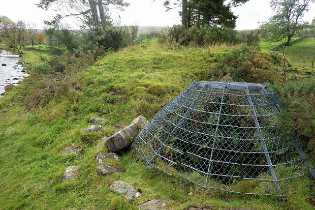
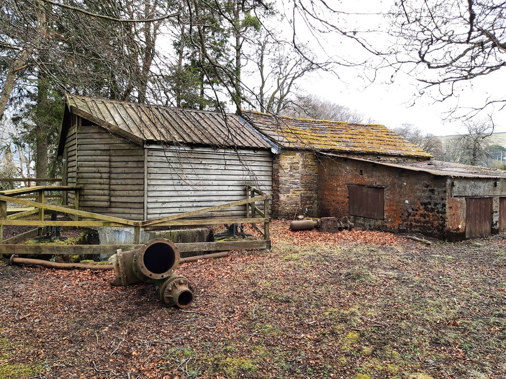
The shafts are what a visitor sees of it now. The last one into the canal level, at Nentsberry, was sunk between 1811 and 1817, 360 feet deep and about ten feet across, with the drive continuing towards Nenthead 150 feet higher up the shaft; it is capped today and carries a viewing platform. The Lovelady Shield Shaft was dug to ventilate the level and survives covered. At the Nenthead end, Brewery Shaft - 3.6 metres in diameter and concrete lined - goes down to the Nent Force Level and to Rampgill, the mine the level was aimed at from the beginning.
Geology
Not a mine but a drainage and exploratory level, driven to unwater the lead mines of the Nent valley and to prospect for new veins along its course. It starts in the shale beneath the Scar Limestone and cuts the Scar and Tynebottom limestones of the Alston Block, rising less than a degree towards the east apart from a gentle six-degree monoclinal rise where it approaches Lovelady Shield Shaft; the lowest horizon it reaches may be some fifty feet above the Tynebottom Limestone. The prospecting was the part that failed: no significant new vein was found along four miles of driving, which is itself a fact about the ground - by the late eighteenth century the Nent valley's veins were already known.
Workings
A single long level, driven in two sections: the first along the dead line to Nentsbury, about three miles from the Alston portal, and a second of about a mile and a half from the Nentsbury shaft to the Wellgill shaft, making just over four miles in all. Designed nine feet by nine, it was first cut only three feet six inches wide, enlarged in 1777 to eight feet square so that boats could float waste rock out, and driven to sixteen or twenty feet along much of its course - among the largest man-made underground passages in the northern Pennine orefield. Shafts were sunk to it at Nentsbury, Wellgill, Lovelady Shield and, at the Nenthead end, Brewery Shaft.
Closure
The level was never finished to Nenthead as intended, and by 1890 was written off as a prospecting failure; its drainage work was later taken over by hydraulic pumps. The mining company kept the tourist boats until about 1900, though the trips themselves had stopped by mid-century. The level itself was never closed in the sense a mine is: it still carries water, and its shafts are capped rather than filled.
What remains
The original Alston portal was destroyed by later quarrying on the site. The level itself survives and has been surveyed underground in recent years, and there have been periodic proposals to develop a heritage centre that would open part of it to visitors again; none has so far come to anything. It is not open to the public. The Nentsberry Haggs Shaft is capped and carries a viewing platform, and the level has collapsed at that point.
The shafts. Nentsberry Haggs Shaft, sunk 1811-17 and 360 feet deep, is capped and carries a viewing platform; the Lovelady Shield ventilation shaft survives covered; and at the Nenthead end Brewery Shaft, 3.6 metres across and concrete lined, still goes down to the level. The Alston portal itself was quarried away.
Related mines
- Nentsberry Haggs Mine — The level runs through the Nentsberry Haggs ground and the mine's shaft, sunk 1811-17, is the last shaft into the canal level; the Old Cumbria Gazetteer files that shaft under the Nent Force Level's own name.
- Rampgill Mine — Brewery Shaft at Nenthead, 3.6 metres in diameter and concrete lined, goes down to both the Nent Force Level and Rampgill, which is the Nenthead end the level was driven towards.
Nearby mines
- Blagill Mine — 1.2 miles (2.0 km) E
- Holyfield Mine — 1.6 miles (2.5 km) SE
- Dowpot Syke and Guttergill Mine — 2.0 miles (3.2 km) SE
- Hudgill Burn Mine — 2.2 miles (3.5 km) SE
- Nentsberry Haggs Mine — 3.1 miles (4.9 km) E
Straight-line distance, within 9 miles (15 km). Show on the map.
What's uncertain
Points where sources disagree or the record could not be settled; both accounts are kept. All open questions in the archive.
- Wallace, writing in 1890, records that the proposal to drive underground canals may have come from John Gilbert, of Bridgewater Canal fame, who was a shareholder in mines on Middle Fell; the memoir judges that Walton probably had more direct influence on the work here than the named engineer. (disputed) 7
Recorded claims
Individual factual claims, each attached to the source(s) that support it below. Where sources disagree, both are kept.
- Construction of Nent Force Level began on 10 June 1776 to a design by the engineer John Smeaton, funded by the Commissioners of Greenwich Hospital at a cost of around £80,000. 1
- Though designed at nine feet by nine feet, the level was driven much larger along many stretches, expanding to between sixteen and twenty feet in height and width. 1
- The level runs about three and a quarter miles from its Alston entrance to Nentsbury engine shaft. 1
- By 1890 the level was being described as a 'total failure' for its goal of finding new mineral veins, and it became known as 'Smeaton's Folly'. 1
- During the first half of the 19th century the level was a tourist attraction, with visitors rowed through the passages in thirty-foot boats propelled by wooden projections; the mining company retained the boats until around 1900. 1
- The original Alston portal was destroyed by later quarrying on the site. The level itself survives underground. 2
- The level is an underground canal of just over four miles linking the Nenthead mines to Alston. It took sixty-six years to drive, at a cost of about £80,000, and became known as Smeaton's Folly. 3
- It was first driven three feet six inches wide, and in 1777 was enlarged to eight feet square so that it could be used as a canal to carry waste rock out of the mines it intersected. 3
- The first section was cut along the dead line to Nentsbury, about three miles from the entrance, where a ventilating shaft was sunk and connected to it; the second, about a mile and a half long, ran on from the Nentsbury shaft to the Wellgill shaft. 3
- The boats were thirty feet long and were propelled by sticks projecting from the sides of the level. The mining company kept them until about 1900, though the underground voyage was a visitor attraction only in the first half of the nineteenth century. 3
- The last shaft into the canal level, at Nentsberry, was sunk between 1811 and 1817 to a depth of 360 feet and about ten feet in diameter; the drive continues towards Nenthead 150 feet higher up the shaft. It is capped, with a viewing platform. 4
- The Lovelady Shield Shaft was dug to ventilate the level, and survives covered. 5
- Brewery Shaft at Nenthead is a concrete-lined shaft 3.6 metres in diameter which goes down to the Nent Force Level and to Rampgill. 6
- The memoir places the portal at NY 7198 4677, now obscured by quarrying in the Scar Limestone, with the level starting in the shale beneath that limestone. The drive cut the Scar and Tynebottom limestones, rising less than one degree eastward apart from a gentle monoclinal rise of six degrees approaching Lovelady Shield Shaft that extends 450 feet beyond it. The lowest horizon cut may be about 50 feet above the Tynebottom Limestone. 7
- It was decided from the commencement of driving to keep the tunnel dead flat, and the plan to use boats for underground transport followed soon after - which is why the level was driven to a minimum cross section rather than the usual size of a drainage adit. 7
- Wallace, writing in 1890, records that the proposal to drive underground canals may have come from John Gilbert, of Bridgewater Canal fame, who was a shareholder in mines on Middle Fell; the memoir judges that Walton probably had more direct influence on the work here than the named engineer. (disputed) 7
- When Westgarth Forster wrote in 1821 the level was approaching Nentsberry Haggs Engine Shaft at NY 7557 4804, where water-wheel-driven pumping allowed a drift to be driven northward to meet the tunnel at 890 feet above sea level, with a second drift being driven south at 1,035 feet. 7
- Shafts recorded on the level's line include High Nent Force Shaft at NY 7333 4685, Foreshield Shaft at NY 7477 4677, Lovelady Shield Shaft at NY 7568 4621 and Nentsberry Haggs at NY 766 450. 7
- The level was surveyed by Norpex in 1981, reported by B. P. Wilkinson to the Northern Mine Research Society, and a sample of black fossiliferous shale taken from within ten feet of the bottom of Nentsberry Shaft resembles the Tynebottom Plate. 7
Photographs & further reading
The gazetteer's entry for the last shaft sunk into the canal level, with its date, depth and diameter.
View sourceDunham's economic memoir of the orefield, online in full, which describes the level's portal, the strata it cut, the decision to keep it dead flat for boats and the shafts sunk to it.
View sourceSources
- (secondary) Mysteries of the Nent Force Level — Salvin House (Alston Moor local history)
- (secondary) Old Cumbria Gazetteer: Nent Force Level Portal, Alston — Old Cumbria Gazetteer
- (secondary) Alston, Cumbria — Wikipedia
- (secondary) Old Cumbria Gazetteer: Nentsberry Haggs Shaft, Alston Moor — Old Cumbria Gazetteer
- (observational) Covered lead mine shaft, Lovelady Shield (Geograph 6648115) — Geograph Britain and Ireland
- (observational) Site of Brewery Shaft, Nenthead (Geograph 7463937) — Geograph Britain and Ireland
- (primary) Northern Pennine Orefield Volume I: Tyne to Stainmore (Dunham, BGS economic memoir) — British Geological Survey
Record created: 26 August 2026 · Last researched: 28 September 2026