 MineArchive
Whitemoor Mine
| Also known as | Whitemoor Colliery |
|---|---|
| Location | Lowmoor Road between Cliffe and Skipwith, east-north-east of Barlby, North Yorkshire — 53.8147, -0.9913 (approximate) |
| Commodity | Coal |
| Type | Coal |
| Worked | January 1988–May 1998 |
| Maximum depth | 965 m (the shafts). |
| Operators | National Coal Board (1976–1987), British Coal Corporation (1987–1994), UK Coal (1995–1998) |
Overview
The easternmost of the Selby coalfield's satellite pits, with 965-metre shafts sunk by Thyssen from February 1980. It was joined underground to Riccall in 1986 and began producing in January 1988, but faulting troubled its faces from the start; it was merged with Riccall in 1996 and its own production ended in May 1998, one of the first Selby pits to go.
History
Whitemoor was one of the five pits of the National Coal Board's Selby scheme, whose coal was to travel underground to a single drift mine at Gascoigne Wood rather than be wound at the pithead. With planning permission granted, preliminary work began in 1977 and continued until February 1980, when Thyssen (GB) Ltd began sinking two 965-metre shafts; like the other eight Selby shafts they were 7.315 metres (24 ft) in diameter. In November 1986 Whitemoor was connected underground to Riccall, and production began in January 1988. The faces were soon troubled by faulting. Output was recorded at 1,343,000 tonnes in 1993, 1,892,000 in 1995 and 1,315,000 in 1996. After privatisation the complex passed to RJB Mining, later UK Coal, and in July 1996 Whitemoor and Riccall were merged; production at Whitemoor ended in May 1998, six years before the last Selby coal. The 1984-85 strike had brought mass pickets and large police deployments to Whitemoor, as to Gascoigne Wood and Riccall, and no coal was produced across the complex that year.
Geology
The Barnsley seam of the concealed coalfield beneath the Vale of York, the only seam the Selby scheme was permitted to work. Faulting affected Whitemoor's faces from early in its life and was the stated reason for its merger with Riccall.
Geological setting: Sedimentary Beds and Seams (well documented example)
Workings
Two 7.315-metre shafts, 965 metres deep, for men and materials; coal left underground, through the connection made to Riccall in November 1986, for Gascoigne Wood.
Closure
Faulting in the faces led to Whitemoor's merger with Riccall in July 1996, and production at Whitemoor ended in May 1998. The rest of the Selby complex closed in 2004.
What remains
Converted to mixed commercial use as a business park by December 2005.
Unknown.
Redevelopment
A business park, in mixed commercial use by December 2005.
Related mines
- Gascoigne Wood Mine — Whitemoor's coal went underground to Gascoigne Wood, the Selby complex's single point of winding.
- Riccall Mine — Connected underground to Riccall in November 1986 and merged with it in July 1996.
Nearby mines
- Riccall Mine — 2.9 km NW
- Stillingfleet Mine — 7.7 km NW
- North Selby Mine — 8.6 km N
- Wistow Mine — 9.1 km W
- Gascoigne Wood Mine — 14.3 km W
Straight-line distance, within 15 km. Show on the map.
Recorded claims
Individual factual claims, each attached to the source(s) that support it below. Where sources disagree, both are kept.
- Preliminary work began in 1977; Thyssen (GB) Ltd began sinking the 965 m, 7.315 m diameter shafts in February 1980. 1,2
- Whitemoor and Riccall were connected underground in November 1986. 1,2
- Production began in January 1988; the faces were soon troubled by faulting. 2
- Known output: 1,343,000 t (1993), 1,892,000 (1995), 1,315,000 (1996). 2
- Whitemoor Mine was merged with Riccall Mine in 1996 (July 1996 in the NMRS account). 3,2
- Production at Whitemoor ended in May 1998. 2
- During the 1984-85 strike there were mass pickets and large police deployments at Whitemoor, Riccall and Gascoigne Wood. 3
- The Whitemoor site had been converted to mixed commercial use as a business park by December 2005. 3
- The BGS / Mining Remediation Authority mine-plans catalogue holds plans filed under 'WHITEMOOR MINE' and 'WHITEMOOR COLLIERY'. 4
Photographs & further reading
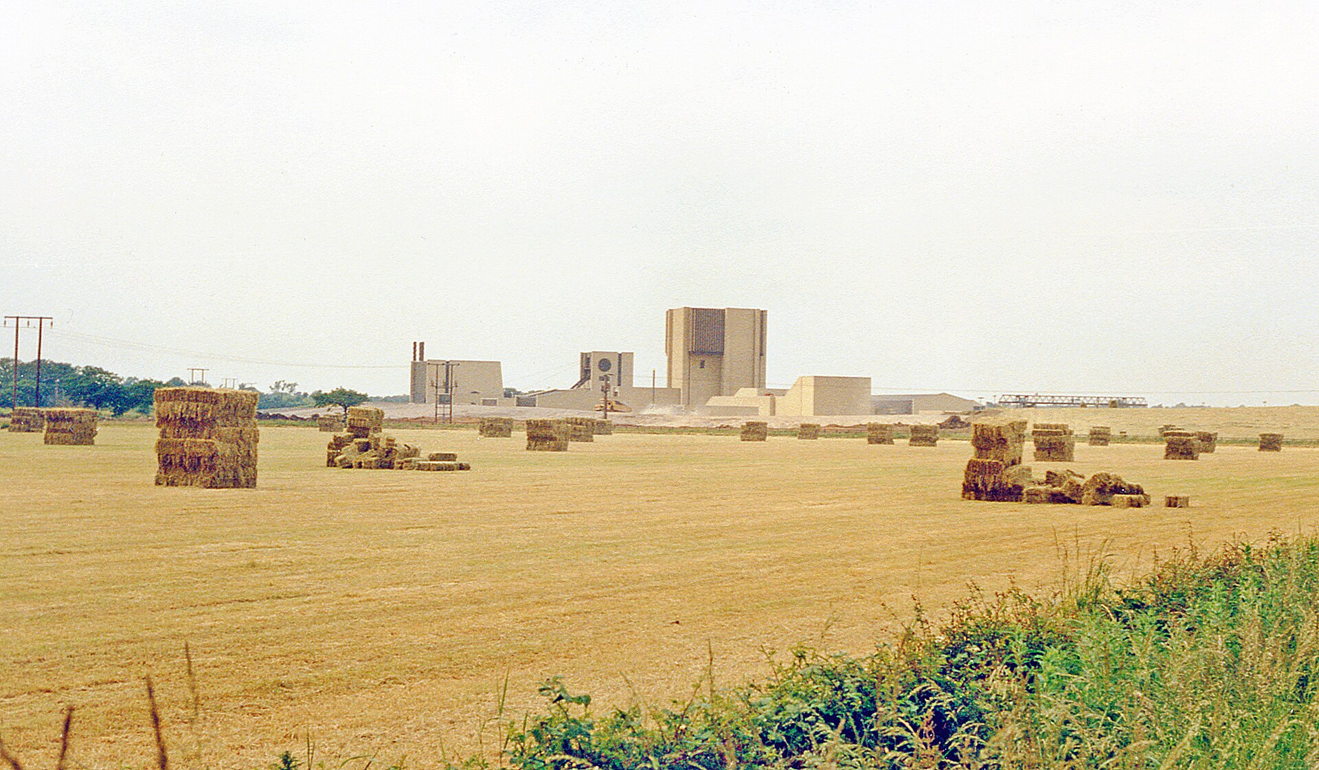
Ben Brooksbank's June 1988 photograph of the working pithead from Lowmoor Road, the year production began.
View sourceSources
- (secondary) Selby Coalfield Timeline — Railway to Greenway (York Greenways)
- (secondary) Whitemoor Mine — Northern Mine Research Society
- (secondary) Selby Coalfield — Wikipedia
- (primary) BGS / Mining Remediation Authority mine plans: WHITEMOOR MINE — British Geological Survey
Record created: 21 September 2026 · Last researched: 21 September 2026