 MineArchive
Stillingfleet Mine
| Also known as | Stillingfleet Colliery |
|---|---|
| Location | Stillingfleet, south of York, North Yorkshire — 53.8571, -1.0847 (exact) |
| Commodity | Coal |
| Type | Coal |
| Worked | January 1988–30 July 2004 |
| Maximum depth | 708 m (the shafts, to the Barnsley seam). |
| Operators | National Coal Board (1976–1987) British Coal Corporation (1987–1994) UK Coal (1995–2004) |
One of the five satellite pits of the Selby coalfield, sunk by Thyssen from 1978 and in production from January 1988. Like its neighbours it raised no coal of its own: its output went underground to Gascoigne Wood. It absorbed North Selby's take in 1997, produced over three and a half million tonnes a year at its peak, and was the last Selby pit but one to stop, on 30 July 2004.
Location
Recorded location. The large pin is this mine; the small round markers are the nearest mines on record. Click one for its page. View on full map
History
Planning permission to sink two 7.315-metre (24 ft) shafts at Stillingfleet was granted in 1976 as part of the National Coal Board's Selby scheme, and preliminary work began in 1977. Thyssen (GB) Ltd sank the shafts, beginning in June 1978 by one account or in September 1978 by another; they reached the Barnsley seam in 1982, the shafts and surface buildings were complete by June 1984, and in March 1987 the mine was connected to the south spine tunnel at Gascoigne Wood. Coal production began in January 1988.
Stillingfleet never wound coal: under the Selby design every pit sent its coal by conveyor to the drift mine at Gascoigne Wood, where it was raised, prepared and sent out by rail, and the pithead handled only men, materials and, during sinking and development, spoil. In the 1990s the mine employed more than 600 men; in April 1992 eight of them were trapped by a roof collapse and all were brought out unhurt.
After privatisation the complex passed from British Coal to RJB Mining, later UK Coal. When North Selby closed in July 1997 because of the geological problems its depth caused, its take was merged with Stillingfleet's, and output rose to 3,630,000 tonnes in 1997, its best recorded year. Continuous losses led UK Coal to announce the phased closure of the whole complex in July 2002, and coal production at Stillingfleet ended on 30 July 2004, between Wistow in May and Riccall in October. The 1976 permission required the site to go back to farmland once the shafts stopped, but only fifteen of its twenty structures had been cleared by 2012, and in 2021 county councillors threw out a plan by the landowner, Harworth Estates, to turn the rest into a waste transfer station.
Geology
The Barnsley seam of the concealed Yorkshire coalfield, which extends north beneath the Vale of York under younger Permian and Triassic cover; the Selby scheme was licensed to work that seam alone. At Stillingfleet the shafts met it at about 708 metres.
Geological setting: Concealed Coalfields (historical documentary reference), Sedimentary Beds and Seams (well documented example)
Workings
Two 7.315-metre shafts, about 708 metres deep, for men, materials and ventilation only. Coal travelled underground by conveyor to Gascoigne Wood, reached through a connection to the south spine tunnel made in March 1987; from July 1997 the mine also worked the former North Selby take.
Closure
UK Coal announced the phased closure of the Selby complex in July 2002 after continuous losses; coal production at Stillingfleet ended on 30 July 2004. Loss of subsidy, geological problems and low coal prices had made the complex unprofitable.
What remains
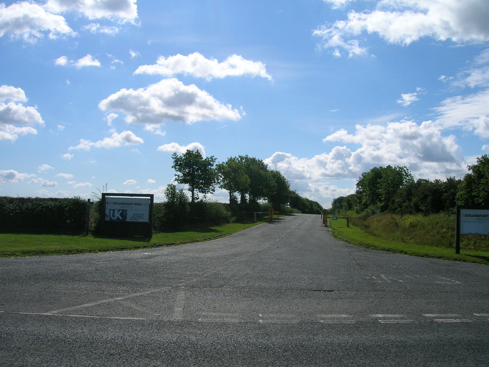
Derelict and partly cleared. In 2023 the administration block, pithead baths, winders and both pitheads had been demolished, workshops and stores stood stripped and vandalised, and both shafts were capped and fenced, with gas drawn from one of them to generate electricity in the old substation buildings. Of the 32-hectare site, 8.2 hectares was the working area of the mine; by 2012 fifteen of its twenty structures had been removed and the shafts filled and capped, leaving two large buildings and wide concrete hardstandings.
Workshops, a stores building with canteen, a small office, the electrical substations and switchrooms, a spoil transfer yard and the narrow-gauge tracks that served the two capped shafts.
Redevelopment
Part of the site generates electricity from mine gas drawn from a capped shaft, with a methane plant permitted in 2012. The 1976 planning permission required restoration to agriculture, which has not been carried out; reuse of the buildings was refused in 2006, and a waste transfer station for construction and demolition waste, proposed by Harworth Estates, was refused in 2021.
Related mines
- Gascoigne Wood Mine — All of Stillingfleet's coal went underground to Gascoigne Wood, to which it was connected through the south spine tunnel in March 1987.
- North Selby Mine — North Selby's take was merged with Stillingfleet's when it closed in July 1997.
Nearby mines
- Riccall Mine — 3.1 miles (5.0 km) SE
- Wistow Mine — 3.6 miles (5.8 km) SW
- North Selby Mine — 3.7 miles (5.9 km) NE
- Whitemoor Mine — 4.8 miles (7.7 km) SE
- Gascoigne Wood Mine — 7.1 miles (11.4 km) SW
Straight-line distance, within 9 miles (15 km). Show on the map.
Photographs & further reading
A 2023 visit report with photographs of the surviving workshops, stores, transfer yard and fenced shaft positions.
View sourceAn archive entry of 34 photographs of the six Selby mine sites as they stood in 2018.
View sourceThe planning history of the site since 1976, what was demolished and what remains, and the restoration condition never carried out.
View sourceSources
- (secondary) Stillingfleet Mine — Northern Mine Research Society
- (observational) Report - Stillingfleet Colliery - August 2023 — 28DaysLater
- (secondary) Selby Coalfield Timeline — Railway to Greenway (York Greenways)
- (secondary) Selby Coalfield — Wikipedia
- (primary) BGS / Mining Remediation Authority mine plans: STILLINGFLEET MINE — British Geological Survey
- (primary) Former Stillingfleet Mine Site: report to the Planning and Regulatory Functions Committee, February 2021 — North Yorkshire County Council
- (secondary) 'Totally unsuitable' plan for waste centre on coal mine site thrown out — YorkshireLive
- (secondary) Inside the Yorkshire coal mine frozen in time — YorkshireLive
Record created: 21 September 2026 · Last researched: 1 October 2026