 MineArchive
Riccall Mine
| Location | About a mile south-east of Riccall, Vale of York, North Yorkshire — 53.8249, -1.0324 (approximate) |
|---|---|
| Commodity | Coal |
| Type | Coal |
| Worked | Shafts sunk from June 1978, completed 1983; mining from January 1988–26 October 2004 |
| Maximum depth | 823 metres (both shafts) |
| Operators | National Coal Board (1978–1994), UK Coal (1995–2004), Cementation Mining (1978–1983) |
Overview
One of the five satellite pits of the Selby coalfield, the National Coal Board's 'super-pit' under the Vale of York. Two 24-foot shafts were sunk at Riccall from 1978 and finished in 1983; mining began in January 1988 and the coal went not up the shafts but along conveyor drifts to the single winding site at Gascoigne Wood. Riccall was the strongest of the satellites, raising nearly 2.9 million tonnes in 1997 and absorbing its struggling neighbour Whitemoor in 1996. It cut its last coal on 26 October 2004, and its surface is now a business park.
History
The Selby scheme was a central part of the 1974 Plan for Coal: instead of reopening older collieries, the National Coal Board proposed one complex of enormous reserves beneath the Vale of York, with a deliberately small surface footprint. Five satellite mines -- Wistow, Riccall, Stillingfleet, North Selby and Whitemoor -- would raise no coal of their own, sending it instead along long underground conveyor drifts to a single central plant at Gascoigne Wood, where everything was wound, prepared and dispatched by rail. The project was inaugurated by the Duchess of Kent in 1976, at an estimated 400 million pounds and a workforce of 4,000. Planning permission for two 7.315 metre (24 foot) shafts at Riccall was granted in 1977, and Cementation Mining began sinking them in June 1978. Both reached 823 metres and were completed in 1983. Mining began in January 1988, in the Barnsley seam that the whole complex was built for. Riccall did well: its recorded output ran from 1.855 million tonnes in 1993 to a peak of 2.899 million in 1997. When the neighbouring Whitemoor Mine ran into trouble its take was merged with Riccall's in July 1996 and its shafts were filled. In 1999 Riccall was given permission to work the Stanley Main seam -- the equivalent of the High Hazel worked at Hatfield -- and to tip its spoil at Gascoigne Wood; the first Stanley Main face came into production at the end of 2001 and the Barnsley was given up soon afterwards. The complex passed with the rest of British Coal to RJB Mining, later UK Coal, in 1995. Cheap imports, falling demand for coal in power generation and the geological complications of the Selby take undid it: in 2002 UK Coal announced closure, and mining ended in 2004 -- at Wistow in May, Stillingfleet in July, and at Riccall on 26 October, the last coal of the whole complex. Over 21 years the Selby pits produced some 121 million tonnes.
Geology
The Barnsley seam beneath the Vale of York, the seam the whole complex was designed around, at depths of roughly 390 to 1,040 metres; a small area of the Stanley Main seam east of Riccall was also worked from 2001, equated by the Northern Mine Research Society with the High Hazel seam worked at Hatfield.
Geological setting: Sedimentary Beds and Seams (well documented example)
Workings
Two 7.315 metre diameter shafts, each 823 metres deep, sunk by Cementation Mining from June 1978 and completed in 1983. They served men, materials and ventilation only: coal travelled underground by conveyor drift to Gascoigne Wood, where the whole complex's output was raised. From July 1996 Riccall also worked Whitemoor's take.
Closure
UK Coal announced in 2002 that the Selby complex would close in 2003-04, the reserves having been undercut by cheap imports, falling demand and what the British Geological Survey calls the geological complications of the take. Riccall cut its last coal on 26 October 2004, after Wistow in May and Stillingfleet in July, and the complex was wound down in stages through that year.
What remains
The mine has been cleared and the site redeveloped; planning permission for an industrial and office development was granted in 2007.
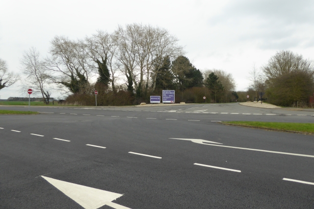
Nothing of the colliery is visible from the road: the site is now Riccall Business Park, entered by the roads built for the mine.
Redevelopment
Riccall Business Park, an industrial and office development on the mine's surface site, permitted in 2007.
Related mines
- Gascoigne Wood Mine — Riccall raised no coal of its own: everything it cut travelled by underground conveyor drift to Gascoigne Wood, the complex's single winding and preparation site.
- Wistow Mine — Both satellite pits of the Selby complex, sending their coal underground to Gascoigne Wood; Wistow cut its last coal in May 2004 and Riccall in October, the complex's last.
Nearby mines
- Wistow Mine — 6.6 km W
- Gascoigne Wood Mine — 12.1 km SW
Straight-line distance, within 15 km. Show on the map.
Recorded claims
Individual factual claims, each attached to the source(s) that support it below. Where sources disagree, both are kept.
- Planning permission for two 7.315 metre diameter shafts at Riccall was granted in 1977; Cementation Mining began sinking in June 1978 and both shafts, 823 metres deep, were completed in 1983. 1
- Mining began at Riccall in January 1988, and the coal was carried underground by conveyor drift to the central site at Gascoigne Wood rather than being wound at the mine itself. 2,1
- Riccall's recorded output rose from 1,855,000 tonnes in 1993 to 2,899,000 tonnes in 1997, and its neighbour Whitemoor's take was merged with Riccall's in July 1996, Whitemoor's shafts being filled. 2,1
- In 1999 Riccall was permitted to work the Stanley Main seam and to tip its spoil at Gascoigne Wood; the first Stanley Main face came into production at the end of 2001 and the Barnsley was discontinued soon afterwards. 1
- Mining at Riccall ended on 26 October 2004, the last coal raised by the Selby complex, which had produced some 121 million tonnes in 21 years. 2,3,1
- The mine site has been converted to an industrial and office development, Riccall Business Park, with planning permission granted in 2007. 2
Photographs & further reading
The complex Riccall belonged to: the 1974 Plan for Coal scheme, the five satellites and Gascoigne Wood, the 1984-85 strike, privatisation and the 2004 closures.
View sourceSources
- (secondary) Riccall Mine — Northern Mine Research Society (Internet Archive)
- (secondary) Selby Coalfield — Wikipedia
- (secondary) The Selby Coalfield — Railway to Greenway
Record created: 20 September 2026 · Last researched: 20 September 2026