 MineArchive
Tan Hill Colliery
| Also known as | Tanhill Colliery, King's Pit |
|---|---|
| Location | Tan Hill, near Keld, Swaledale, North Yorkshire — 54.4519, -2.1589 (approximate) |
| Commodity | Coal |
| Type | Coal |
| Worked | By the 13th century (first dated record 1384)–1935 or 1938 (sources differ) |
| Maximum depth | Gin shafts between 60 and 240 feet (about 18 to 73 m) deep. |
| Operators | Christopher Hanby (?–1670), Thomas Pulleine (1690–?), Harker and Co. (1855–1855), Knowles and Co. (1880–?), Tan Hill Colliery Co., Capt. F. H. Lyell, C. Sinclair |
Overview
Tan Hill Colliery worked the Tan Hill Coal on the bleak watershed at the head of Swaledale, around what is now Britain's highest inn. Coal was dug here from shallow pits by the 13th century and sent to Richmond Castle in 1384; later deeper gin shafts and board-and-pillar workings supplied household coal, lime coal and the coke, known locally as cinders, that fired the Swaledale lead smelters. The last pits were abandoned in the 1930s, though the sources disagree on the year.
History
The Northern Mine Research Society dates coal working from shallow pits along the Tan Hill outcrop to the 13th century, and the Yorkshire Dales National Park's record notes that the area supplied coal to Richmond Castle in 1384. By the 17th century the coal was being coked in simple beehive ovens: the account book of the lead mining agent Adam Barker shows him buying cinders from Tan Hill for the Old Gang smelt mill as early as 1682. L. O. Tyson's study of the neighbouring manor of Bowes records Christopher Hanby of Gilmonby working Tanhill Colliery in the 1650s and 1660s while holding the adjoining King's Pit Colliery in Bowes, and by the 1690s Thomas Pulleine of Carleton Hall, Master of the Stud to William III and twice High Sheriff of Yorkshire, held a lease of Tanhill Colliery from Lord Wharton; the Pulleine family dominated coal mining in the district for the next 250 years. Messrs Harker and Co. were lessees of King's Pit in 1855. Drainage was improved in the 19th century, first by a steam engine on Gin Shaft from 1843 and then by the Mould Gill Level, driven up to the Low Gin Shaft in the early 1840s and given a long south-eastern branch from January 1854 that reached coal further down dip and extended the mine's life. The 1880 List of Mines gives Tanhill, Swaledale, near Richmond, under Knowles and Co.; the Durham Mining Museum then records the Tan Hill Colliery Co. in the 1890s, Capt. F. H. Lyell in the 1910s, the Tan Hill Colliery Co. again in the 1920s and C. Sinclair in the 1930s. The workforce was small and shrinking: 14 in 1883, 15 in 1894, 8 by 1905 and five through the 1920s. Wikipedia's account says the Tan Hill miners worked through the 1926 General Strike because their wages were so marginal. The inn, which dates to the 17th century, was known as the King's Pit and was surrounded by miners' cottages; the cottages were demolished in the early 1930s once mining ended, and the inn survived on the trade of farmers and, later, motorists.
Geology
The Tan Hill Coal, one of the most productive seams in the Dales, lies in the Upper Howgate Edge Grit of the Namurian (Millstone Grit). The Lists of Mines placed it in the 'Limestone Series', which the NMRS calls wrong, probably a confusion arising because the pits sold lime coal for lime burning. At Tan Hill and King's Pit the seam was typically about 30 inches (0.75 m) thick, made up of an 8-inch top coal, a thin dirt band, a 6-inch Bible Coal and a 16-inch bottom coal. It was a compact, bright, mature coal of fairly high rank that coked strongly, though it lacked the heat of the William Gill coal. The seam dips gently south and is cut off by faults on the east and west. A 1975 Ancient Monuments Laboratory spore analysis of a coal sample from Brough matched it to the lower Namurian Tan Hill Coal outcropping south-east of the town.
Geological setting: Sedimentary Beds and Seams (well documented example)
Workings
Early working was from shallow pits along the outcrop. Away from it the coal was won by extensive board and pillar working from a series of horse-gin shafts 60 to 240 feet deep, and for some years most production came from robbing the pillars, which was cheap using existing roadways but needed much timber and sometimes caused creep, the crushing of pillars into the floor under the settling roof. Most shafts were sunk through peat and served by causeways floated across it. Many had cinder ovens for coking. Water was drained by a steam engine on Gin Shaft from 1843 and by the Mould Gill Level, with its 1854 branch. The Lists of Mines name the seams as the Limestone Series in 1905-25, Yoredale in 1927-30 and Mountain in 1935.
Closure
The sources disagree. The Durham Mining Museum records three men employed in 1935 and the colliery abandoned in July 1935, with abandonment plans for the Yoredale seam dated 1936 and for the Limestone Series seam 1940. The NMRS says mining was abandoned in September 1938, and its 1854 list entry gives both July 1935 and 1938. Wikipedia's articles put the closure of the last mine in 1929, with local people working the upper seams by hand until the mid-1930s, while the National Park record says the area was still working as late as 1934. Better coal brought in over improved roads is given as the reason the local coal lost its market.
What remains
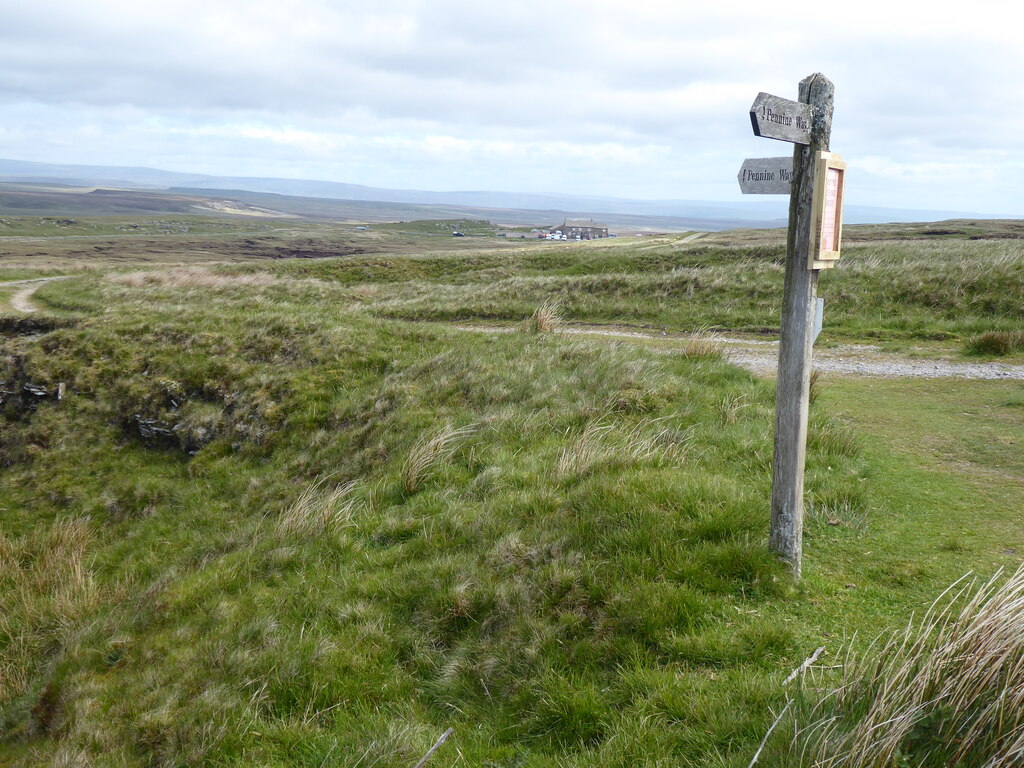
The Yorkshire Dales National Park's record describes hundreds of grassed-over early shallow shafts across the coalfield, with the Pennine Way running through it; the Tan Hill Inn is the only building left standing among them.
Grassed-over shafts and spoil mounds, and trackways laid across the peat to reach the outlying shafts; the NMRS notes that some causeways shown on mine plans are no longer visible because they have sunk into the peat.
Related mines
- Stockdale Colliery — Both worked the Tan Hill Coal (here the Stockdale Seam), and Capt. F. H. Lyell owned both in the 1910s.
- William Gill Colliery — Both worked the Tan Hill Coal: William Gill on the coalfield's eastern outcrop.
Nearby mines
- William Gill Colliery — 2.0 km SE
- West Stonesdale Mine — 3.5 km S
- Cleasby Mines — 5.7 km E
- Swinnergill Mine — 6.1 km S
- Sun Hush Mine — 6.3 km SE
Straight-line distance, within 15 km. Show on the map.
Recorded claims
Individual factual claims, each attached to the source(s) that support it below. Where sources disagree, both are kept.
- Coal was worked from shallow pits around the Tan Hill outcrop by the 13th century. 1
- The Tan Hill area supplied coal to Richmond Castle in 1384. 2,3
- Lead mining agent Adam Barker's account book shows cinders bought from Tan Hill for Old Gang as early as 1682. 2
- Christopher Hanby worked Tanhill Colliery in the mid-17th century; by the 1690s Thomas Pulleine held a lease of it from Lord Wharton. 4
- The Tan Hill Coal, about 30 inches thick, lies in the Upper Howgate Edge Grit of the Namurian; the Lists of Mines' 'Limestone Series' is an error. 1
- A coal sample from Brough, Westmorland, was matched by its spore assemblage to the lower Namurian Tan Hill Coal (Neves, 1975). 5
- Board and pillar workings were served by gin shafts 60 to 240 feet deep, many with cinder ovens. 1
- A steam engine on Gin Shaft drained the mine from 1843, followed by the Mould Gill Level with a branch begun in January 1854. 1
- Owners were Knowles & Co. (1880), the Tan Hill Colliery Co. (1890s, 1920s), Capt. F. H. Lyell (1910s) and C. Sinclair (1930s). 6,7
- The colliery was abandoned in July 1935, with three employed that year. (disputed) 7,8
- Mining at Tan Hill was abandoned in September 1938. (disputed) 1,8
- The last mine closed in 1929, with hand working of the upper seams until the mid-1930s. (disputed) 3,9
- Tan Hill miners worked through the 1926 General Strike because their wages were marginal. (uncertain) 3
- The Tan Hill Inn was formerly called The Kings Pit and was surrounded by miners' cottages, demolished in the early 1930s. 9
Photographs & further reading
The seam, its section and coking quality, the gin shafts, pillar robbing and the Mould Gill drainage level.
View sourceOwners, employment, seams and abandonment dates from the Lists of Mines, 1880 to 1935.
View sourceYorkshire Dales National Park record of the coalfield, with an aerial photograph and the medieval and cinder trade.
View sourceBackground on the Bowes manor mineral rights and the Hanby and Pulleine interests in Tanhill and King's Pit.
View sourceSources
- (secondary) Tan Hill Colliery and Kings Pit — Northern Mine Research Society (after M. C. Gill, British Mining No. 86, 2008)
- (secondary) Tan Hill coal field (HER MYD20505) — Out of Oblivion, Yorkshire Dales National Park Authority
- (secondary) Tan Hill, North Yorkshire — Wikipedia
- (secondary) Aygill Lead Mine, Stainmore, North Yorkshire (Tyson, British Mining No. 45, 1992) — Northern Mine Research Society
- (primary) Brough under Stainmore: Coal (R. Neves, AML Report 1815, 1975) — Historic England
- (secondary) List of coal mines UK 1880 — Coalmining History Resource Centre
- (secondary) Durham Mining Museum - Tan Hill Colliery — Durham Mining Museum
- (secondary) Mines of coal and stratified deposits 1854 T - Z — Northern Mine Research Society
- (secondary) Tan Hill Inn — Wikipedia
Record created: 13 September 2026 · Last researched: 13 September 2026