 MineArchive
St Peter's Mine
| Also known as | St Peters Mine, St Peter's Shaft |
|---|---|
| Location | Sparty Lea, East Allendale, Northumberland — 54.8330, -2.2660 (approximate) |
| Commodities | Fluorspar, Lead |
| Type | Metal |
| Worked | 1902–1946 |
| Maximum depth | Unknown. |
| Operators | W. B. Lead Company, Weardale Lead Company |
Overview
A twentieth-century lead mine at Sparty Lea in East Allendale, working a vein that only existed as far as anyone knew because a drainage tunnel ran into it. The St Peter's Vein was discovered in 1902 during the driving of the Blackett Level, and was thought at the time to be a continuation of the Swinhope Vein. It was worked first from the level itself by W. B. Lead and then from its own shaft by the Weardale Lead Company. Concrete foundations of the shaft-head buildings are what is left.
History
The Blackett Level was one of the great drainage undertakings of the North Pennines, driven up the East Allen from 1854 to unwater the Allendale mines from below. Its value was never only drainage: a level driven for miles through the orefield crosses ground nobody has prospected, and in 1902 it cut a vein that had not been known before. That was the St Peter's Vein, taken at the time for a continuation of the Swinhope Vein.
It was worked first from the Blackett Level itself by W. B. Lead, and afterwards from a shaft of its own, the St Peter's Shaft, by the Weardale Lead Company - the combine that by then held most of what was left of the North Pennine lead industry. Galena was the object, with fluorite, quartz, chalcopyrite and siderite in the vein alongside it. The working belongs to the last phase of Allendale lead mining, when new ore was found by driving rather than by prospecting from surface and the industry was already in long decline.
When it finished is not agreed. Geograph's record of the site gives lead working from about 1922 to 1946; the Buddlepit database has the mine worked until 1943 while putting the Weardale Lead Company's tenure at 1923 to 1945. Both readings put the end inside the same few years, and the difference is likely the gap between the last ore drawn and the last year the lease was held.
What outlasted the lead was the fluorite. St Peter's is one of the classic British fluorite localities, known for apple-green cubes; specimens from it are in the Natural History Museum in London. Collectors have since gone back down the main shaft, finding no significant new ground but taking out straw and light-brown fluorite groups with cubes up to ten centimetres across, many of them partly coated in siderite. The shaft is one of four sunk along the Blackett Level from about 1855, with Studdon Dene, Holmes Linn and Sipton, and the level itself still runs.
Geology
The North Pennine orefield, lead in veins cutting the Carboniferous limestones and sandstones of the Alston Block. The St Peter's Vein carries galena with fluorite, quartz, chalcopyrite and siderite, the fluorite-rich assemblage characteristic of the inner part of the orefield, and the fluorite is what the locality is known for: apple-green cubes of museum quality, with straw and light-brown groups running to ten centimetres and often coated in siderite. Whether the vein is a separate structure or the continuation of the Swinhope Vein was an open question when it was found and is the kind of thing a drainage level settles by accident.
Geological setting: Veins and Lodes (well documented example)
Workings
Two ways in, in sequence. The vein was worked at first directly from the Blackett Level, the drainage tunnel that had found it, which meant the ore came out along a road already driven and already unwatered. Later the Weardale Lead Company sank the St Peter's Shaft to it and worked from there, with the shaft-head buildings whose concrete foundations survive.
Closure
Accounts of the closing date differ by three years. Geograph's site record gives lead working from about 1922 to 1946; the Buddlepit database says the mine was worked until 1943 and puts the Weardale Lead Company's tenure at 1923 to 1945. Both place the end in the mid-1940s, with the North Pennine lead industry closing around it. The site is recorded now only by its remains, and collectors have worked the vein for fluorite specimens since.
What remains
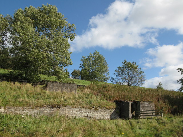
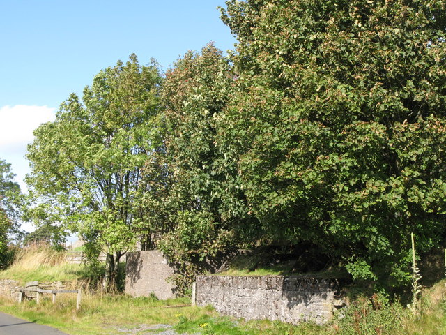
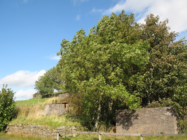
The site at Sparty Lea is cleared and grassed. Concrete foundations from some of the mine buildings survive at the shaft head among rough pasture, and comparison photographs of the mine as it stood about 1900 and in 1930 have been published against views of the same ground today. The main shaft has been entered in recent years by mineral collectors working the vein for fluorite specimens.
Concrete foundations of the mine buildings at the shaft head; the site at Sparty Lea is otherwise cleared.
Related mines
- Sipton Mine — Both are East Allendale lead mines on the ground drained by the Blackett Level; St Peter's is named on the Sipton record.
Nearby mines
- Sipton Mine — 1.3 miles (2.0 km) NE
- Swinhope Mine — 1.5 miles (2.4 km) S
- Scraithole Mine — 2.0 miles (3.2 km) SW
- Carshield Mine — 2.1 miles (3.3 km) SW
- Holmslinn Mine — 2.4 miles (3.8 km) N
Straight-line distance, within 9 miles (15 km). Show on the map.
What's uncertain
Points where sources disagree or the record could not be settled; both accounts are kept. All open questions in the archive.
- Geograph's 2008 record of the site states the mine worked for lead from about 1922 to 1946. (disputed) 2
- The Buddlepit database gives the mine as worked until 1943, with the Weardale Lead Co. Ltd holding it from 1923 to 1945 - three years of company tenure after work is said to have stopped. (disputed) 3
Recorded claims
Individual factual claims, each attached to the source(s) that support it below. Where sources disagree, both are kept.
- The St Peter's Vein was discovered in 1902 during the driving of the Blackett Level, and was thought at the time to be the continuation of the Swinhope Vein. 1
- The deposit was worked initially from the Blackett Level by W. B. Lead, and then from the St Peter's Shaft by the Weardale Lead Company. 1
- The vein produced galena with fluorite, quartz, chalcopyrite and siderite. 1
- Concrete foundations from some of the mine buildings survive at the shaft head at Sparty Lea. 2
- Geograph's 2008 record of the site states the mine worked for lead from about 1922 to 1946. (disputed) 2
- The Buddlepit database gives the mine as worked until 1943, with the Weardale Lead Co. Ltd holding it from 1923 to 1945 - three years of company tenure after work is said to have stopped. (disputed) 3
- St Peter's is renowned among mineral collectors for apple-green fluorite, specimens of which are in the collection of the Natural History Museum in London. 3
- Exploration through the main shaft in recent years produced no significant new ground but yielded straw to light-brown fluorite groups of good quality, with cubes up to ten centimetres across and often partly coated with siderite. 3
- The shaft stands at NY 8515 4876, 345 metres above sea level, in the East Allen valley about half way between Allendale Town and Allenheads. 3
- The Blackett Level was begun in 1854 and driven up the East Allen to unwater the Allendale mines, reaching about four and a half of an intended seven and a half miles before work stopped in 1903. Four shafts were sunk along its course from about 1855, at Studdon Dene, Holmes Linn, Sipton and Breckon Hill, and the level still runs. 4
- The mine is described in Dunham's Geology of the Northern Pennine Orefield (1948, pages 70 and 203), in Smith's Lead and Zinc: Northumberland and Alston Moor (Mineral Resources of Great Britain XXV, 1923, pages 59-60) and in Fairbairn's Allendale, Tynedale and Derwent Lead Mines (British Mining No.65, 2000, pages 19, 24-27 and 130); a plan of the mine was drawn by Helen Wilkinson in 2008. 3
Photographs & further reading
Newcastle University's community heritage record for the mine, with the account of the vein's discovery during the driving of the Blackett Level.
View sourceSite record for the shaft, with its position and height, the Weardale Lead Company's tenure, the mine's reputation for apple-green fluorite and a twelve-item bibliography.
View sourceSources
- (secondary) St Peter's Mine, Sparty Lea, East Allendale — Co-Curate — Co-Curate, Newcastle University
- (observational) Site of St Peter's Mine — Geograph Britain and Ireland
- (secondary) St Peter's — Buddlepit Mine Database — Buddlepit Mine Database
- (observational) Blackett Level in Allendale — Fabulous North
- (observational) (The site of) St. Peter's Mine, Spartylea — Geograph Britain and Ireland
Record created: 9 September 2026 · Last researched: 28 September 2026