 MineArchive
Speedwell Cavern
| Location | Castleton, Winnats Pass, Derbyshire — 53.3414, -1.7921 (exact) |
|---|---|
| Commodity | Lead |
| Type | Metal |
| Worked | 1771–1790 |
Overview
Speedwell, driven into the hillside below Winnats Pass at Castleton from 1771, was a financial failure as a lead mine within twenty years — but the flooded adit its Staffordshire investors blasted through solid limestone has drawn visitors by boat ever since, longer than the mine itself was ever actually worked.
History
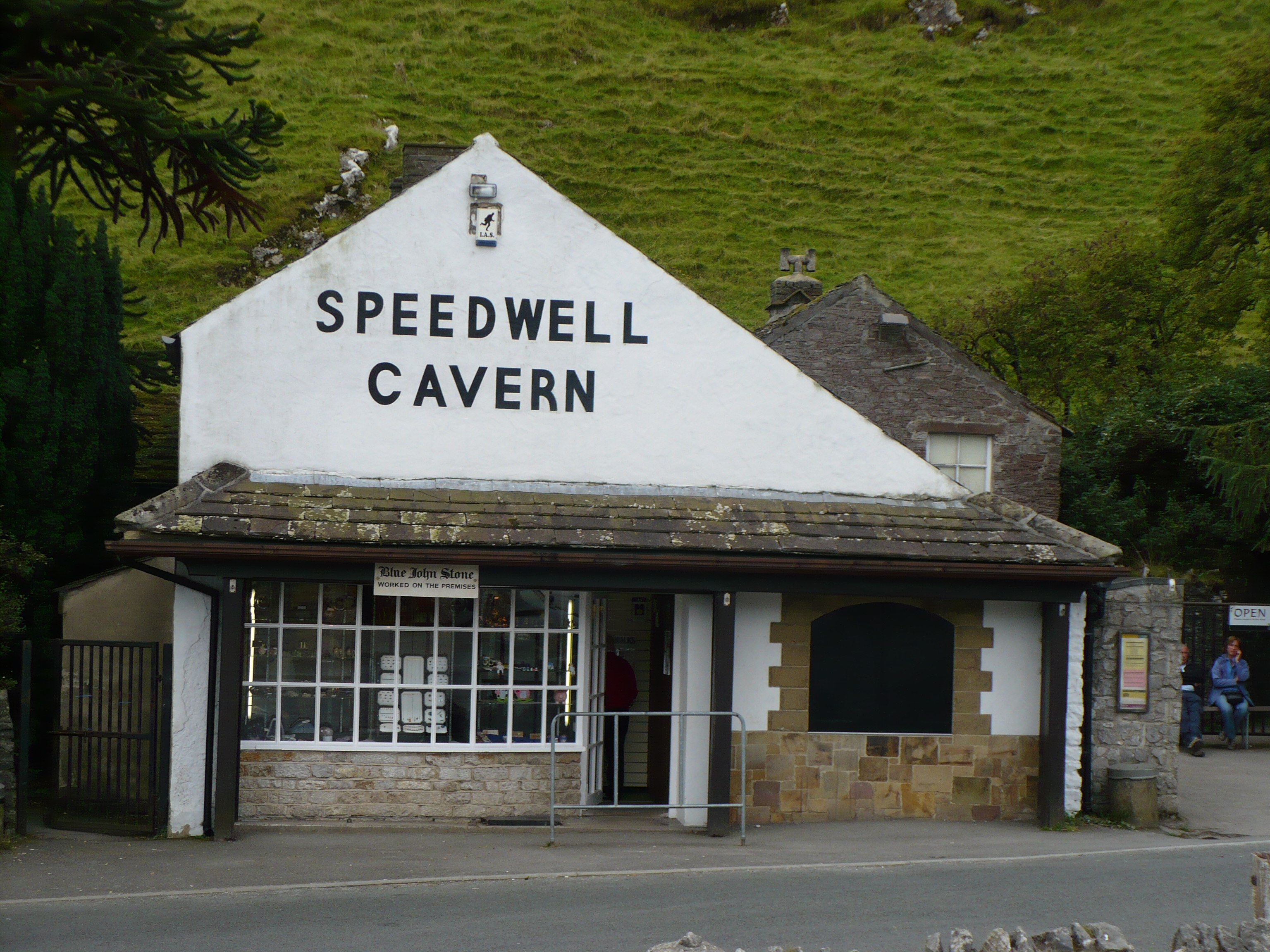
A group of investors from Staffordshire raised £14,000 to open Speedwell in 1771, driving a horizontal adit some 200 metres into the hillside below Winnats Pass in the hope of striking a rich lead vein. The lode proved too limited to repay the investment, and the mine was abandoned as unprofitable by 1790. During construction, miners broke into a large natural limestone cavern and, close by, a vertical natural shaft now known as the Bottomless Pit — in reality some 490 feet deep, though decades of miners tipping spoil into it have since raised its apparent floor to around 66 feet below the surface. Rather than waste the flooded adit, guides began taking visitors along it by boat almost as soon as mining stopped, at first pushing the boat by hand and later 'legging' it through the low passage by lying on their backs and walking their feet along the roof; the journey is powered by electric motor today, but Speedwell has now operated as a show cave for far longer than it ever operated as a working mine.
Geology
The mine's adit was driven through Carboniferous limestone to reach a lead-bearing vein in the Castleton orefield, the same hydrothermal mineralisation that produced the fluorspar variety Blue John worked nearby.
Geological setting: Hydrothermal Deposits (well documented example), Veins and Lodes (well documented example)
Workings
A horizontal adit around 200 metres long connects the surface entrance to an underground canal and a natural limestone cavern; nearby, the natural vertical shaft known as the Bottomless Pit descends around 490 feet, though mining spoil tipped into it over the years has raised its apparent floor to roughly 66 feet down.
Closure
The mine closed as unprofitable by 1790, less than twenty years after opening, its lead vein having proved too limited to justify the £14,000 raised to work it.
What remains
Open as a show cave: visitors are taken along the flooded adit by an electrically powered boat.
The mine entrance and its underground boat journey survive intact as a show cave, one of the longest continuously operating tourist attractions in the Peak District.
Related mines
- Faucet Rake — Rouster Mine may connect underground to the Speedwell Cavern system.
Nearby mines
- Treak Cliff Cavern — 0.3 miles (0.5 km) NW
- Faucet Rake — 0.4 miles (0.6 km) SW
- New Rake Lead Mines — 0.4 miles (0.7 km) S
- Odin Mine — 0.6 miles (0.9 km) NW
- Dirtlow Rake Mine — 1.0 miles (1.6 km) E
Straight-line distance, within 9 miles (15 km). Show on the map.
Recorded claims
Individual factual claims, each attached to the source(s) that support it below. Where sources disagree, both are kept.
- Staffordshire investors raised £14,000 to open the mine in 1771, driving an adit around 200 metres into the hillside, before the mine was abandoned as unprofitable by 1790. 1,2
- The natural vertical shaft known as the Bottomless Pit descends around 490 feet, though mining spoil tipped into it has raised its apparent floor to roughly 66 feet below the surface. 1
- The British Geological Survey holds a plan of Speedwell Cavern catalogued for lead at 4 cm to 50 m (MP23298) and a plan at 1:300 of 'the lost Pilkington's system' within it (MP23303). 3,4
- A connection between the Speedwell system and Titan, a natural shaft 141.5 metres high, was found in 2006. 1
- Located at about 53.341 N, 1.792 W. 1
Sources
- (secondary) Speedwell Cavern — Wikipedia
- (secondary) Speedwell Cavern, Castleton, History & Visiting Information — Britain Express
- (primary) The Speedwell Cave and Mine Derbyshire (BGS Mine Plans Catalogue) — British Geological Survey / Peak District Mines Historical Society
- (primary) The lost Pilkington's system, Speedwell Cavern, MP23303 (BGS mine plans catalogue) — British Geological Survey
Record created: 23 August 2026 · Last researched: 24 September 2026