 MineArchive
Odin Mine
| Location | Castleton, Derbyshire — 53.3479, -1.8000 (exact) |
|---|---|
| Commodities | Lead, Barite, Calcite, Fluorspar |
| Type | Metal |
| Worked | 1280 (documented)–1869 |
| Operators | Richard Bagshawe (?–1856), Robert How Ashton (1856–1869) |
Overview
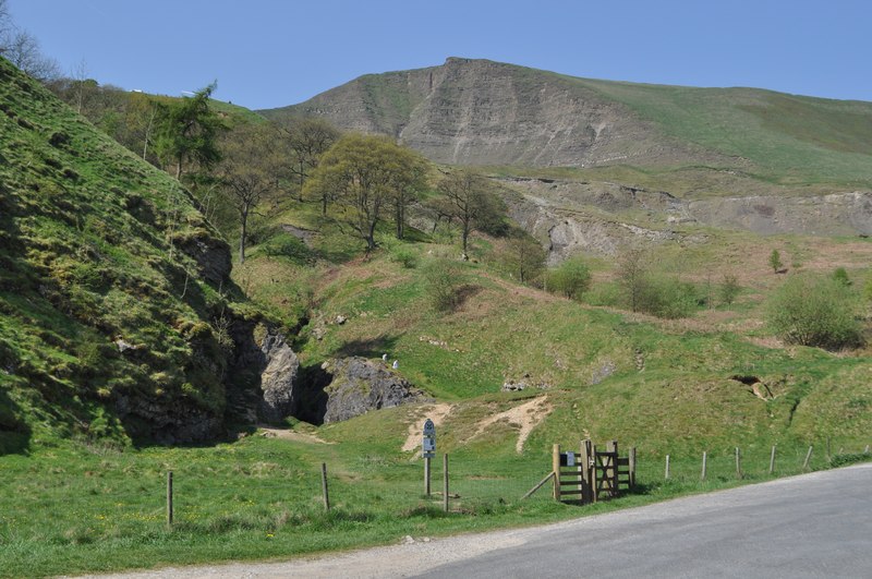
Odin Mine, at the foot of Mam Tor near Castleton, is reputed to be the oldest recorded lead mine in Derbyshire. Now owned by the National Trust, its open limestone gorge and surviving crushing wheel make it one of the most visited relics of the Peak District's lead-mining past.
History
The earliest documented reference to the mine is a 1280 trial record concerning a poacher, making it one of the oldest named lead mines in the region — though claims of still-earlier Roman, Saxon or Danish working are unsupported by direct evidence. Early extraction used fire-setting: fires were lit against the rock face and left to burn overnight, and the heated rock was then doused with water to crack it, since there was as yet no way to deal with the water that constantly flooded the workings. Those drainage problems were only overcome around four centuries later, allowing production to climb to its peak between 1720 and 1800, when around 100 men, women and children worked the mine and raised up to 800 tonnes of lead ore a year — a rich vein struck in April 1706 alone employed 41 men and eight women. Richard Bagshawe, later High Sheriff, was an early investor, and the Bagshawe family retained an interest until September 1856, after which the mine passed to Robert How Ashton of Losehill Hall. Lead production ceased in 1869, though a final, brief episode of fluorspar and barite extraction took place in 1908 and 1909.
Geology
The mine worked lead-bearing veins within a limestone gorge at the foot of Mam Tor, on the interface between the sandstones and shales to the north and west and the limestone plateau to the south. The site lies within the Castleton Site of Special Scientific Interest, its spoil supporting metal-tolerant plants including spring sandwort and alpine scurvy-grass.
Geological setting: Veins and Lodes (well documented example)
Workings
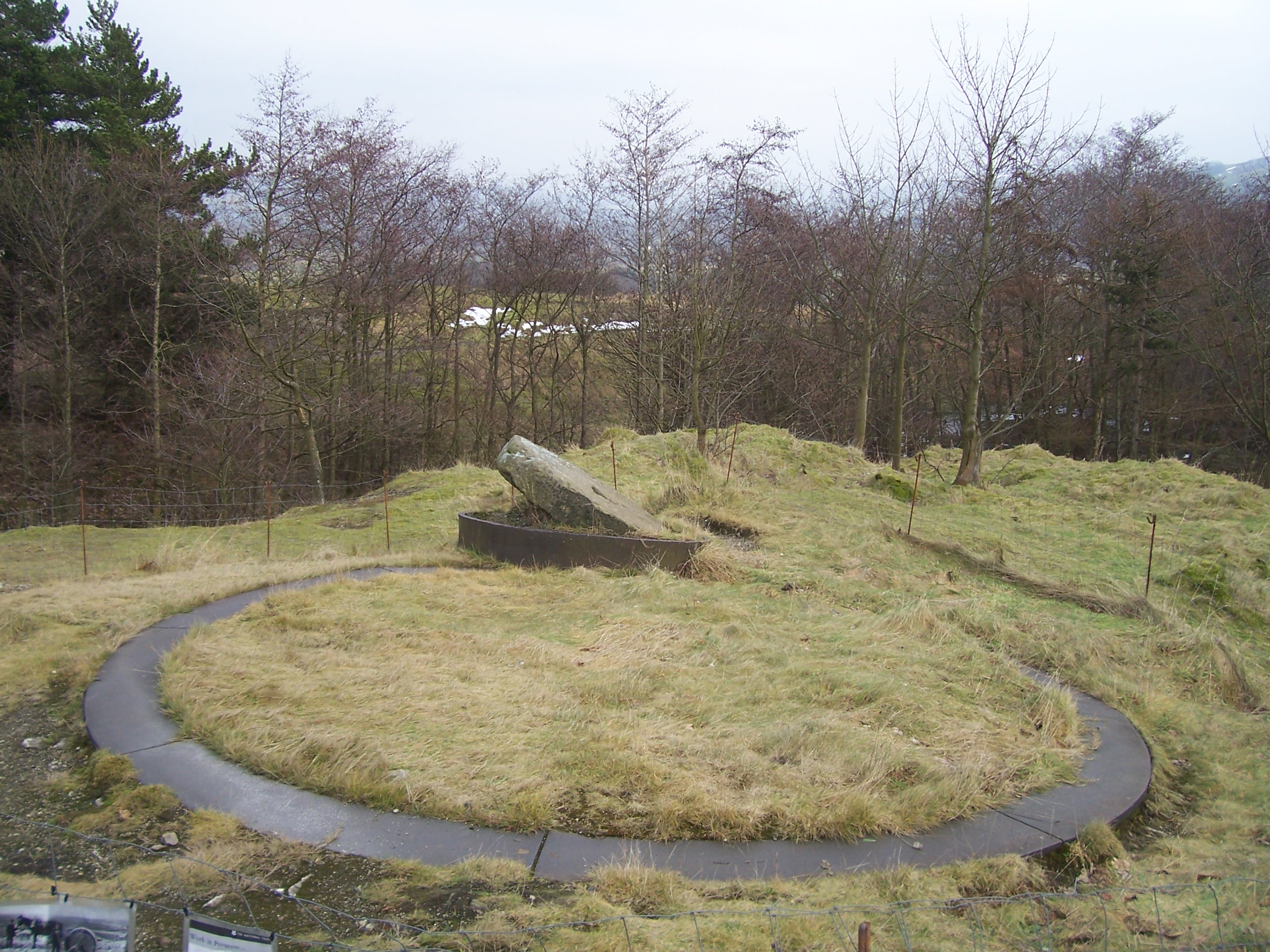
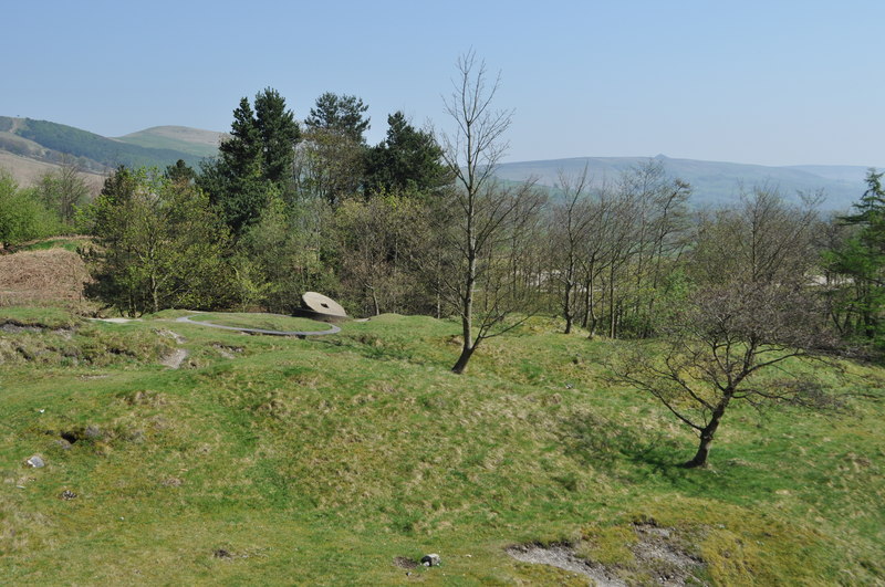
The mine was worked on two horizontal levels — an upper cart-gate for moving ore out and a lower water level for drainage — running more than a mile in from the entrance, within a complex of levels and shafts totalling around 1,500 metres. At least two shafts keep their winding platforms on the eastern side, one with a well-preserved stone lining. A gritstone ore-crushing wheel, 1.75 metres across and built in 1823 for £40, survives on site with its iron tyre and circular iron track.
Closure
Lead production ceased in 1869; a final brief period of fluorspar and barite extraction followed in 1908–1909 before the mine was abandoned for good.
What remains
The site is disused and now owned by the National Trust, within a designated Scheduled Ancient Monument and Site of Special Scientific Interest. Underground, much of the old mine is unstable: a collapse in 2011 left a hole around 15 m deep in the floor of the main passage, and the caving community treats parts of the system as past safe reach.
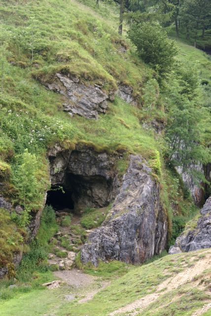
Visible remains include the limestone gorge itself, the original open-cast workings, spoil heaps, and the surviving 1823 crushing wheel; Odin Cave, a short natural feature at the site, extends around 10 metres underground.
Redevelopment
No redevelopment has taken place; the site is preserved by the National Trust as a heritage and access site.
Related mines
- Peakshill or Oden Sough — Named directly in both sources as the mine this sough was driven in 1726-1729 to drain and to prospect from, though it never reached Odin's vein.
Nearby mines
- Treak Cliff Cavern — 0.2 miles (0.4 km) SE
- Speedwell Cavern — 0.6 miles (0.9 km) SE
- Faucet Rake — 0.7 miles (1.1 km) S
- New Rake Lead Mines — 0.9 miles (1.5 km) S
- Peakshill or Oden Sough — 1.1 miles (1.8 km) W
Straight-line distance, within 9 miles (15 km). Show on the map.
What's uncertain
Points where sources disagree or the record could not be settled; both accounts are kept. All open questions in the archive.
- Sources disagree on the earliest documentary reference. Wikipedia gives 1280, when a poacher, John of Bellhag, was tried for hunting at Bactor Wood and at the entrance to Odin Mine; the National Trust's own monument record instead gives 1260, describing it as the oldest record of a named mine in Derbyshire. Both agree the mine is the earliest documented in the county. (disputed) 1,2
- Much of the old mine is unstable underground: a collapse in 2011 left a hole some 15 m deep in the floor of the main passage, the entrance passages are slippery with black shale mud, and the caving community regards parts of the system as beyond safe reach. (uncertain) 3
Recorded claims
Individual factual claims, each attached to the source(s) that support it below. Where sources disagree, both are kept.
- The earliest documented reference to Odin Mine is a 1280 trial record concerning a poacher; claims of earlier Roman, Saxon or Danish working are not supported by direct historical evidence. 1
- Lead production ceased in 1869; some brief further working for fluorspar and barite took place in 1908 and 1909. 1
- Sources disagree on the earliest documentary reference. Wikipedia gives 1280, when a poacher, John of Bellhag, was tried for hunting at Bactor Wood and at the entrance to Odin Mine; the National Trust's own monument record instead gives 1260, describing it as the oldest record of a named mine in Derbyshire. Both agree the mine is the earliest documented in the county. (disputed) 1,2
- The National Trust records the mine as worked on two horizontal levels — an upper cart-gate for moving ore and a lower water level for drainage — running more than a mile in from the entrance. At least two shafts with their winding platforms survive on the eastern side, one retaining a well-preserved stone lining. 2
- Output peaked in the 1720s, the 1770s and again around 1800. A 19th-century crushing circle survives on the eastern ore works, where ore was washed in the water of Odin Sitch before being crushed. 2
- Much of the old mine is unstable underground: a collapse in 2011 left a hole some 15 m deep in the floor of the main passage, the entrance passages are slippery with black shale mud, and the caving community regards parts of the system as beyond safe reach. (uncertain) 3
- The BGS catalogue holds entries for both 'The Odin Mine Castleton' and 'Odin Sough Castleton', though neither has a publicly viewable scan. 4
Photographs & further reading
Further freely-licensed photographs of the crushing wheel and gorge.
View sourceSources
- (secondary) Odin Mine — Wikipedia
- (primary) Odin Mine Complex, Castleton — National Trust Heritage Records — National Trust
- (observational) Odin Mine, Castleton — Peak District Caving
- (primary) Odin Mine and Odin Sough plans (BGS catalogue) — British Geological Survey
- (secondary) Odin mine lead mine near Castleton — Derbyshire Heritage
Record created: 19 August 2026 · Last researched: 28 August 2026