 MineArchive
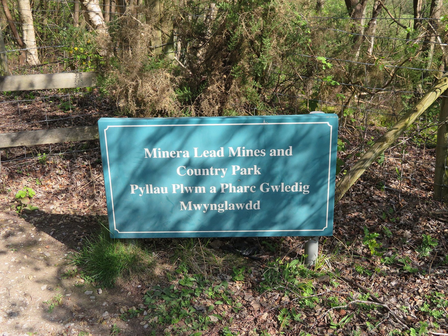
Minera Lead Mines
| Also known as | Meadow Shaft, City Shaft Mine |
|---|---|
| Location | Minera, Wrexham — 53.0507, -3.0826 (exact) |
| Commodities | Lead, Zinc |
| Type | Metal |
| Worked | 13th century–1914 |
| Maximum depth | c. 300-400m (Meadow and Taylor's shafts) |
| Operators | John Taylor & Sons (1848–1875), United Minera Mining Company (1897–1914) |
Overview
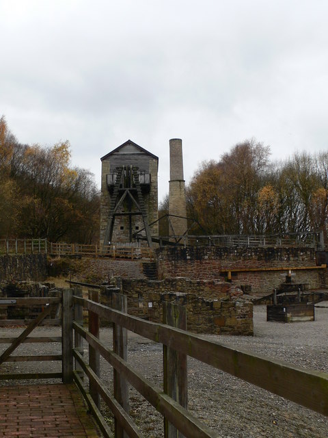
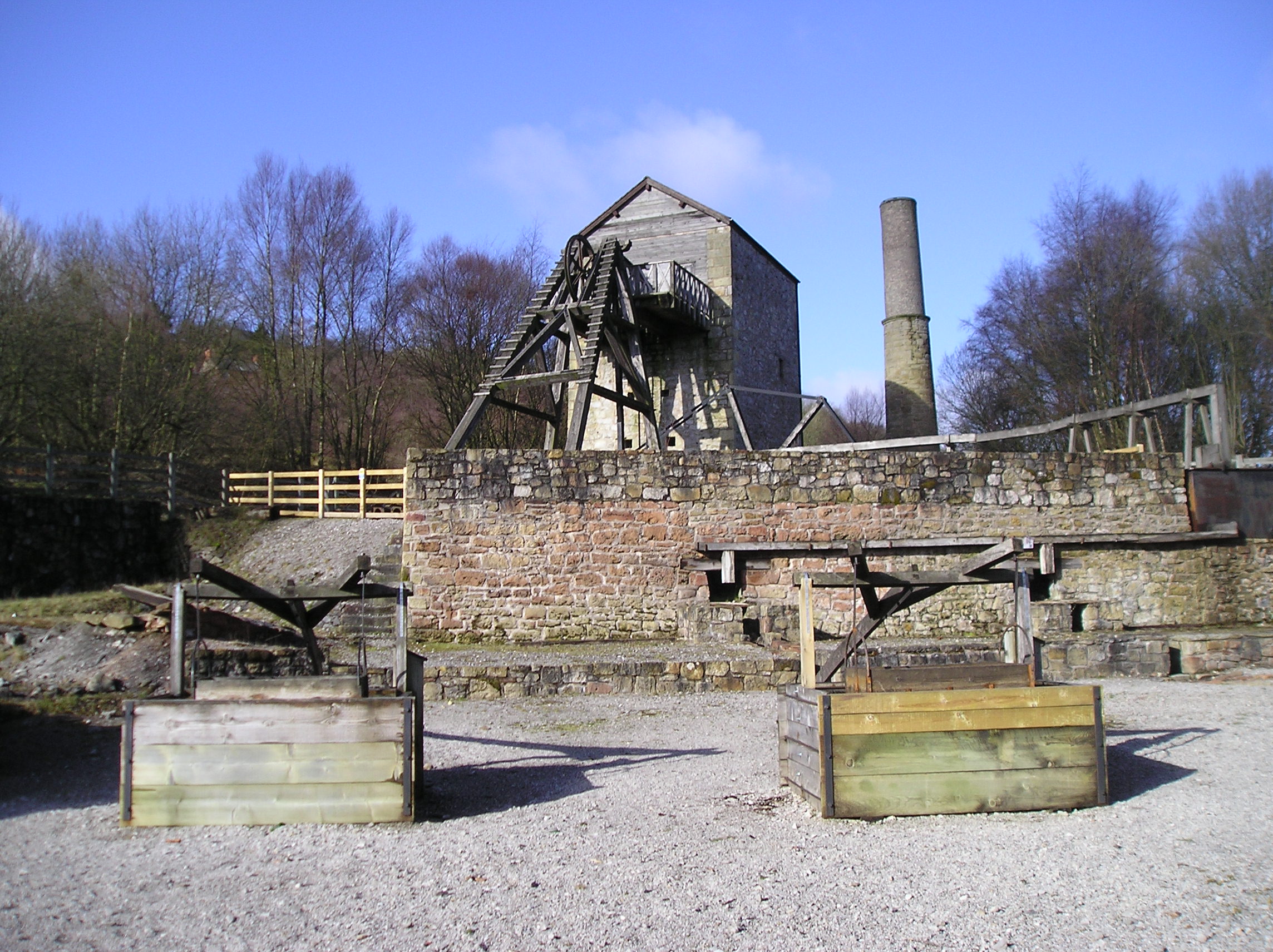
A major North-East Wales lead- and zinc-mining field on the eastern scarp of Esclusham Mountain, near Wrexham, worked intermittently from the medieval period and intensively from 1845 to 1914. The site is now restored as Minera Lead Mines Country Park, centred on the Meadow Shaft's Cornish pumping-engine house.
History
The first written record of lead mining at Minera dates to 1296, when Edward I's administration recruited miners from the site to work new mines in Devon; mining is popularly said to go back further, into the Roman period, but no archaeological evidence confirms this. Medieval working seems to have lapsed after the Black Death (1349) and the field was reworked in phases from the late 18th century, including a partnership involving the ironmaster John Wilkinson at the Maesffynnon mine from 1783, with a steam pumping engine installed there in 1784. The field was divided across three main areas: the Eisteddfod Mines and Mountain Mines on Esclusham Mountain, and the Old Minera Mines west of the Clywedog valley (worked 1720-1824 and again 1848-1914). Intensive working began in earnest in 1845 when the Cornish firm John Taylor & Sons formed the Minera Mining Company in 1848, investing some £30,000 by 1851. A drainage adit driven from near Nant Mill in 1852 ran 1,711 yards to help unwater the workings. A mineral railway branch, completed in 1851 and connecting to the Wrexham and Minera line at Minera Limeworks, carried ore and coal; the locomotive 'Henrietta' (Manning Wardle 0-6-0ST, works no. 21, built 1861) is associated with the line. Production peaked in the 1860s: the mines reportedly returned some £60,000 profit in 1864 alone. Several successor companies worked parts of the field after Taylor's -- the Consolidated Minera Lead Mining Company (1875), Hush Eisteddfod Lead Mining Company (1876-1886), Minera Mountain Lead Mining Company (1885-1891), New Minera Mining Company (which sank a new shaft in 1888, productive by 1893 but loss-making within a year) and the United Minera Mining Company (formed 1897, merging New Minera with the established Minera Mining Company). By 1900 falling lead and zinc prices, against rising coal costs for the pumping and winding engines, made the mines increasingly uneconomic. In 1908 the operators announced the pumps would be switched off, and the workings flooded progressively over the following two years; mining ended in 1914, and the Meadow Shaft's pumping engine was sold for scrap in 1910.
Geology
The lead (galena) and zinc (sphalerite) ores occur in Carboniferous limestone on the eastern scarp of Esclusham Mountain, in multiple main veins each of which carried its own name, worked through about a hundred shafts across the field; once John Taylor & Sons had the water under control after 1852, further exploration found significant new veins of ore. The limestone hosts underground rivers, which made flooding a persistent and expensive problem throughout the mine's working life and was the proximate cause of its 1908-1914 closure once pumping was no longer economic.
Geological setting: Veins and Lodes (well documented example)
Workings
Around 100 shafts are recorded across the wider Minera field, though only a handful -- notably Meadow Shaft and Taylor's Shaft, both around 300-400m deep -- were the field's principal working and pumping shafts in its later, most intensive phase. Meadow Shaft's engine house was built in 1857 to house a 42-inch-cylinder Cornish pumping engine (sources also cite it as 40-inch) on a 9-foot stroke, running about three strokes a minute; a separate 80-inch Cornish pumping engine by Harvey's of Hayle raised water 108 yards to the level of the 1852 adit.
Closure
Falling metal prices and rising coal costs made continued pumping uneconomic; the operators announced in 1908 that the pumps would be switched off, and the workings flooded over the following two years as mining wound down by 1914.
What remains
The workings themselves are flooded and inaccessible; a 2011 underground exploration report describes only limited, cramped sections reachable at all, with little room to stand. Surface remains are managed as a country park by Groundwork North Wales in partnership with Wrexham County Borough Council. A 2024 safety inspection found the heavy replica timberwork supporting the reconstructed headgear had deteriorated and it was removed as a precaution, and a 2020 site visit had already reported decay in the 1990s restoration work, including the replica headframe pulling away from its foundations, since given some metal bracing. The visitor centre, closed from September 2019, has since been brought back into use: a Heritage Lottery Fund grant paid for work on sustainable ways to run it, and money from the Welsh Government's Brilliant Basics fund, the Heritage Lottery Fund and the borough council has remodelled the rangers' office and toilet block and is putting new interpretation and exhibition displays into the centre.
The restored Meadow Shaft engine house (a stone-built Cornish pumping-engine house) and a replica headgear are the site's centrepiece. The Royal Commission's record of Meadow Shaft, also known as City Shaft, lists alongside it the boiler house and chimney, the winder engine house, the rock crusher house, the restored ore house and the restored buddles, all now within the country park; the dressing floors became buried when the shaft was used as a dumping ground for the neighbouring Roy's shaft. There are further engine house and boiler house foundations, the capped Taylor's Shaft with its balance bob pit, the mine smithy building, and traces of the former mineral railway.
Redevelopment
Reclamation of the site began in 1988, funded by Wrexham (Maelor) Borough Council and the Welsh Development Agency, restoring the Meadow Shaft engine house and other structures through the early 1990s and opening the area as Minera Lead Mines Country Park -- 53 acres of grassland, woodland and the mining remains -- with an on-site visitor centre.
Related mines
- Erglodd Mine — Both were worked under the Cornish mine-management firm John Taylor & Sons, which took its Cornish methods into the Welsh orefields.
- Frongoch Mine — Both were worked under the Cornish mine-management firm John Taylor & Sons, which took its Cornish methods into the Welsh orefields.
- West Tolgus Mine — Both were worked under the Cornish mine-management firm John Taylor & Sons.
- Wheal Grenville — Both were worked under the Cornish mine-management firm John Taylor & Sons.
Nearby mines
- Talwrn Colliery — 0.8 miles (1.3 km) NE
- Pentrefron Colliery — 0.9 miles (1.4 km) NE
- Vron Colliery — 1.1 miles (1.8 km) NE
- Brymbo Colliery — 1.2 miles (1.9 km) NE
- Plas Power Colliery — 1.6 miles (2.6 km) NE
Straight-line distance, within 9 miles (15 km). Show on the map.
What's uncertain
Points where sources disagree or the record could not be settled; both accounts are kept. All open questions in the archive.
- Roman-period working of the field is often claimed but has no supporting archaeological evidence. (disputed) 1
- One observational source dates the effective abandonment to around 1909, ahead of the commonly cited 1914 closure. (disputed) 1
- Meadow Shaft and Taylors Shaft each reached roughly 300-400m (c. 400 yards) deep. (uncertain) 2
Recorded claims
Individual factual claims, each attached to the source(s) that support it below. Where sources disagree, both are kept.
- The first written record of lead mining at Minera dates to 1296. 1,2
- Roman-period working of the field is often claimed but has no supporting archaeological evidence. (disputed) 1
- Mining at Minera ended in 1914, after pumping was announced uneconomic and switched off from 1908, flooding the workings over roughly two years. 1,3
- One observational source dates the effective abandonment to around 1909, ahead of the commonly cited 1914 closure. (disputed) 1
- Meadow Shaft and Taylors Shaft each reached roughly 300-400m (c. 400 yards) deep. (uncertain) 2
- The mines returned an estimated £60,000 profit in 1864 alone, at the height of production. 1
- As of a 2011 exploration, the accessible underground workings are very confined, with little space to stand upright. 3
- As of a 2020 site visit, the visitor centre had been closed (since September 2019) and 1990s restoration work, including the replica headframe, was visibly deteriorating. 1,4
- There were multiple main lead veins at Minera, each with its own name, worked through about a hundred shafts; after the 1852 drainage adit brought the water under control, further exploration found significant new veins of lead ore. 1
- The Royal Commission records the restored pumping engine house, boiler house and chimney, winder engine house, rock crusher house, restored ore house and restored buddles at Meadow Shaft, also known as City Shaft, all now part of Minera Lead Mines Country Park; the shaft remained in use for pumping until 1914. 5
- The visitor centre has been brought back into use: a Heritage Lottery Fund grant supported work on sustainable ways to open it to the public, and funding from the Welsh Government's Brilliant Basics fund, the Heritage Lottery Fund and Wrexham County Borough Council has remodelled the rangers' office and toilet block and is installing new interpretation and exhibition displays. 6
Photographs & further reading
The country park as it stands — the restored beam engine house, winding engine and boiler houses, the 53 acres of grassland and woodland, and the recent funding that has remodelled the rangers' office and is refitting the visitor centre.
View sourceThe Royal Commission's site record for Meadow Shaft, listing each surviving structure with its own national record number.
View sourceSources
- (secondary) Minera Lead Mines — Wikipedia
- (secondary) Minera mines locality — Mindat.org
- (observational) Report - Minera lead mine — 28DaysLater Urban Exploring Forums
- (observational) Minera Lead Mines - Derelict Places report — Derelict Places
- (primary) Minera Lead Mines, Meadow Shaft Lead Mine; City Shaft Mine, Minera — Coflein (RCAHMW)
- (secondary) Visit Minera — Groundwork North Wales
Record created: 20 August 2026 · Last researched: 9 September 2026