 MineArchive
Lolly Scar Mine
| Also known as | Lolly Mine |
|---|---|
| Location | South-west bank of the River Nidd, south-east of Lofthouse, Nidderdale, North Yorkshire — 54.1480, -1.8370 (exact) |
| Commodity | Lead |
| Type | Metal |
| Worked | 1866 (crosscut begun)–1910 |
| Maximum depth | Unknown. |
Overview
A Nidderdale lead mine on the south-west bank of the River Nidd near Lofthouse, opened by a 550-foot crosscut begun in 1866 and restarted in 1889, which produced about 450 tons of lead a year around 1900 and closed in 1910.
History
Lolly Scar Mine lies on the south-west bank of the River Nidd, three-quarters of a mile south-east of Lofthouse in upper Nidderdale. Its main crosscut was begun in 1866 and soon stopped; driving restarted in 1889 and ran 550 feet due south through the Basal Grits to the Lolly vein. The portal is dated July 1895, possibly when Joseph Cradock of Stockton-on-Tees took up the lease. Cradock, chairman of the Old Gang Company in Swaledale, brought men from Old Gang when it closed, employed Edward Cherry of Fremington as agent, and is said to have used the bing system here until 1904. The vein was worked for 4,400 feet. Lead output averaged 450 tons a year from 1898 to 1904 but fell to 65 tons in 1906. A parallel south vein found in 1901 probably supplied most of the later output, and Bents New Level was driven from Blayshaw Gill in 1901 to reach the Lolly vein. Trials on nearby strings, among them Silver Hill vein, came to little, and the mine closed in 1910.
Geology
The Lolly vein runs east-west, 3-4 feet wide and vertical in the thick-bedded Basal Grits, pinching out in the thin grits and shales above. Its minerals are amber fluorite, barytes, calcite, witherite, blende and galena; linarite has also been collected there. A single trial into the limestone in 1904 found the vein barren.
Workings
A 550-foot crosscut to the Lolly vein, worked for 4,400 feet; the Horse Level; John Peacock's and James Walker's crosscuts to the south vein; Bents New Level from Blayshaw Gill (1901), connected to the Top Durk Drift in 1903; and trial levels on Silver Hill vein (1905-08) and Joseph Caygill's Hand Level (1906).
Closure
Output fell from about 450 tons of lead a year to 65 tons by 1906, and the mine closed in 1910.
What remains
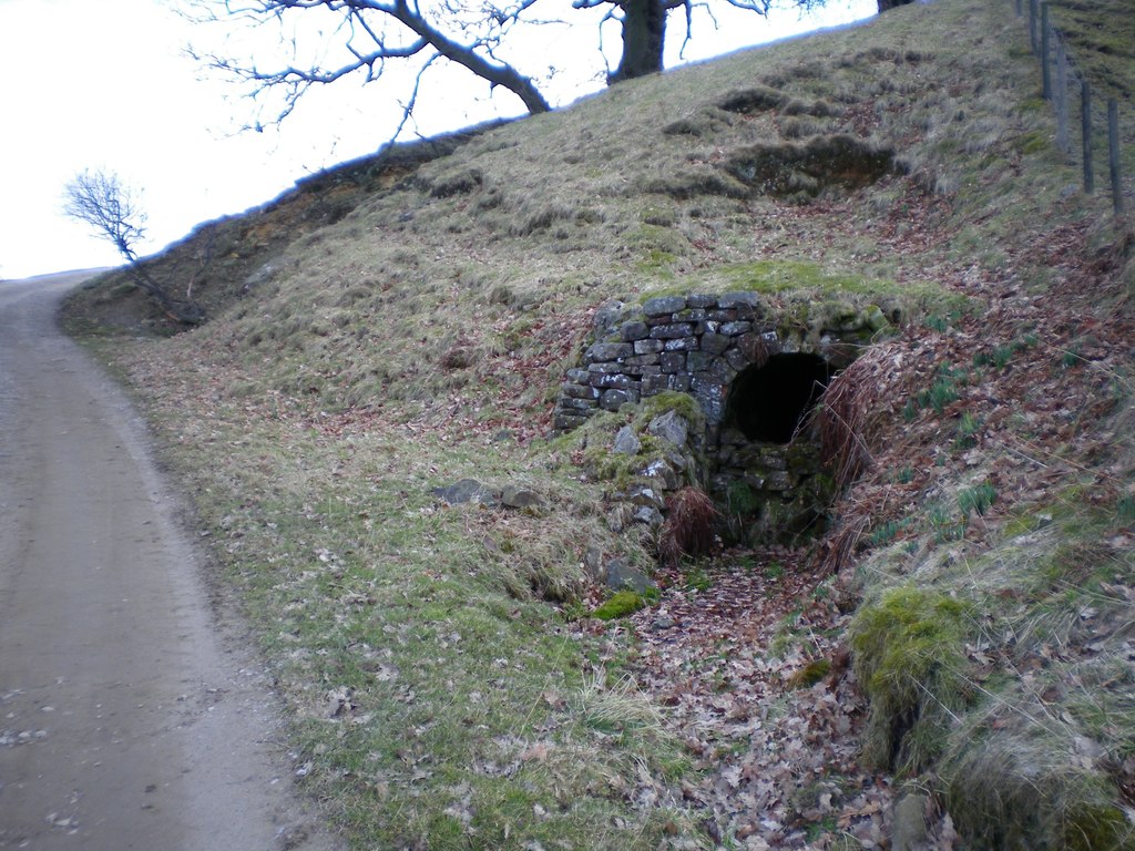
The stone-arched portal of a level survives in a grassy bank beside a track.
Stone-arched level portal.
Redevelopment
Unknown.
Related mines
- Old Gang Mines — Joseph Cradock, chairman of the Old Gang Company, moved Old Gang miners to Lolly Scar when Old Gang closed (NMRS).
Nearby mines
- Stony Grooves Mine — 3.6 miles (5.9 km) S
- Prosperous Lead Mine — 4.0 miles (6.5 km) S
- Greenhow Mines — 4.9 miles (7.9 km) S
- Red Scar Mine — 4.9 miles (7.9 km) SW
- Scotgate Ash Quarry — 4.9 miles (7.9 km) SE
Straight-line distance, within 9 miles (15 km). Show on the map.
Recorded claims
Individual factual claims, each attached to the source(s) that support it below. Where sources disagree, both are kept.
- Lolly Scar Mine is on the south-west bank of the River Nidd, three-quarters of a mile south-east of Lofthouse, at SE 1074 7248. 1
- The main crosscut was begun in 1866, restarted in 1889, and the portal bears the date July 1895. 1
- Lead output averaged 450 tons a year from 1898 to 1904 and fell to 65 tons in 1906; the mine closed in 1910. 1
- Vein minerals include amber fluorite, barytes, calcite, witherite, blende and galena. 1
- Linarite specimens have been collected from Lolly Scar Mine. 2
- A stone-arched level entrance survives at Lolly Scar. 3
Sources
- (secondary) Lolly Scar Mine — Northern Mine Research Society
- (secondary) Linarite from Lolly Scar Mine, North Yorkshire — Albion Fire and Ice
- (observational) Entrance to Lolly Scar lead mine (Geograph 1754125) — Geograph Britain and Ireland
Record created: 16 October 2026 · Last researched: 16 October 2026