 MineArchive
Scotgate Ash Quarry
| Also known as | Scot Gate Ash Quarry, Scot Gate Ash Quarries |
|---|---|
| Location | Pateley Bridge, North Yorkshire — 54.0947, -1.7561 (approximate) |
| Commodity | Sandstone |
| Type | Stone |
| Worked | By 1351–1915 |
| Maximum depth | Not applicable: chiefly surface workings, with some stone won by mining. |
| Operators | The Metcalfe family (1872–1915) |
Overview
Sandstone workings on the hillside above Pateley Bridge, worked from the fourteenth century to 1915 and by the 1880s the largest quarry in the West Riding. Its Delph Stone edged the platforms at York, Scarborough, Holyhead, London Victoria and London Paddington and built the National Gallery. A standard gauge incline dropped the stone six hundred feet into the town.
History
Stone was got at Scot Gate Ash from at least 1351, and between the early fourteenth century and 1915 the workings supplied dimension stone — known in the trade as Delph Stone — for buildings across Yorkshire and London. The Metcalfe family, landholders locally, had a major stake, and by 1880 their influence had made it the largest quarry in the West Riding.
The railway reached Pateley Bridge in 1862 and for the first time allowed stone out of the dale. In 1872 the Metcalfes installed a standard gauge inclined tramway to bring the stone down to the goods sidings west of Pateley Bridge station: it dropped six hundred feet over three thousand nine hundred, the loaded wagons going down hauling the empties up, with escape routes off it along its length. It crossed Corporation Road before joining the sidings at Millfield Street, and turned a journey of several hours by horse and cart into one of minutes.
The stone's reputation was for durability, and it went where wear mattered: the platform edges at York, Scarborough, Holyhead, London Victoria and London Paddington; the National Gallery, the National Safe Deposit Bank and the Kensington Museum in London; the government works at Aldershot, Enfield, Plymouth, Portsmouth and York; the Station Hotel at York and many buildings in Harrogate; post offices at Newcastle, Sunderland and Durham; steps for public buildings and edging for dockyards and harbours, the last because of the stone's high resistance to crushing. Scar House Reservoir further up the dale was built of it too.
By 1889 there were seven distinct working areas spread across the hill, all going under the one name. At the peak in the 1890s the workings ran for over a kilometre along the northern flank above the town, five steam cranes were at work and over five hundred men and boys were employed. In October 1892 extreme rainfall brought huge rockfalls down in the quarry area and the flooding destroyed the incline. The workings closed in 1915.
Geology
The quarries worked the Libishaw Sandstone, a bed of the Millstone Grit series described as a fine to medium-grained, micaceous, feldspathic, thin-bedded sandstone of variable colour — buff, brown, pale yellow and grey — quarried widely in the nineteenth century on the north side of Pateley Bridge. Its thin, even bedding is what made it a flagstone: blocks and flags could be got as large as sixteen square feet and sixteen inches deep, and its resistance to crushing is why it was chosen for platform edges and dock copings.
Geological setting: Sedimentary Beds and Seams (well documented example)
Workings
Seven distinct working areas by 1889, spread over more than a kilometre of hillside, with five steam cranes at the peak. Not all of it was open quarrying: some of the stone was won by mining rather than from the surface, though the shafts have since been filled in. The incline of 1872 was the spine of the operation, and the drum house, the manager's office and a reservoir at the eastern edge of the site all survive.
Closure
The workings closed in 1915. The incline had already been destroyed by flooding after the extreme rainfall of October 1892.
What remains
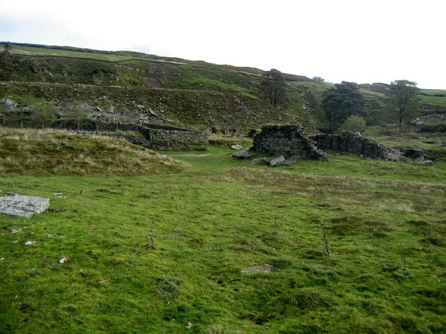
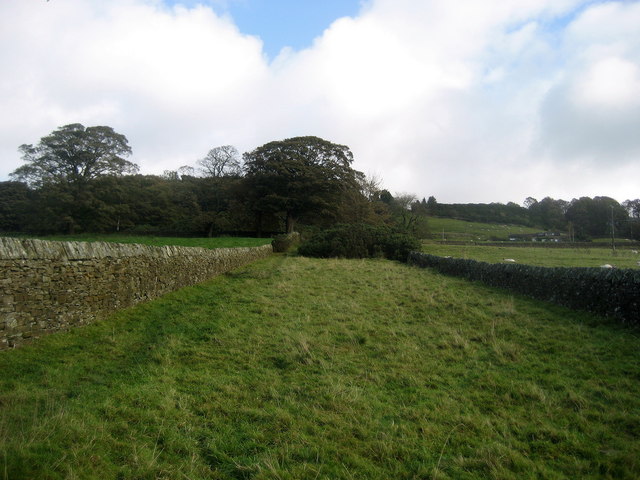
English Heritage have described the remains as striking. The incline survives and is shown on mapping, along with the manager's office, the drum house for the incline and a reservoir at the eastern edge of the site; ramps, machine beds, spoil heaps ten metres high and cliff-like working faces are all still there. The site and the former incline course are both on public footpaths, and there is a waymarked Scotgate Ash trail.
The incline and its drum house, the manager's office, a reservoir, ramps, machine beds and spoil heaps up to ten metres high.
Redevelopment
None; the site is open ground crossed by public footpaths.
Nearby mines
- Prosperous Lead Mine — 2.5 miles (4.1 km) W
- Coldstones Quarry — 2.8 miles (4.5 km) SW
- Greenhow Mines — 3.2 miles (5.1 km) W
- Stony Grooves Mine — 3.7 miles (6.0 km) W
- Appletreewick Mines — 4.8 miles (7.7 km) SW
Straight-line distance, within 9 miles (15 km). Show on the map.
Recorded claims
Individual factual claims, each attached to the source(s) that support it below. Where sources disagree, both are kept.
- The workings ran from at least 1351 to 1915, and by 1880 were the largest quarry in the West Riding; at the 1890s peak over five hundred men and boys were employed across workings more than a kilometre long, with five steam cranes. 1
- The Metcalfes installed a standard gauge inclined tramway in 1872 which lowered stone six hundred feet over three thousand nine hundred feet to the goods sidings at Pateley Bridge, the loaded wagons hauling the empties up. 1
- Scotgate Ash stone was used for the platform edges at York, Scarborough, Holyhead, London Victoria and London Paddington, and in the National Gallery, the National Safe Deposit Bank and the Kensington Museum. 1
- Some of the stone was won by mining rather than surface quarrying; the spoil heaps remain but the mining shafts have been filled in. 1
- The site retains ramps, machine beds, spoil heaps ten metres high and cliff-like working faces, and demonstrates the impact of mechanised industry on Upper Nidderdale. 2
- In October 1892 extreme rainfall in the valley caused huge rockfalls in the quarry area and the resulting flooding destroyed the incline. 1
Photographs & further reading
The fullest account online — the Metcalfes, the 1872 incline, the Libishaw Sandstone, the buildings and stations the stone went into, and what survives on the hillside.
View sourceThe waymarked Scotgate Ash trail through the abandoned workings, in the context of Nidderdale's wider quarrying and lead-mining history.
View sourceSources
- (secondary) Scotgate Ash Quarry — Wikipedia
- (secondary) Post-medieval Nidderdale — Nidderdale Landscape Partnership
Record created: 9 September 2026 · Last researched: 9 September 2026