 MineArchive
Prosperous Lead Mine
| Location | Ashfold Side, Bewerley, Nidderdale, North Yorkshire — 54.0906, -1.8183 (approximate) |
|---|---|
| Commodity | Lead |
| Type | Metal |
| Worked | 1781–1889 |
| Maximum depth | The Wonderful Level lay 27 m below the surface at the shaft beside the smelt mill. |
| Operators | Woods and Company (1786–?), Nidderdale Lead Mining Company (1860–1873) |
Overview
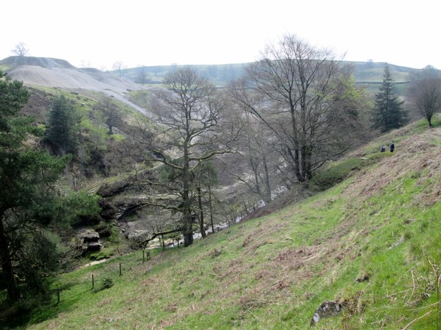
A lead mine and water-powered smelt mill on Ashfold Side Beck in Nidderdale, first leased in 1781 and abandoned in 1889 — a hundred years of trying to make lead pay. Underground waterwheels in the shaft beside the mill pumped the workings dry, and the mill's flue runs 170 m up the hillside through a beehive condenser to its chimney.
History
The earliest lease of the mine is dated 1781, and a smelt mill serving Prosperous along with the Providence and Stony Grooves mines to the west was built in 1785, or by another account 1814. Woods and Company worked the mine from 1786, but profits fell away between 1789 and 1793 and the lessees Luton and Baker gave it up. In 1816–17 the leases passed to John Honer, who sank a shaft beside the smelt mill to reach the Wonderful Level, 27 m below ground; three waterwheels were hung in that shaft between the surface and the level, the topmost, the smelters' wheel, six metres across and driving the mill's bellows. The downturn in the price of lead in the 1830s left the mine in disrepair. The Nidderdale Lead Mining Company took it over in the 1860s, but in 1873 the plant was sold and reused at the Stony Grooves and Merryfield mines up the valley, and the mine was finally abandoned in 1889. Since then the spoil has been picked over for other minerals, leaving concrete and timber structures and abandoned equipment across the site.
Geology
The mine worked the lead veins of the Greenhow field in the Millstone Grit of upper Nidderdale, on the line that runs down Ashfold Gill from Grassington Moor. The spoil is now colonised by spring sandwort, a metal-tolerant plant of national importance.
Workings
The smelt mill is a rectangular sandstone building of two main chambers, with further chambers for the pump gear to the west and a small roasting hearth to the east where ore was prepared for smelting. Underground waterwheels in the shaft west of the mill drove a pump to drain the mine, and part of the pump gearing still protrudes from the shaft with some of its timber frame intact; a substantial stone loading stands north of it. Collapsed material inside the mill is thought to cover two wheelpits. Water came to the wheels along a launder, two of whose wooden posts survive, and the smaller wheel worked a bellows serving a double ore hearth. The external roasting hearth on the east wall is attached to an arched flue that runs 170 m south-east, interrupted by an unusual beehive condenser standing 1.5 m high where lead fume was caught, and ending in a square chimney base. Bouse teams stand at the east end of the mill, with a wash kiln north-west of it and dressing floors revetted into the slope to the south-west; an intact slag heap lies on a platform near the beck.
Closure
A century of intermittent working ended in 1889. The mine's plant had already gone in 1873 to the Stony Grooves and Merryfield mines further up the valley, and later attempts reworked the spoil rather than the veins.
What remains
The structural, earthwork and buried remains are a scheduled monument and were consolidated and conserved by the Upper Nidderdale Landscape Partnership. The smelt mill's walls stand, with its flue, beehive condenser and chimney base, and the spoil heaps and revetted dressing platforms survive; the spoil carries a nationally important colony of spring sandwort.
The smelt mill with its roasting hearth, flue, beehive condenser and chimney base; the pumping shaft with gearing and timber frame; the stone loading; bouse teams; a wash kiln; revetted dressing platforms; an intact slag heap; and the later concrete and timber structures of the spoil reworking.
Redevelopment
None. The site is open valley side in the Nidderdale AONB.
Related mines
- Stony Grooves Mine — The Prosperous smelt mill served the Stony Grooves and Providence mines as well as its own, and when Prosperous was given up in 1873 its plant was sold and reused at Stony Grooves and Merryfield.
Nearby mines
- Stony Grooves Mine — 1.0 km W
- Greenhow Mines — 1.7 km SW
- Scotgate Ash Quarry — 4.1 km E
- Coldstones Quarry — 4.9 km W
- Red Scar Mine — 6.4 km SW
Straight-line distance, within 15 km. Show on the map.
Recorded claims
Individual factual claims, each attached to the source(s) that support it below. Where sources disagree, both are kept.
- The earliest lease of the mine is dated 1781, and the smelt mill serving Prosperous, Providence and Stony Grooves was built in 1785, or by another account in 1814. 1
- In 1816–17 the leases passed to John Honer, who sank a shaft near the smelt mill to reach the Wonderful Level 27 m below ground, with three waterwheels hung in the shaft, the topmost six metres across driving the bellows. 1
- The mill's arched flue runs about 170 m south-east, interrupted by an unusual beehive condenser standing 1.5 m high, and ends in a square chimney base. 2
- The mine's plant was sold in 1873 and reused at the Stony Grooves and Merryfield mines, and the mine was abandoned in 1889. 1
Photographs & further reading
The partnership's account of the site it conserved, with a dated timeline of leases, companies and closure and a note of the spring sandwort growing on the spoil.
View sourceSources
- (secondary) Prosperous lead mine — Upper Nidderdale Landscape Partnership
- (primary) Prosperous lead mines and smelt mill, Bewerley (List entry 1017752) — Historic England
Record created: 22 September 2026 · Last researched: 22 September 2026