 MineArchive
Providence Mine
| Location | Dowber Gill, above Kettlewell, North Yorkshire — 54.1680, -2.0500 (approximate) |
|---|---|
| Commodity | Lead |
| Type | Metal |
| Worked | 1663–1874 |
| Operators | Smithson, Swale and Barker (1663–?) |
Overview
The richest of Kettlewell's lead mines, on the south side of Dowber Gill in Wharfedale, worked from a 1663 partnership through to 1874 -- known as Old Providence once workers from it founded the rival New Providence mine across the valley.
History
Lead has been worked in Dowber Gill, above Kettlewell in Wharfedale, since 1663, when three men -- Smithson, Swale and Barker -- formed a partnership to exploit the ground. The mine, on the south side of the gill, became the richest at Kettlewell, and the village itself grew up on the fortunes it generated. It was originally known simply as Providence, taking the name Old Providence only once men from the mine went on to found the separate New Providence workings on the other side of the valley around 1820. Production peaked in the 19th century -- 192 tons of galena were raised in 1838, and in 1851 a large block of Providence ore was exhibited at the Crystal Palace Exhibition. Most of the later ore came from the Middle Level, near the head of the gill, worked from around 1860. The associated smelt mill was enlarged and refitted in 1868, with a longer flue built up the hillside, but closed again by 1872; the mine itself closed in 1874.
Geology
Lead of the Wharfedale orefield; most of the later ore came from the Middle Level near the head of the gill.
Workings
Worked via a series of levels including the Low Level (from around 1857) and the Middle Level (from around 1860, the source of most later ore); other named levels -- Hooksbank and the Plate (or Top) Level -- were driven with more limited success.
Closure
Closed in 1874, after the associated smelt mill had already closed in 1872.
What remains
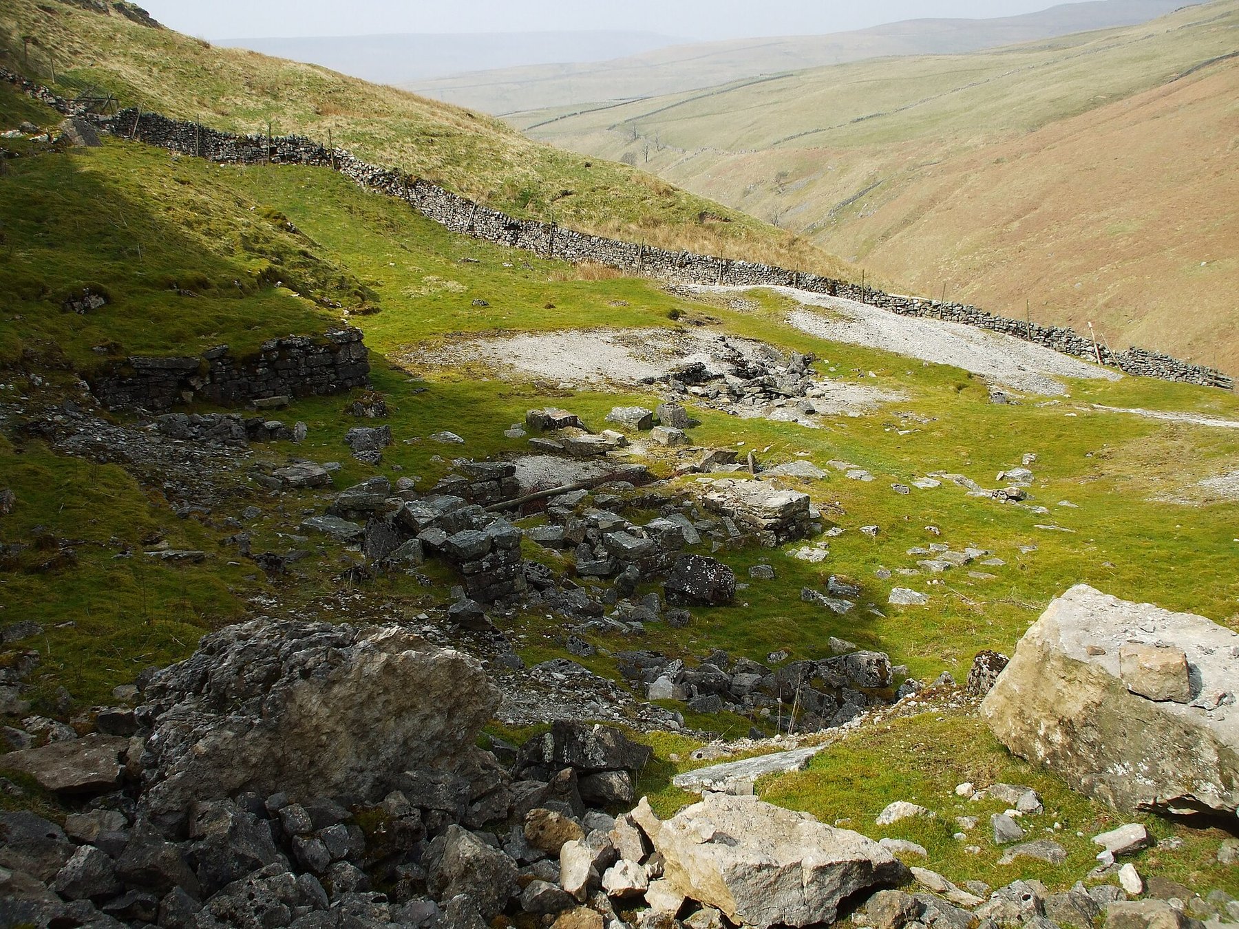
A 2025 exploration report found several levels still accessible, including the Low Level, which extends some distance underground with branching passages, and the re-excavated Middle Level with worked-out stoping; Providence Pot, a natural cave system connected to the workings, remains open. Extensive waste heaps survive, along with smelting waste and part of a wall at the former smelt mill site, and the remains of a wheelpit for an ore crusher. Some workings have collapsed or their entrances are now invisible.
The stone-walled dressing floors in Dowber Gill, with the spoil and level mouths above them.
Related mines
- New Providence Lead Mine — New Providence was founded around 1820 by men from this mine, striking out on their own ground across the valley.
- Prosperous Lead Mine — Sectioned together on the BGS longitudinal section KP4759.
Nearby mines
- New Providence Lead Mine — 1.6 miles (2.5 km) SW
- Buckden Gavel Mine — 2.3 miles (3.7 km) N
- Frankland Fold Mine — 5.8 miles (9.3 km) SE
- Grassington Moor Mines — 6.0 miles (9.7 km) SE
- Beever Mine — 6.4 miles (10.3 km) S
Straight-line distance, within 9 miles (15 km). Show on the map.
Recorded claims
Individual factual claims, each attached to the source(s) that support it below. Where sources disagree, both are kept.
- 192 tons of galena were raised in 1838, and in 1851 a large block of Providence ore was exhibited at the Crystal Palace Exhibition. 1
- A 2025 exploration report found several levels (Low, Middle) still accessible along with Providence Pot, extensive waste heaps, smelt-mill remains and an ore-crusher wheelpit, while other named levels have collapsed or their entrances are lost. 2
- Old Providence and New Providence are directly linked: New Providence was founded around 1820 by men from this mine, striking out on their own ground across the valley. 3
- The British Geological Survey holds a longitudinal section of the Prosperous and Providence lead mines (KP4759, scale not recorded, map sheet SE16NW), which can be viewed online. 4
Photographs & further reading
The scanned section, viewable online.
View sourceSources
- (secondary) Lead Mining - Earby Museum to Dales Countryside Museum — Upper Wharfedale Field Society
- (observational) Mines 56 - Old Providence Lead Mine (Yorkshire, 2025) — 28DaysLater Urban Exploring Forums
- (secondary) Slei Gill and the Floods — Upper Wharfedale Field Society
- (primary) A longitudinal section of Prosperous and Providence lead mines, KP4759 (BGS mine plans catalogue) — British Geological Survey
- (observational) Mines 58 - Starbotton Lead Mines (Yorkshire, 2025) — 28DaysLater Urban Exploring Forums
Record created: 1 September 2026 · Last researched: 24 September 2026