 MineArchive
Bullcliffe Wood Colliery
| Also known as | Bullcliffe Old Lane Colliery, Bullcliff Wood Colliery |
|---|---|
| Location | Bretton West, near Wakefield, West Yorkshire — 53.6294, -1.5698 (exact) |
| Commodity | Coal |
| Type | Coal |
| Worked | 1927–30 August 1985 |
| Maximum depth | No depth figure applies in the ordinary sense. Bullcliffe was a complex of drift mines, entered by inclined roadways from the surface rather than by winding shafts, with two further drifts added in 1956. |
| Operators | Bullcliffe Wood Colliery Co., Ltd. (1927–1946), National Coal Board (1947–1985) |
Overview
A small West Yorkshire drift mine complex at Bretton West near Wakefield, begun in 1927 and called Bullcliffe Old Lane until 1948, when it was renamed Bullcliffe Wood. It worked the Barnsley and Top Haigh Moor seams for gas, household and steam coal, and stayed small: eighty people through the 1930s, 140 at nationalisation and 251 by 1954. Two further drifts were driven in 1956. It closed on 30 August 1985 and was merged the following month with the Calder drift and Caphouse into the combined Denby Grange. The site is now woodland.
History
Bullcliffe stands on Denby Dale Road at Bretton West, four and a half miles south-west of Wakefield, on the Yorkshire coalfield. Sinking started in 1927, and for its first two decades the colliery went by the name of the lane it stood on, Bullcliffe Old Lane. It was renamed Bullcliffe Wood in 1948, the year after nationalisation, and the two names are the reason the colliery can be hard to trace in the record.
It was never large. The Lists of Mines return 80 employed in 1933, 1937 and 1940, 65 of them below ground each year, a figure so steady it reads like a settled small operation rather than a growing one. In 1933 the registered office of the Bullcliffe Wood Colliery Co. Ltd was at Denby Dale Road, Bretton, Wakefield, and the colliery worked the Barnsley seam for an annual output of 25,000 tons of gas, household and steam coal. Under the National Coal Board it grew: 140 employed in 1947, raising 65,000 tons, and 251 by 1954, working the Barnsley and Top Haigh Moor seams.
The colliery was a complex of drift mines rather than a shaft pit, and two further drifts were established in 1956. It closed on 30 August 1985, at the end of the year of the miners' strike, and in September 1985 was merged with the Calder drift and Caphouse, the combined undertaking taking the name Denby Grange. Caphouse survives as the National Coal Mining Museum for England, so the ground Bullcliffe was finally joined to is still open.
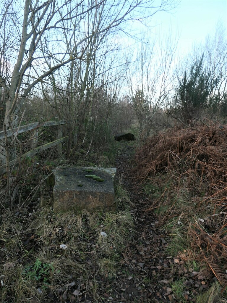
The site itself has gone back to trees. It is now a woodland area of about seven hectares managed by Wakefield Metropolitan District Council, crossed by public footpaths; one runs north from Denby Dale Road along the southern end of Bullcliffe Old Lane, close to where the colliery stood, and a former colliery railway nearby is now part of a longer walking route.
Geology
Bullcliffe worked the Barnsley seam, the thickest and most valuable coal of the Yorkshire coalfield, and by 1954 the Top Haigh Moor as well. Both lie in the Middle Coal Measures, and here they come close enough to the surface on the western side of the field to be reached by drifts driven in from the outcrop rather than by sinking, which is why the colliery took the form it did.
Geological setting: Sedimentary Beds and Seams (well documented example)
Workings
A complex of drift mines rather than a shaft colliery, begun in 1927 with two further drifts established in 1956. Working the Barnsley seam gave an output of about 25,000 tons a year before nationalisation and 65,000 tons by 1947, with the Top Haigh Moor added by 1954. A colliery railway served the site and its embankment survives as part of a walking route.
Closure
Bullcliffe Wood closed on 30 August 1985, months after the end of the 1984-85 miners' strike, and did not simply disappear: in September 1985 it was merged with the Calder drift and with Caphouse, and the combined undertaking was renamed Denby Grange. The colliery had grown rather than shrunk under the National Coal Board, from 80 employed before nationalisation to 251 in 1954. No account of the specific closure decision is recorded.
What remains
The colliery site is now a woodland area of about 6.92 hectares managed by Wakefield Metropolitan District Council and open to the public. Footpaths cross it, including one heading north from Denby Dale Road at the southern end of Bullcliffe Old Lane close to where the colliery stood, and another following the line of the former colliery railway, now carried over the embankment rather than through the underpass beneath it.
No colliery buildings are recorded. What survives is earthwork and alignment: the embankment and underpass of the former colliery railway, and the lane that gave the colliery its first name.
Redevelopment
The site has been planted and is managed as public woodland by Wakefield Metropolitan District Council.
Related mines
- Denby Grange Colliery — Part of the Denby Grange complex; Bullcliffe Wood was merged into Denby Grange in 1985.
Nearby mines
- Bentley Grange Ironstone Pits — 1.7 miles (2.7 km) SW
- Crigglestone Colliery — 2.0 miles (3.2 km) NE
- Caphouse Colliery — 2.3 miles (3.7 km) NW
- Hostingley Colliery — 2.3 miles (3.8 km) NW
- Denby Grange Colliery — 2.5 miles (3.9 km) W
Straight-line distance, within 9 miles (15 km). Show on the map.
Recorded claims
Individual factual claims, each attached to the source(s) that support it below. Where sources disagree, both are kept.
- Sinking started in 1927. The Lists of Mines return 80 employed in 1933, 1937 and 1940, 65 of them below ground; 140 in 1947 with an output of 65,000 tons; and 251 in 1954, working the Barnsley and Top Haigh Moor seams. 1
- The Bullcliffe Wood Colliery Co. Ltd had its registered office on Denby Dale Road, Bretton, Wakefield, and in 1933 worked the Barnsley seam for an annual output of 25,000 tons of gas, household and steam coal. 2
- The colliery was called Bullcliffe Old Lane from 1925 to 1947 and Bullcliffe Wood from 1948. It was a complex of drift mines, with two established in 1956, and closed on 30 August 1985, merging in September 1985 with the Calder drift and Caphouse or Denby Grange under the name Denby Grange. 1,3
- The former colliery site is a woodland area of 6.92 hectares managed by Wakefield Metropolitan District Council. 3
Photographs & further reading
Location on Denby Dale Road at Bretton West, grid reference, the 1927 start of sinking, the owners, and output and employment by List of Mines year from 1933 to 1954 with the seams worked.
View sourceThe company behind the colliery, with its registered office on Denby Dale Road and the 1933 Colliery Year Book entry giving the Barnsley seam and an output of 25,000 tons a year.
View sourceThe former colliery site as it now is, a wood of about seven hectares in the care of Wakefield Metropolitan District Council.
View sourceSources
- (primary) Bullcliffe Wood Colliery — Durham Mining Museum
- (primary) Bullcliffe Wood Colliery Co., Ltd. — Durham Mining Museum
- (observational) Bullcliffe Former Colliery — Woodland Trust
Record created: 10 September 2026 · Last researched: 10 September 2026