 MineArchive
Bentley Grange Ironstone Pits
| Also known as | Bentley Grange Bell Pits |
|---|---|
| Location | Bentley Grange, Emley, West Yorkshire — 53.6133, -1.6007 (approximate) |
| Commodity | Ironstone |
| Type | Ironstone |
| Worked | Late 12th century–By mid-15th century |
| Maximum depth | Unknown. Shallow bell-pit workings. |
| Operators | Byland Abbey (1180–1450) |
Overview
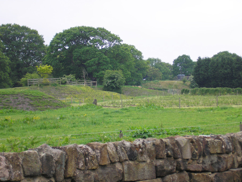
Sixty or more shaft mounds in a rough grid across the fields at Bentley Grange near Emley, dug for ironstone and long taken as medieval bell pits worked from Byland Abbey's grange here. Historic England calls them among the best preserved mining landscapes in Britain to predate the Industrial Revolution, though the scheduling now dates the mounds themselves to the 16th century or thereabouts.
History
The Cistercian abbey of Byland, in the North Riding, had a grange and an iron forge at Bentley by the late 12th century, and a reference of about 1226 to 'stones for burning at the grange of Bentley' is taken to mean that ore was being smelted here as well as forged; the abbey also held land or rights at Emley, Denby and West Bretton. Iron working appears to have ceased at the grange by the mid-15th century, when it was being leased out as agricultural land, and when Byland was dissolved in 1538 the assets of Bentley Grange were recorded as enclosed pastures. In 1953 J. K. St Joseph photographed the earthworks from the air and connected them with the documentary references to medieval iron working, concluding that the shaft mounds were medieval bell pits for iron ore; the modern scheduling is more cautious, judging the mounds to predate the Industrial Revolution and probably to be of the 16th century, without ruling a medieval date out. The ore came from the Tankersley ironstone, the seam that fed the iron trade of this part of the West Riding.
Geology
The pits worked the Tankersley ironstone, a nodular clay ironstone of the Coal Measures that was mined across the South and West Yorkshire coalfield and was the mainstay of the district's medieval and later iron making.
Workings
The shaft mounds are not scattered at random but set out in a rough grid, the shafts typically about 50 m apart. The smallest mounds are about 25 m across and are simple rings of spoil around a central hollow marking the shaft; most are larger, around 40 m across and 2 to 3 m high, with flattened tops and the shaft either central or set to one side. A number have access ramps and platforms interpreted as gin circles. About five mounds in the western part of the area, south of Woodhouse Lane, are noticeably bigger and more irregular, with earthworks suggesting horse gins set beside the shaft. At least fifty mounds survive as upstanding earthworks south of the lane and another ten, more spread and eroded, to the north, where up to four further shafts are thought to survive as buried remains. The mounds overlie the ridge and furrow of a medieval open field, laid out in two blocks, together with the earthworks of building platforms and small enclosures.
Closure
Iron working at the grange appears to have stopped by the middle of the 15th century, when the land was being leased for farming; at the Dissolution in 1538 the grange's assets were simply enclosed pastures. The date of the surviving mounds is less certain than the date of the grange.
What remains
The shaft mounds, the ridge and furrow they overlie and the associated earthworks are a scheduled monument in pasture south and north of Woodhouse Lane, and are on the Heritage at Risk register. They survive as upstanding earthworks, those north of the lane more spread and eroded than those to the south.
At least sixty shaft mounds with their central hollows, flattened tops, access ramps and probable gin circles, overlying medieval ridge and furrow, building platforms and small enclosures.
Redevelopment
None. The ground is farmland around Bentley Grange Farm.
Nearby mines
- Duke Wood Colliery — 2.1 km S
- Bullcliffe Wood Colliery — 2.6 km NE
- Flockton Collieries — 2.9 km NW
- Caphouse Colliery — 4.3 km NW
- Shuttle Eye Colliery — 4.9 km NW
Straight-line distance, within 15 km. Show on the map.
Recorded claims
Individual factual claims, each attached to the source(s) that support it below. Where sources disagree, both are kept.
- Byland Abbey had established a grange and an iron forge at Bentley by the late 12th century, and a reference of about 1226 to 'stones for burning at the grange of Bentley' is taken to indicate smelting as well as forging. 1
- At least fifty shaft mounds survive as upstanding earthworks south of Woodhouse Lane and ten more to the north, set out in a rough grid with the shafts typically 50 m apart. 1
- In 1953 J. K. St Joseph's aerial photographs led to the identification of the mounds as medieval bell pits for iron ore, though the scheduling judges them probably of the 16th century without excluding a medieval date. 1
- Iron working at the grange appears to have ceased by the mid-15th century, and at the Dissolution in 1538 the assets of Bentley Grange were recorded as enclosed pastures. 1
- The ore mined here was the Tankersley seam. 2
Photographs & further reading
The village article, which covers Byland Abbey's holdings at Emley, the Tankersley ironstone worked here and the bell pits at Bentley Grange.
View sourceSources
- (primary) Iron mining shaft mounds and medieval earthworks south of Bentley Grange Farm, Denby Dale (List entry 1005786) — Historic England
- (secondary) Emley — Wikipedia
Record created: 22 September 2026 · Last researched: 22 September 2026