 MineArchive
Blayshaw Gill Mine
| Location | Blayshaw Gill, above Lofthouse, upper Nidderdale, North Yorkshire — 54.1514, -1.8507 (exact) |
|---|---|
| Commodity | Lead |
| Type | Metal |
| Worked | By 1870 (earlier old workings)–1909–1910 |
| Maximum depth | 12.5 fathoms (West Shaft); old men's drift at 76 feet |
| Operators | Joseph Cradock (1894–1909), Blayshaw Gill Lead Mining Company |
Overview
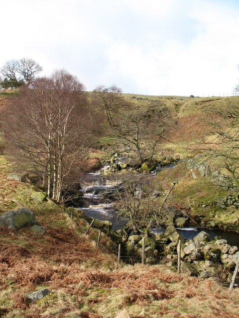
A poor lead mine in the grits on the north-west bank of Blayshaw Gill above Lofthouse in upper Nidderdale, where the old men's shafts were reopened by the Blayshaw Gill company in the 1870s and by Joseph Cradock of Lolly Scar from 1894, who drove a level and crosscuts to the Great Cross Vein for a few dozen tons of ore before abandoning it in 1910.
History
The old men had worked the veins by Blayshaw Gill from shafts, and were probably beaten by water and the poverty of the ground. West Shaft was sunk twelve and a half fathoms on the old men's North Vein with a drift from it, another shaft of which nothing is known went down on the Great Cross Vein, and Speakwath Shaft was sunk on North Vein.
The Blayshaw Gill Lead Mining Company took up the ground in the 1870s, with John Appleby as agent, and worked from West and Speakwath shafts; the NMRS page has the company appearing in 1876 and beginning Blayshaw Level from the north bank of the gill, while Gill's 1974 memoir has the company at work from 1870 to 1880 and the level started in 1885, from a point on the north-west bank at 650 feet. The level followed a step-faulted vein in the grits dipping five to ten degrees south, with a little stoping above it. An abandonment survey of July 1891 by A. Rodwell of Wensley shows the forehead 1,914 feet from the portal, 160 feet inbye of Speakwath Shaft.
Joseph Cradock of Stockton-on-Tees, who had taken the neighbouring Lolly Scar mine, took over Blayshaw Gill in 1894 and drove the level on to the Great Cross Vein, following it north until 1901. That year he reopened West Shaft, found the old men's drift 76 feet down and continued it 400 feet westwards in thin grits, following the vein east and down to the Horse Level. A south crosscut of 770 feet crossed a number of east-west strings, worked in 1908 and 1909 with some work on the Great Cross Vein in the Horse Level. The return was small: 35 tons of ore between 1905 and 1908 by the memoir, 62 tons in Cradock's fifteen years by the NMRS page. From a field examination it was a poor mine, kept going by its richer neighbour at Lolly Scar, and it was abandoned with the Lolly Scar workings in 1909 and 1910.
Geology
East-west lead veins and strings in the Millstone Grit above Lofthouse: North Vein, the Great Cross Vein and a step-faulted vein in the grits dipping five to ten degrees south, carrying little mineral, on the northern fringe of the Greenhow field.
Geological setting: Veins and Lodes (historical documentary reference)
Workings
Old men's shafts (West Shaft, twelve and a half fathoms on North Vein; Speakwath Shaft; a shaft on the Great Cross Vein), Blayshaw Level driven from the north-west bank of the gill to 1,914 feet by 1891 and on to the Great Cross Vein, West Shaft reopened in 1901 to the old drift at 76 feet, a 770-foot south crosscut and the Horse Level.
Closure
Abandoned in 1909 and 1910 with Cradock's Lolly Scar workings; the veins were poor and the mine was sustained only by its neighbour.
What remains
Blayshaw Gill Level is walled up on the north side of the gill, as a 2026 visit found.
A walled-up level portal on the north-west bank of the gill; the shaft sites on the moor above.
Redevelopment
None.
Related mines
- Lolly Scar Mine — Joseph Cradock worked both mines together from the 1890s; Lolly Scar's Bents New Level was driven from Blayshaw Gill and the two are on one abandonment plan of 1909.
Nearby mines
- Lolly Scar Mine — 0.6 miles (1.0 km) SE
- Stony Grooves Mine — 3.9 miles (6.2 km) S
- Prosperous Lead Mine — 4.4 miles (7.1 km) S
- Red Scar Mine — 4.7 miles (7.6 km) SW
- Greenhow Mines — 5.2 miles (8.4 km) S
Straight-line distance, within 9 miles (15 km). Show on the map.
What's uncertain
Points where sources disagree or the record could not be settled; both accounts are kept. All open questions in the archive.
- The Blayshaw Gill Lead Mining Company appeared in 1876 and began driving Blayshaw Level from the north bank of the gill. (disputed) 1
- The Blayshaw Gill company, with John Appleby as agent, worked West and Speakwath shafts between 1870 and 1880, and Blayshaw Level was started in 1885 from the north-west bank at 650 feet, NGR SE098728. (disputed) 2
- Only 62 tons of ore were produced in the fifteen years Cradock worked the mine. (disputed) 1
- Between 1905 and 1908 a total of 35 tons of ore were raised. (disputed) 2
Recorded claims
Individual factual claims, each attached to the source(s) that support it below. Where sources disagree, both are kept.
- The old men worked the veins by shafts: West Shaft twelve and a half fathoms on North Vein with a drift, a shaft on the Great Cross Vein and Speakwath Shaft on North Vein. 1
- The Blayshaw Gill Lead Mining Company appeared in 1876 and began driving Blayshaw Level from the north bank of the gill. (disputed) 1
- The Blayshaw Gill company, with John Appleby as agent, worked West and Speakwath shafts between 1870 and 1880, and Blayshaw Level was started in 1885 from the north-west bank at 650 feet, NGR SE098728. (disputed) 2
- An abandonment survey of July 1891 by A. Rodwell of Wensley shows the forehead of Blayshaw Level 1,914 feet from the portal, 160 feet inbye of Speakwath Shaft. 1
- Joseph Cradock took over the mine in 1894, drove the level to the Great Cross Vein and followed it north until 1901, then drove crosscuts between 1901 and 1909. 1,2
- In 1901 Cradock reopened West Shaft at SE08887278, found the old men's drift 76 feet down and continued it 400 feet westwards; a 770-foot south crosscut crossed several east-west strings worked in 1908 and 1909. 2
- Only 62 tons of ore were produced in the fifteen years Cradock worked the mine. (disputed) 1
- Between 1905 and 1908 a total of 35 tons of ore were raised. (disputed) 2
- The abandonment plan covering Lolly Scar, Bents New, Blayshaw, Silver Hill, Speakwath and Thompsons workings is dated 31 December 1909, and the memoir gives abandonment in 1910. 2,3
- Blayshaw Gill Level was walled up on the north side of the valley in May 2026. 4
Photographs & further reading
The Northern Mine Research Society's page on the mine.
View sourceGill's memoir with the grid references, dates and workings of both mines.
View sourceA 2026 report on the Lolly Scar levels which records Blayshaw Gill Level as walled up.
View sourceSources
- (secondary) Blayshaw Gill Mine — Northern Mine Research Society
- (secondary) Lolly Scar & Blayshaw Gill Lead Mines (M. C. Gill, Memoirs NCMRS vol. 2 no. 4, 1974) — Northern Mine Research Society
- (primary) BGS mine plan: Lolly Scar, Bents New, Blayshaw, Silver Hill, Speakwath, Thompsons (lead ore, abandoned 1909) — British Geological Survey
- (observational) Mines 68: Lolly Scar Lead Mine (Yorkshire, May 2026) — 28DaysLater
- (observational) Blayshaw Gill between High Blayshaw and Moor House (photograph, 2009) — Geograph
Record created: 16 October 2026 · Last researched: 21 October 2026