 MineArchive
Bedlay Colliery
| Location | Annathill, near Coatbridge, North Lanarkshire — 55.9110, -4.0485 (exact) |
|---|---|
| Commodity | Coal |
| Type | Coal |
| Worked | 1905–1981 |
| Maximum depth | Unknown. |
| Operators | William Baird & Company (1905–?), Bairds & Scottish Steel Limited (?–1981) |
Overview
A Lanarkshire coking-coal colliery sunk in 1905 by William Baird and Company to feed the Gartsherrie Iron Works and, later, modernised to supply the Ravenscraig steelworks; the mining village of Annathill grew up around it and outlived it after closure in 1981.
History
William Baird and Company sunk Bedlay Colliery in 1905 specifically to supply coking coal to their own Gartsherrie Iron Works, and built the mining village of Annathill alongside it to house the workforce, with three Miners' Rows of housing plus shops, a butcher and a pub raised at the same time. On 20 October 1923 a firedamp explosion killed two men at the colliery -- one of many small, thinly-documented fatal accidents in the everyday toll of the coal industry, with no surviving record beyond the bare fact of it. Ownership passed to Bairds & Scottish Steel Limited, and the colliery was later modernised to supply coal to the Ravenscraig steelworks. The pit had two shafts, one fitted with modern enclosed headgear and the other with older open-type headgear. Bedlay was closed on 11 December 1981 by the Conservative government of the day; the site was left abandoned before being filled in ('capped') and demolished in 1982. Land restoration to something like the site's pre-colliery condition, undertaken by the National Coal Board, began in the 1990s and was still under way decades later.
Geology
Coal of the Lanarkshire field; the seams worked are not recorded.
Workings
A two-shaft pit, one fitted with modern enclosed headgear and the other with older open-type headgear.
Closure
Closed on 11 December 1981 by the Conservative government of the day; filled in and demolished in 1982.
What remains
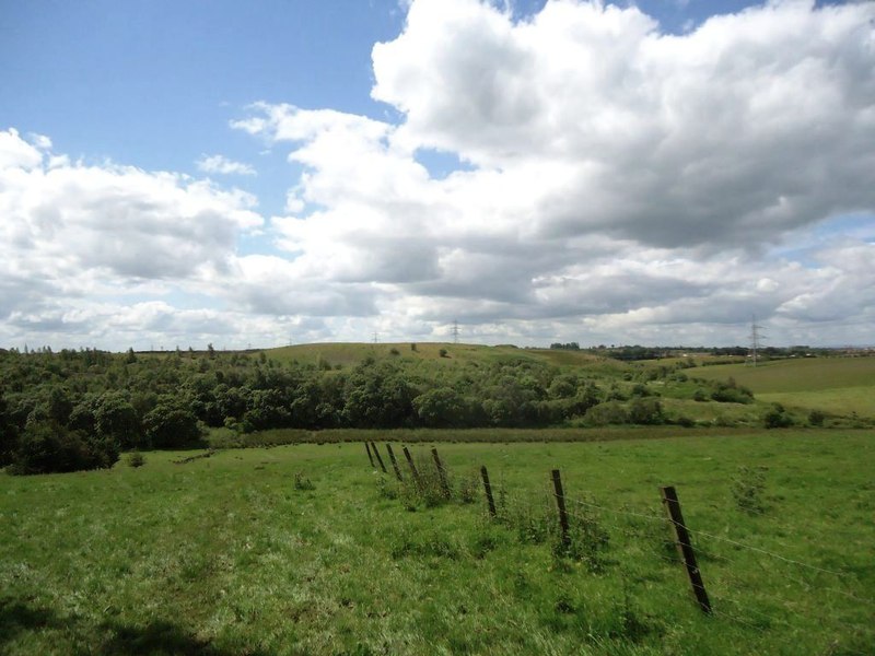
The colliery buildings were demolished and the shafts capped in 1982; the site today is a landscaped hillside, the visible result of later open-cast coal recovery and land restoration rather than any surviving colliery structure.
No colliery structures survive; the site is now a landscaped hill formed by open-cast recovery and subsequent land restoration.
Related mines
- Gartshore Colliery — Both were William Baird & Co. pits, and when Gartshore 9/11 shut in 1968 as the last colliery in the area, Twechar men travelled daily to Bedlay until it too closed in the early 1980s.
Nearby mines
- Glenboig Fireclay Mines — 1.3 miles (2.1 km) S
- Auchengeich Colliery — 2.2 miles (3.5 km) W
- Cardowan Colliery — 3.6 miles (5.9 km) SW
- Meiklehill Colliery — 3.9 miles (6.2 km) NW, East Dunbartonshire
- Woodilee Colliery — 3.8 miles (6.2 km) W, East Dunbartonshire
Straight-line distance, within 9 miles (15 km). Show on the map.
Recorded claims
Individual factual claims, each attached to the source(s) that support it below. Where sources disagree, both are kept.
- William Baird and Company sunk Bedlay Colliery in 1905 to supply coking coal to their own Gartsherrie Iron Works, building the mining village of Annathill -- three Miners' Rows, shops, a butcher and a pub -- alongside it. 1
- Bedlay Colliery was closed on 11 December 1981, then filled in and demolished in 1982; land restoration to the site's pre-colliery condition began in the 1990s and remained under way decades later. 1
- A firedamp explosion at Bedlay Colliery killed two men on 20 October 1923 -- the only detail recorded for the event is the date, cause and death toll. 2
Photographs & further reading
A list of recorded fatal accidents at the colliery.
View sourceSources
- (secondary) Annathill — Wikipedia
- (primary) Fatal Accidents at Bedlay Colliery — Durham Mining Museum
- (observational) Annathill, Bedlay Colliery, site of — Geograph Britain and Ireland (Robert Murray)
Record created: 30 August 2026 · Last researched: 30 August 2026