 MineArchive
Longstone Edge
| Location | near Great Longstone, White Peak, Derbyshire — 53.2590, -1.6840 (exact) |
|---|---|
| Commodities | Fluorspar, Barite, Lead |
| Type | Metal |
| Worked | worked from at least the 18th century (lead veins)–2009 |
| Operators | Laporte Minerals (1965–2009) |
Overview
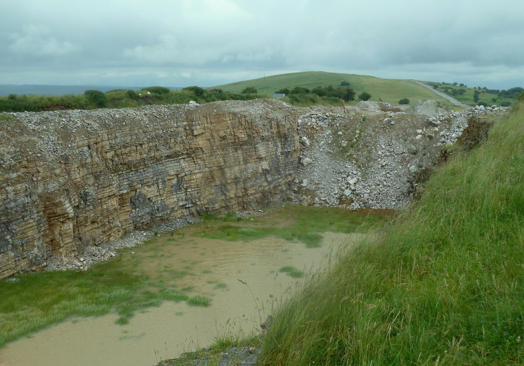
Longstone Edge, a limestone ridge in the White Peak north of Bakewell, has been worked for lead, fluorspar and barytes since at least the 18th century — and became, in the early 21st century, the site of one of the Peak District National Park's longest and most bitterly fought legal battles over exactly what a historic mineral permission actually allowed.
History
Lead veins along Longstone Edge were worked from at least the 18th century, drained in part by Sallet Hole, originally driven as a sough — an underground drainage channel — before being converted into a haulage level around 1840-42. Large-scale fluorspar extraction began in 1926, continuing until 1930, and resumed in 1965 under Laporte Minerals, working ore both underground and from opencast workings along a strike of some 3.5 kilometres. A 1952 mineral permission granted for the site became the centre of a prolonged and contentious dispute in the early 21st century, when operators were accused of using it to justify large-scale extraction of limestone aggregate — far more valuable and abundant than the fluorspar the permission had originally been intended to cover, and causing what campaigners argued was permanent damage to a ridge at the heart of the Peak District National Park. A 2009 Court of Appeal ruling ultimately allowed quarrying to continue, but confirmed that the original 1952 permission had to be interpreted with its emphasis on fluorspar, not limestone.
Geology
The mine worked lead, fluorspar and barytes mineralisation within Carboniferous limestone of the White Peak, deposited by the same non-magmatic hydrothermal system responsible for the wider Derbyshire orefield.
Geological setting: Hydrothermal Deposits (well documented example), Veins and Lodes (well documented example)
Workings
Sallet Hole was originally driven as a sough to drain the Longstone Edge workings before being converted to a haulage level around 1840-42; later 20th-century fluorspar working combined underground development with opencast extraction along a strike of around 3.5 kilometres.
Closure
No single closure date is well documented; fluorspar and limestone extraction, and the legal disputes surrounding it, continued into the early 21st century. Quarrying at Backdale ceased in July 2009 and the fluorspar workings under the edge had closed in 1998.
What remains
Quarrying at Longstone Edge remained a live source of controversy into the 2000s, with campaigners arguing that limestone extraction under a permission originally intended for fluorspar had caused lasting damage to the ridge.
Related mines
- Sallet Hole Mine — Sallet Hole began as a drainage sough for Longstone Edge's lead workings, and later directly worked its Deep Rake deposit.
Nearby mines
- Silver Hillocks Mine — 0.3 miles (0.5 km) S
- Brightside Lead Mine — 1.2 miles (1.9 km) E
- Cackle Mackle and Stadford Hollow Lead Mines — 1.3 miles (2.0 km) W
- Seedlow Lead Mine — 1.4 miles (2.3 km) NW
- Nickergrove Mine — 1.5 miles (2.4 km) N
Straight-line distance, within 9 miles (15 km). Show on the map.
Recorded claims
Individual factual claims, each attached to the source(s) that support it below. Where sources disagree, both are kept.
- Fluorspar was worked from 1926 to 1930 and again from 1965 under Laporte Minerals, combining underground and opencast extraction along a strike of around 3.5 kilometres. 1
- A 2009 Court of Appeal ruling allowed quarrying to continue under the site's 1952 mineral permission, but confirmed that the permission had to be interpreted with its original emphasis on fluorspar rather than limestone. 1
- Sallet Hole's 32-foot waterwheel drove crushing rollers, though later workings destroyed every trace of it; the fluorspar workings below the opencasts on Deep Rake produced 73,000 tonnes of ore in 1990 and closed in 1998. 2
- The Mining Remediation Authority's abandonment plan OMR69, at 40 yards to the inch, covers the lead-ore workings of Longstone Edge together with Brightside, Backdale, Folly, Gospel, Hare, Hare Stile, Old Red Rake, Sallad Hole, Saturday Night, Silver Hillock, Taylors Coe, Waterholes and White Coe. 3
- Quarrying at Backdale Quarry ceased in July 2009, five months after the Court of Appeal's ruling, and the machinery was removed. 1
- Located at about 53.259 N, 1.684 W. 1
Sources
- (secondary) Longstone Edge — Wikipedia
- (secondary) Sallet Hole Mine — Stoney Middleton Heritage
- (primary) Longstone Edge and Brightside, Backdale, Folly, Gospel, Hare Stile and other mines: abandonment plan OMR69 (BGS mine plans catalogue) — British Geological Survey / Mining Remediation Authority
- (primary) Section Along the Longstone Edge Vein (BGS Mine Plans Catalogue) — British Geological Survey / Rio Tinto Zinc
Record created: 23 August 2026 · Last researched: 24 September 2026