 MineArchive
Sallet Hole Mine
| Location | Stoney Middleton, Derbyshire — 53.2803, -1.6699 (approximate) |
|---|---|
| Commodities | Fluorspar, Lead |
| Type | Mineral |
| Worked | at least 17th century (as a sough)–1998 |
| Maximum depth | 130m level (plus a further 40m above) |
| Operators | Laporte Minerals |
Overview
One of Britain's leading underground fluorspar mines by the late 20th century, reached through a level originally driven simply to drain lead workings on Longstone Edge.
History
Sallet Hole began as a sough — an underground drainage channel — to the lead workings under Longstone Edge, with mineral veins in the area worked since at least the 17th century. It was converted into a haulage level around 1840-42, and a 32ft waterwheel was installed to power ore-crushing rollers, though all trace of the wheel was later destroyed by subsequent mining. Twentieth-century fluorspar production followed in two phases, first from 1926 to 1930, then resuming in 1965 under Laporte Minerals, working the Deep Rake deposit beneath the Longstone Edge opencast. Output peaked around 1990 at roughly 73,000 tonnes a year, making Sallet Hole one of Britain's leading underground fluorspar mines, before cheaper imported fluorspar made it uneconomic and the mine closed in 1998. It later served as an underground connection to the neighbouring Watersaw Mine (Sallet Hole No. 2) until that mine closed too, in 2009.
Geology
The mine worked mineral veins associated with Longstone Edge, including the Deep Rake fluorspar deposit that lay beneath the area's opencast workings.
Workings
Access follows the original sough/haulage level to a 130m level, with a further 40m of workings above reached by iron ladders; extensive galleries and side workings run off both.
Closure
Long closed, and one of the most collapsed and unstable mines in Derbyshire: explorers describe crumbling ground throughout.
What remains
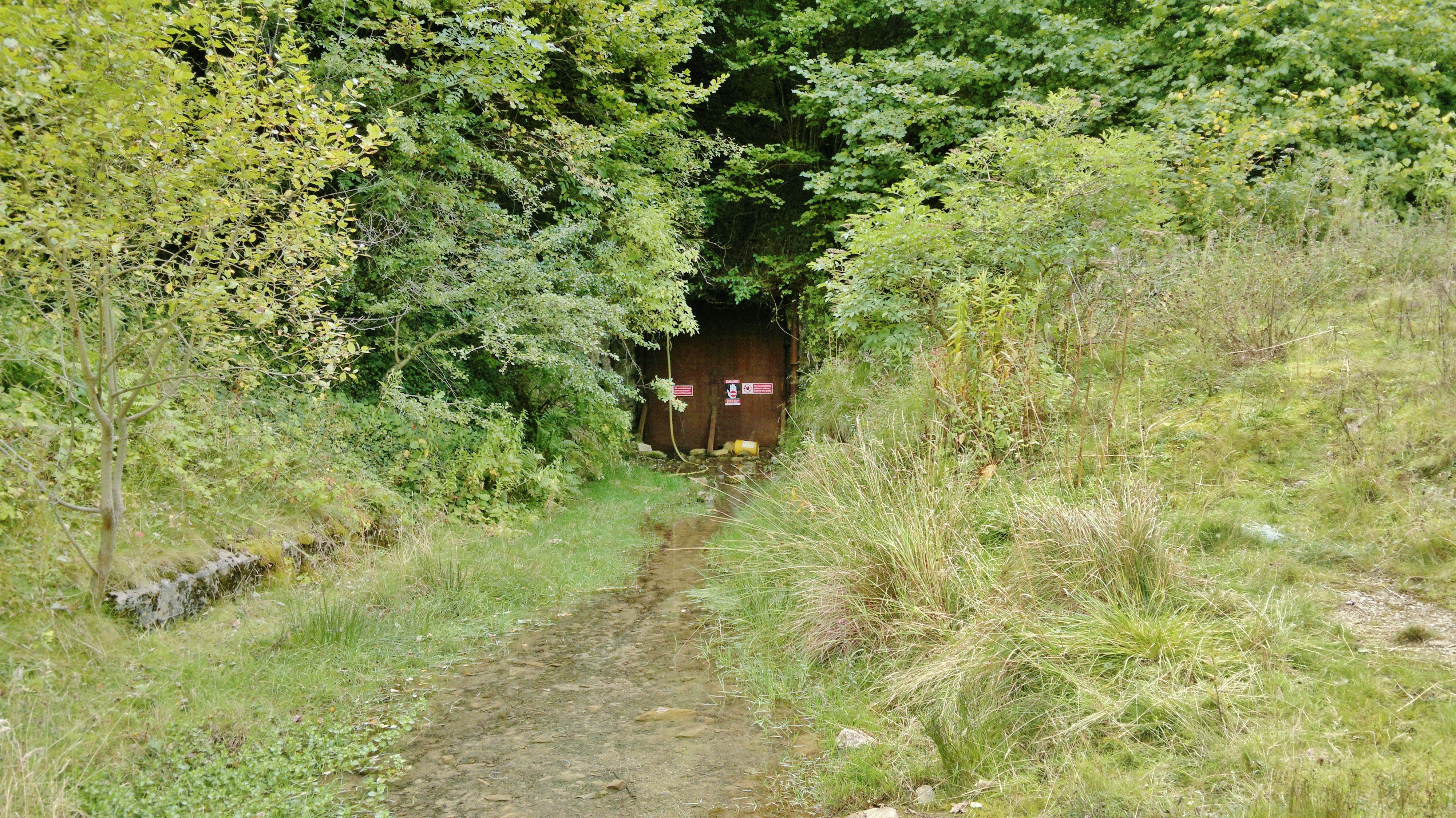
Long closed and considered one of the most collapsed and unstable mines in Derbyshire — recent explorers describe crumbling rock, multiple roof falls blocking sections of the mine, and hidden sub-levels lost to collapse. Water still flows from the entrance today, and parts of the workings are flooded.
The entrance adit survives, along with surface disturbance from the associated Longstone Edge opencast workings.
Related mines
- Glebe Mine — Sallet Hole was worked for fluorspar under Laporte Minerals, which took over Glebe Mines, and its ore went to the Cavendish Mill that Glebe built in 1965.
- Longstone Edge — Sallet Hole began as a drainage sough for Longstone Edge's lead workings, and later directly worked its Deep Rake deposit.
Nearby mines
- Glebe Mine — 0.4 miles (0.6 km) N
- Ladywash Mine — 0.4 miles (0.6 km) NE
- Nickergrove Mine — 0.3 miles (0.6 km) W
- Little Brookhead Mine — 0.4 miles (0.7 km) N
- Merlin Mine — 1.2 miles (1.9 km) NW
Straight-line distance, within 9 miles (15 km). Show on the map.
Recorded claims
Individual factual claims, each attached to the source(s) that support it below. Where sources disagree, both are kept.
- A June 2025 exploration report described Sallet Hole as 'a fantastic mine, but given the past collapses, one to treat with caution' — three iron ladders to the 130m level, five more to a 40m level above, an 'absolute death trap' blind incline, and a muddy, part-flooded lower level. 1
- Sallet Hole was driven as a sough to the workings under Longstone Edge and converted to a haulage level in 1840-42; its 32-foot waterwheel drove crushing rollers until later workings destroyed all trace of it. 2
- Laporte hauled with five-tonne Clayton battery locomotives, two of them photographed outside the entrance on 5 July 1980, and gave up rail after September 1984; the mine produced 73,000 tonnes of ore in 1990, closed in 1998, and water still flows from it. 2
- The British Geological Survey holds a plan of Sallet Hole Mine revised to 24 May 1970 (KP842, 1:2500, lead), and the Mining Remediation Authority the abandonment plans of Watersaw and Sallet on the High Rake, Deep Rake and Gospel seams at 1:1000 (18172, 34 sheets). 3,4
Sources
- (observational) Sallet Hole No.1 Mine, Stoney Middleton, Derbyshire, June 2025 — 28DaysLater
- (secondary) Sallet Hole Mine — Stoney Middleton Heritage
- (primary) Sallet Hole Mine Plan (BGS/Mining Remediation Authority, KP842) — British Geological Survey
- (primary) Watersaw / Sallet abandonment plans 18172 (BGS mine plans catalogue) — British Geological Survey / Mining Remediation Authority
- (secondary) Sallet Hole Mine
Record created: 22 August 2026 · Last researched: 24 September 2026