 MineArchive
Linton Colliery
| Also known as | Linton Pit |
|---|---|
| Location | Linton, near Ellington, Northumberland — 55.2162, -1.5945 (approximate) |
| Commodity | Coal |
| Type | Coal |
| Worked | 1894–1968 |
| Maximum depth | The Yard seam was met at 360 ft in the shaft, about 200 ft below the High Main; the No. 2 shaft was deepened by a further 65 yards in 1949-50. |
| Operators | Ashington Coal Company (1894–1946), National Coal Board (1947–1968) |
Overview
An Ashington Coal Company pit sunk from November 1894 a mile west of Ellington, which raised household and steam coal from the High Main, Yard, Five Quarter and Low Main seams, was rebuilt from the bottom up by the National Coal Board around 1950, and closed on 28 September 1968.
History
Linton was a village of twelve houses and fifty-nine people in 1891, most of them coal miners or farmers. The Ashington Coal Company began sinking the No. 1 Pit on 6 November 1894, with thirty-five men on the books that year preparing to sink; a borehole put down at Linton in 1891 had continued an earlier hole of G. Stott's of 1848, from a surface some seventy-eight feet above sea level. Output and employment first appear in 1896, when 182 were employed, 120 of them below ground, raising steam coal. The pit changed the face of the village, bringing three rows of colliery houses, shops and, in 1912, a co-operative store built on land that had been part of the Cresswell estate. Employment climbed past a thousand by 1910 and peaked at 1,394 in 1930; at nationalisation in 1947 the colliery employed 1,381 men and raised 330,000 tons.
In 1951 Colliery Engineering described Linton as part of a North Northumberland modernisation scheme. Four seams were working — the High Main and Yard nearing exhaustion, with reserves left in the Five Quarter and Low Main and the Bensham and Plessey still untouched. Single-unit faces seventy yards long were undercut and blasted, the coal hand-loaded onto chain conveyors, and from November 1945 a trunk conveyor system carried it to four loading points. All coal was wound at No. 1 shaft and sent by private railway to Ashington for washing. The Cementation Company deepened the No. 2 upcast shaft between July 1949 and June 1950 to open a new pit bottom sixty-five yards lower, and automatic alternating-current winders were to replace the 1896 steam winder. Management hoped for 13,500 tons a week for seventy years. The colliery closed on 28 September 1968.
Geology
The colliery worked the Northumberland part of the Great Northern Coalfield, taking the High Main, Yard, Five Quarter and Low Main seams, with the Bensham and Plessey left virgin. The Yard lay about 200 ft below the High Main and the Five Quarter nearly 160 ft below the Yard, some 25 ft above the Low Main. The Five Quarter was five to seven feet thick overall but carried three dirt bands averaging four, five and eight inches, the bottom one thickening at times to three feet. The Low Main was two feet eight inches to three feet thick with a fireclay roof and a hard post floor. Four or more sizeable faults divided the take into four zones.
Geological setting: Sedimentary Beds and Seams (well documented example)
Workings
Two shafts: No. 1, the downcast, sunk from 6 November 1894 and used for all coal winding, and No. 2, the upcast, deepened in 1949-50 and intended to wind coal and men as well. Single-unit faces of about seventy yards were undercut by machine, blasted and hand-loaded onto chain conveyors feeding twenty-six inch gate belts; alternate panels were advanced to the boundary so that a centre panel could be worked back on the retreat through the same gateroads. Tubs holding eleven and a half hundredweight ran on two-foot gauge and were drawn in sets of four by endless overtub rope haulage. Supports were withdrawn on some faces by portable power haulers. The reorganised pit bottom was laid out for two-and-a-quarter-ton mine cars moved by controlled gravity feed, with battery locomotives on a main arterial road driven north east and a water lodge holding 600,000 gallons.
Closure
Linton closed on 28 September 1968, both pits together, under the National Coal Board, eighteen years after the modernisation scheme that had been costed against a seventy-year life. A halt on the colliery line, opened by the Ashington Coal Company west of the post office, had already closed to passengers on 16 May 1966.
What remains
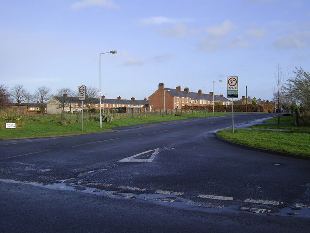
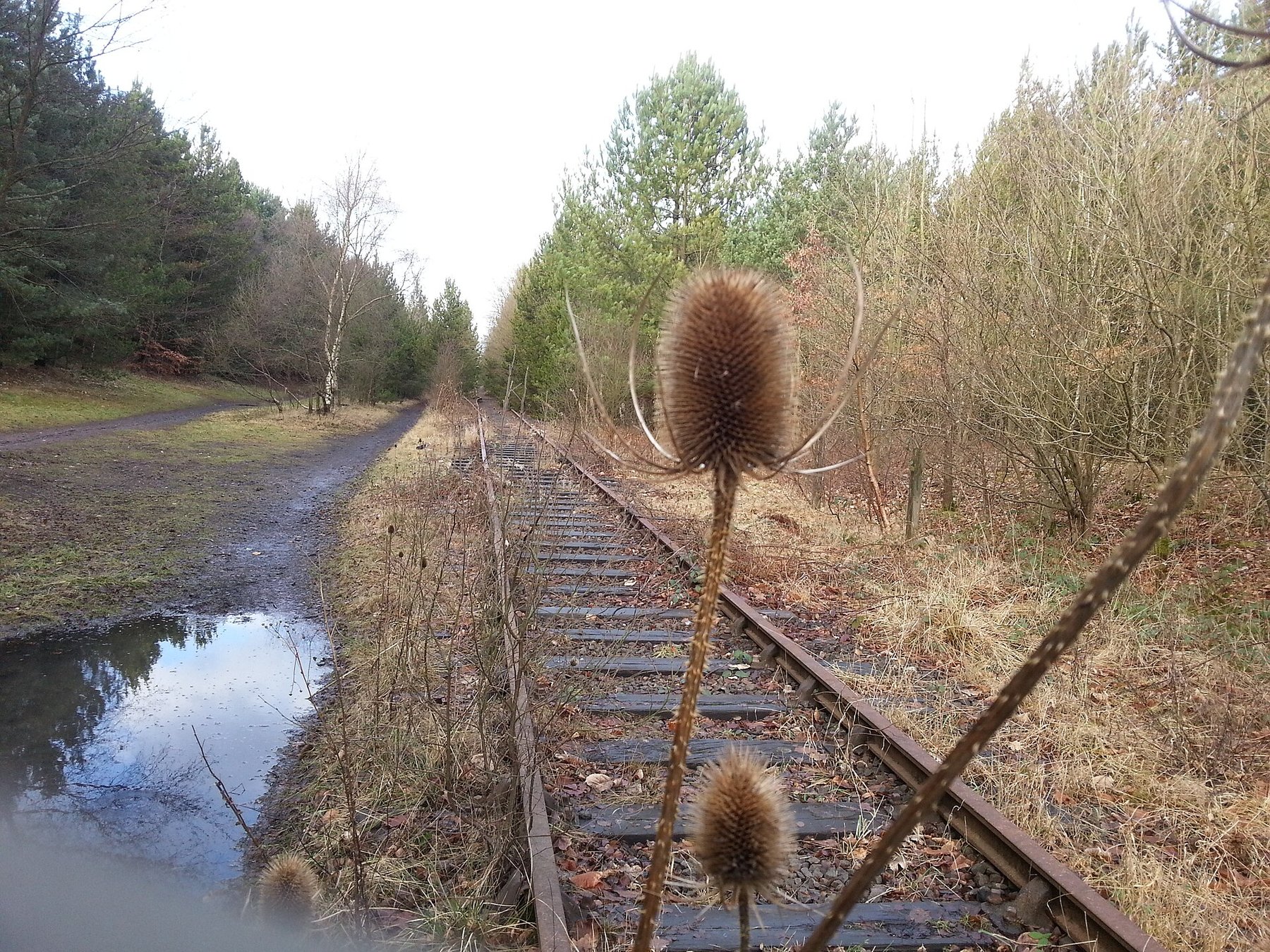
Nothing of the colliery survives. The village of Linton Colliery remains, and the mineral lines that served the pit have become walking routes; a single track mineral railway still runs parallel to the minor road south of the village.
None above ground at the pit. The colliery village, its rows and its entrance survive, together with the trackbed of the colliery line and the level crossing south of the village.
Redevelopment
The colliery site has gone back to fields and the village is now mostly private housing, with a primary school, a village hall, a public house and the social welfare centre known locally as the Tute.
Related mines
- Ashington Colliery — Both were Ashington Coal Company pits, and all of Linton's coal went by private railway to Ashington for washing.
- Ellington Colliery — The two collieries lie a mile apart, shared an owner before nationalisation, and were developed on the same pattern; a winder was installed at Linton, Ellington and Lynemouth alike.
- Woodhorn Colliery — One of the Ashington Coal Company's group of Northumberland collieries alongside Linton and Ellington.
Nearby mines
- Ellington Colliery — 2.4 km E
- Woodhorn Colliery — 3.4 km SE
- Ashington Colliery — 3.6 km S
- Lynemouth Colliery — 3.8 km SE
- Widdrington Colliery — 4.9 km N
Straight-line distance, within 15 km. Show on the map.
Culture
- Jack Charlton (Sports)
Jack Charlton's father Bob was a collier at Linton, and the record's central image is his shift 360 feet down on the day Jack played in the 1966 World Cup semi-final, unable to come up for the score. Jack's own time underground is disputed between the record's two sources and the junction rests on his father's employment, which both agree on.
What's uncertain
Points where sources disagree or the record could not be settled; both accounts are kept. All open questions in the archive.
- Output and employment are first recorded for 1896, when 182 people were employed, 120 of them below ground, raising steam coal. (disputed) 1
- The parish council's history states that the colliery began production in 1911, nine years after the Lists of Mines first record output from it. (disputed) 2
Recorded claims
Individual factual claims, each attached to the source(s) that support it below. Where sources disagree, both are kept.
- The Ashington Coal Company began sinking the No. 1 Pit, the downcast, on 6 November 1894, with thirty-five men employed that year preparing to sink. 1
- Output and employment are first recorded for 1896, when 182 people were employed, 120 of them below ground, raising steam coal. (disputed) 1
- The parish council's history states that the colliery began production in 1911, nine years after the Lists of Mines first record output from it. (disputed) 2
- Before the colliery opened, Linton had twelve houses and a population of fifty-nine in 1891, most of them coal miners or farmers; in 1894 there were no real roads and men travelled to Ashington and back on the tankey line. 2
- Employment rose above a thousand by 1910 and peaked at 1,394 in 1930; 1,381 men were employed at nationalisation in 1947, when the colliery raised 330,000 tons. 1,2
- The seams worked were the High Main, the Yard, the Five Quarter and the Low Main; the Yard was met at a depth of 360 ft in the shaft, about 200 ft below the High Main. 3
- By 1951 the High Main and the Yard were approaching exhaustion, with appreciable reserves left in the Five Quarter and the Low Main and the Bensham and Plessey seams still virgin. 3
- The Cementation Company deepened the No. 2 upcast shaft between July 1949 and June 1950, keeping its original 13 ft diameter and lining the extension with nine-inch brickwork, to open a new inset sixty-five yards below the old pit bottom. 3
- The No. 1 winding engine was supplied by Bradley and Craven Limited when the colliery started, with cylinders twenty inches in diameter and a five-foot stroke driving a parallel drum twelve feet across; it was to be replaced by automatic alternating-current winders, one of them transferred from Lynemouth. 3
- All coal was wound at the No. 1 shaft, screened and hand-sorted on picking belts, cleaned in spiral dry cleaners, and the remainder sent over a private railway to Ashington colliery for washing. 3
- In February 1951 about 1,400 were on the books at an output per manshift of some 25 cwt, with the modernisation intended to give a steady 13,500 tons a week for the next seventy years. 3
- The colliery closed on 28 September 1968, both pits together; it was owned by the Ashington Coal Company from 1894 and by the National Coal Board from 1947. 1
- Linton Colliery Halt, opened by the Ashington Coal Company west of the Linton Colliery post office, closed to passengers and completely on 16 May 1966 and has been demolished. 4
- A bore-hole at Linton of 1891 continued a hole put down by G. Stott in 1848, from a surface level about seventy-eight feet above Ordnance datum, and had proved 423 ft by the bottom of the old hole. 5
- A photograph taken on 24 January 2018 shows the abandoned colliery line south of the village still in place on the ground half a century after the pit closed. 6
Photographs & further reading
The museum's transcription of the Lists of Mines for Linton: sinking and closing dates, owners, outputs, employment by year and the names of those killed at the colliery.
View sourceA detailed account of the colliery under the National Coal Board's North Northumberland modernisation scheme, covering seams, faces, haulage, shaft deepening and winders.
View sourceThe record of the colliery's passenger halt, closed in May 1966 and since demolished.
View sourceSources
- (primary) Linton Colliery — Durham Mining Museum
- (secondary) History — Ellington & Linton Parish Council — Ellington & Linton Parish Council
- (primary) Linton colliery, Colliery Engineering, February 1951 — Colliery Engineering, via the Durham Mining Museum
- (secondary) Linton Colliery (Halt) — Disused Stations
- (primary) Linton shaft details: account of strata passed through in a bore-hole at Linton, 1891 — Durham Mining Museum
- (observational) Abandoned Linton colliery line (Geograph 6449595) — Geograph Britain and Ireland
Record created: 28 September 2026 · Last researched: 28 September 2026