 MineArchive
Hilton and Scordale Mines
| Location | Scordale, near Murton, Cumbria — 54.5966, -2.3737 (exact) |
|---|---|
| Commodities | Barite, Fluorspar, Lead, Witherite |
| Type | Mineral |
| Worked | By the 18th century–After 1919 |
| Operators | London Lead Company (1824–1876), Brough Barytes Co. Ltd (1906–1911) |
Overview
A lead mining landscape in a steep Pennine valley, worked by the London Lead Company for half a century and then reopened for the barytes and witherite its lead miners had left behind. It now sits inside an army firing range.
History
Mining in Scordale is older than its records: 18th-century working is documented at Hilton and Murton and at Mason Holes, and the beginning is unknown. The London Lead Company worked Hilton and Murton for galena from 1824 to 1876. What brought the valley back to life was a change in what counted as ore — the barytes and witherite the lead miners had discarded — and a run of small companies took it up in turn: the Scordale Lead Mines Syndicate from 1892, the Scordale Mining Company from 1896, Brough Barytes from 1906 and Scordale Barytes from 1912. Work ceased after 1919. The lease was held on without working until 1963, when the mines were finally abandoned.
Geology
The veins and an extensive belt of associated flats sit at the top of the Melmerby Scar Limestone. It is the baryte-rich flats, rather than the veins, that made the later phases worth working — and the Dow Scar Level in particular that produced the amber-yellow fluorite the mine is known for among collectors.
Geological setting: Hydrothermal Deposits (well documented example), Veins and Lodes (well documented example)
Workings
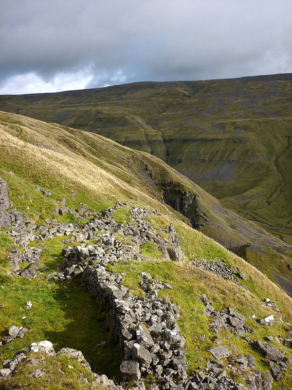
An industrial landscape rather than a single mine: levels and shafts up both sides of the valley, hand and machine dressing floors, crushing mills, settling tanks, buddle pits, wheelpits, dams and leats to work the machinery, tramways, trackways and mineshops. Water was used to strip ground as well as to power machinery — Lowfield Hush is a steep-sided V-shaped valley cut by hushing, and Mason Holes has a large opencut with its own hushing system.
Closure
Nothing was worked after 1919, though the lease ran on for another forty-four years before formal abandonment in 1963.
What remains
The valley lies inside the Warcop Military Training Area, and access is through the range office. Military activity between 1960 and 1980 damaged parts of the site, but the mining landscape survives well enough to be scheduled; the open workings that have not collapsed are in dangerous condition and underground collecting is prohibited.
Levels, shafts, dressing floors, crushing mills, buddle pits, wheelpits, dams, leats, hushes and mineshops across both sides of the valley.
Nearby mines
- Cow Green Mine — 4.9 miles (7.9 km) NE, County Durham
- Lunehead Mine — 5.5 miles (8.8 km) E, County Durham
- Closehouse Mine — 5.6 miles (9.0 km) E, County Durham
- Augill Mine — 6.0 miles (9.7 km) SE
- Borrowdale Colliery, Brough — 6.1 miles (9.8 km) SE
Straight-line distance, within 9 miles (15 km). Show on the map.
Recorded claims
Individual factual claims, each attached to the source(s) that support it below. Where sources disagree, both are kept.
- The London Lead Company worked the Hilton and Murton mines for galena from 1824 to 1876; the Brough Barytes Company reopened them in the 1890s and Scordale Barytes worked on from 1912 until after 1919. 1
- The scheduled landscape includes levels, shafts, dressing mills, crushing equipment, settling tanks, buddle pits, wheelpits, dams, leats, tramways and mineshops, with Lowfield Hush cut by hushing and a large opencut at Mason Holes. 1
- Military activity between 1960 and 1980, after the Warcop training area was established, destroyed part of the site, though the mines remain well preserved. 1
- BGS holds publicly scanned plans of the Scordale mines, including an 1856 plan of the mines on the east side of Scordale Beck, in Cumbria Amenity Trust Mining History Society custody. 2
Photographs & further reading
The full monument description of the valley’s mining landscape.
View sourceSources
- (primary) Scordale lead mines, Murton — scheduled monument — Historic England (via Ancient Monuments)
- (primary) BGS mine plans catalogue: Plan of mines on the east side of Scordale Beck, Westmorland, 1856 (record 32711) — British Geological Survey / Cumbria Amenity Trust Mining History Society
Record created: 25 August 2026 · Last researched: 25 August 2026