 MineArchive
Augill Mine
| Also known as | North Westmorland Mine |
|---|---|
| Location | North Stainmore, near Brough, Cumbria — 54.5268, -2.2835 (exact) |
| Commodity | Lead |
| Type | Metal |
| Worked | By 1843–1896 |
| Maximum depth | Largely opencast, with small trial shafts; no depth is recorded. |
| Operators | North Stainmore Mining Company (1843–1860), North Westmorland Lead Mining Company Ltd (1882–1896) |
Overview
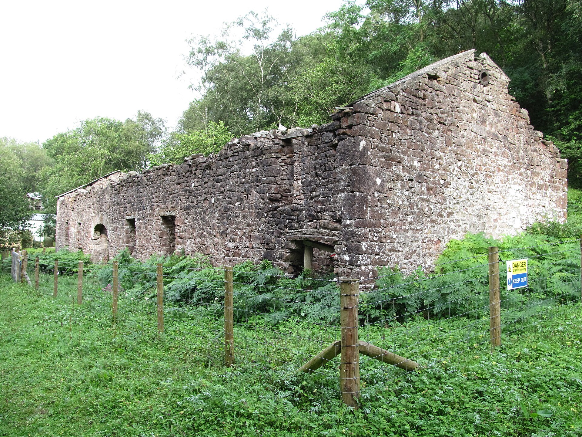
Augill was a lead mine on the north side of Stainmore, near Brough, working mineralisation along a fault belt considered to be a continuation of the Dent Fault System. The orebody was modest and was taken largely by opencast working, with a few small trial shafts. A smelt mill was built beside Augill Beck in 1843 by the North Stainmore Mining Company to treat ore raised from the mines higher up the valley, but the local lead veins disappointed and the enterprise was short-lived; by about 1859-60 the mill had been converted to roast iron instead. The mine appears under the North Westmorland Lead Mining Company in the 1880s and 1890s. The smelt mill survives as a scheduled monument and was taken off Historic England's Heritage at Risk Register in November 2025.
History
Mining at Augill turned on a belt of mineralised ground running along the northern edge of Stainmore. The venture was substantial enough by 1843 for the North Stainmore Mining Company to build a smelt mill on the east bank of Augill Beck, about 50 m north-east of Augill Bridge, to treat the ore raised from the mines higher up the valley; a header leat ran to it alongside the overgrown trackway that gave access to those mines. The promise did not hold. Production from the local lead veins soon proved disappointing and the lead enterprise was short-lived: by about 1859-60 the mill had been adapted to roast the iron nodules also found in the local mines, driving off carbon dioxide to leave a lighter, magnetic oxide to cart to the blast furnaces, and an early Ordnance Survey map marks the site as an iron foundry. Lead working nevertheless continued or resumed on a small scale: the North Westmorland Lead Mining Company is recorded at Augill in 1882-1883, and the North Westmorland Lead Mining Company Ltd, of 31 Westgate Road, Newcastle-upon-Tyne, from 1887 to 1896 — the company listed against the mine in the 1888 List of Mines. The mill had gone out of production altogether by 1894 and ended its working life as a stable.
Geology
The workings lie in an area of mineralised overthrust considered to be a continuation of the Dent Fault System. Rather than a single strong vein, the mineralisation fills numerous small cracks in dolomitised limestone — most likely the Melmerby Scar Limestone — immediately beside the fault. The resulting orebody is modest in quality, which is the geological reason behind the mine's commercial disappointment: there was no concentrated shoot of ore to follow underground, only a diffusely mineralised belt best taken from surface. Iron nodules occur in the same ground and were worked once the lead failed.
Geological setting: Faults and Fractures (well documented example)
Workings
The orebody was exploited chiefly by opencast working along the mineralised belt, with some small trial shafts sunk in the area — a pattern that follows directly from mineralisation dispersed through many small cracks rather than gathered into a workable vein. Ore went down the valley to the smelt mill on Augill Beck, a stone-built two-celled rectangular structure about 25 m by 7 m with a waterwheel pit immediately outside its north wall. Four bays along the inside of the east wall held the ore hearths, each with two square-headed openings at the back: the lower provided draught, the upper carried the fumes into a flue which ran to a chimney some 245 m away on higher ground.
Closure
The lead venture failed early on the poor quality of the ore, and the smelt mill was converted to iron roasting about 1859-60. The North Westmorland Lead Mining Company Ltd is recorded at the mine until 1896. The mill itself had gone out of production by 1894.
What remains
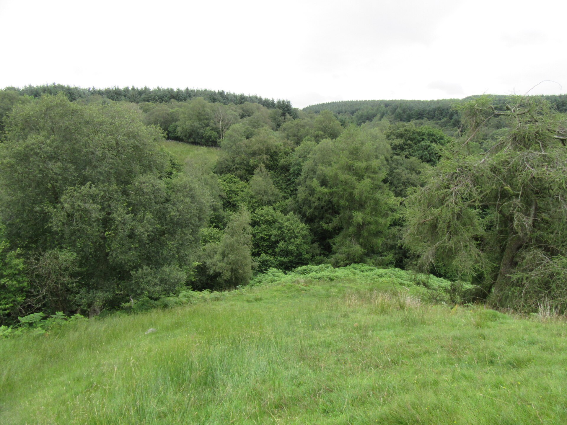
The smelt mill survives as a scheduled monument, together with the earthwork remains of its reservoir, leats, flue and chimney, and the buried remains of structures known from early Ordnance Survey maps to have stood on three sides of it. Also within the scheduling is a Roman signal station 300 m east-north-east of Augill Bridge, partly mutilated by the construction of the mill's own flue and chimney. The mill's west wall stands to eaves height and both gables to full height; most of the east wall was built into the hillside and its upper courses have fallen in. The roof was removed about 1949. In November 2025 Historic England removed the mill from its Heritage at Risk Register, following consolidation work by the North Pennines National Landscape team as part of the Land of Lead and Silver project. The ground around it forms Augill Pasture, a Cumbria Wildlife Trust upland hay meadow reserve. The mine workings themselves lie on private land.
The upstanding smelt mill is the principal survival, with its waterwheel pit, the intermittent earthwork of the header leat running beside the old trackway east of Augill Beck, and the flue and chimney earthworks climbing to higher ground. There is no surface trace of a tail race, which suggests water was culverted from the wheel back into the beck. The mine workings above the valley were surveyed for Cumbria County Council by Ed Dennison Archaeological Services in 1997.
Nearby mines
- Borrowdale Colliery, Brough — 1.2 miles (2.0 km) NE
- Cabbish Mine — 1.4 miles (2.2 km) NE
- Lunehead Mine — 4.0 miles (6.5 km) NE, County Durham
- Closehouse Mine — 5.5 miles (8.8 km) N, County Durham
- Hilton and Scordale Mines — 6.0 miles (9.7 km) NW
Straight-line distance, within 9 miles (15 km). Show on the map.
Recorded claims
Individual factual claims, each attached to the source(s) that support it below. Where sources disagree, both are kept.
- The North Westmorland Lead Mining Co. is recorded at Augill in 1882-1883 and the North Westmorland Lead Mining Co. Ltd from 1887 to 1896. 1
- The mineralisation fills numerous small cracks in dolomitised limestone adjacent to a fault considered a continuation of the Dent Fault System. The orebody is modest in quality and was exploited by opencast working, with some small trial shafts. 1
- The smelt mill on Augill Beck was built in 1843 by the North Stainmore Mining Company to smelt lead ore raised from nearby mines, and was converted about 1859-60 to roast iron nodules. It had gone out of production by 1894 and was later used as a stable; the roof was removed about 1949. 2,3
- Despite the initial promise of the local lead veins, production soon proved disappointing and the enterprise was short-lived. 3
- The scheduling text describes four bays along the inside of the east wall considered to have held ore hearths; the North Pennines National Landscape account states the mill originally contained four ore-hearth furnaces, their fumes drawn through a long horizontal flue to a chimney about 245 m away on higher ground. 2,3
- Augill smelt mill was removed from Historic England's Heritage at Risk Register on 6 November 2025, following consolidation work by the North Pennines National Landscape team as part of the Land of Lead and Silver project. 3
- The scheduling also covers the earthworks and buried remains of a Roman signal station 300 m east-north-east of Augill Bridge, partly mutilated by the construction of the smelt mill's flue and chimney. 2
Photographs & further reading
The November 2025 account of the consolidation work that took the mill off the Heritage at Risk Register, with a clear summary of why the lead venture here was so short-lived.
View sourceSources
- (secondary) Augill (aka North Westmorland) — Buddlepit Mine Database
- (primary) Augill lead smelting mill, later iron roasting plant, associated reservoir, leats, flue and chimney and a Roman signal station immediately east of Augill Bridge, Brough — scheduled monument (Historic England scheduling text) — Historic England scheduling text, via ancientmonuments.uk
- (secondary) Conservation at Augill smelt mill (17 November 2025) — North Pennines National Landscape
Record created: 4 September 2026 · Last researched: 4 September 2026