 MineArchive
Borrowdale Colliery, Brough
| Location | North Stainmore, near Brough, Cumbria — 54.5383, -2.2603 (approximate) |
|---|---|
| Commodity | Coal |
| Type | Coal |
| Worked | By 1873–December 1934 |
| Maximum depth | No depth figure has been located in the sources read; the mine was entered by a level rather than a shaft. |
| Operators | Executors of Thomas Walton (1880–1880), North Stainmore Mining Co. (1880–1888), J. B. Walton, Mrs E. S. Walton (1921–?) |
Overview
Borrowdale Colliery was a small drift coal mine on the moorland edge of North Stainmore, near Brough in the old county of Westmorland, worked by about ten men from at least the 1870s until it was abandoned in December 1934. It raised household coal from thin seams in the Namurian Little Limestone series, one of the few coal workings on Stainmore outside the small Argill Beck coalfield.
History
The earliest dated record found for Borrowdale is a death: the Durham Mining Museum lists William Steel, aged 26, killed by a fall of coal from the roof on 6 February 1873, so the pit was at work by then. The 1880 List of Mines enters it twice, once under Westmorland as Borrowdale (North Stainmoor), Brough, worked by the North Stainmoor Company, and once among the Durham district collieries under the Executors of Thomas Walton. By 1888 the North Stainmore Mining Co. of Brough was the owner, with W. Deighton as manager. The museum records J. B. Walton as owner in the 1890s and Mrs E. S. Walton in the 1920s; the 1921 List gives her address as Brough, Kirkby Stephen, with J. Bouch, who held no certificate, as manager. It was always a tiny concern: ten men in 1883, nine in the 1890s and 1900s, a high of thirteen (twelve underground, one on the surface) in 1921, and six by 1930 and 1933. Household coal is recorded in every return from 1894 to 1934. A newspaper visit, quoted undated from the Herald by the Old Cumbria Gazetteer, gives the only picture of the pit at work: a low building by the pit mouth served as a two-stall pony stable with a fireplace, horses drew tubs out along a main level about half a mile long, and eight men ate their lunch by candlelight at its far end before returning to cross workings no more than 2 ft 6 in high. The Gazetteer wonders whether the account could be of Cabbish Mine, but Cabbish, a mile or so to the west, was a lead and later barytes mine, and the coal mine at Borrowdale the report describes matches this colliery.
Geology
The Northern Mine Research Society places the Borrowdale pits, a short distance north of Argill Beck, on the Little Limestone seam, in strata of the Pendleian sub-stage of the Namurian, distinct from the small Westphalian coal outlier worked from adits in Argill Beck itself. The Lists of Mines record the seams as the Limestone Series in 1910-21, the 18 Inch in 1923-27, the 14 Inch in 1929-30 and the Twelve Inch in 1934.
Geological setting: Sedimentary Beds and Seams (well documented example)
Workings
A drift or level mine. The Herald account describes a main level about half a mile long, laid with rails, along which horses drew tubs in pairs, with low, narrow roadways and cross workings no more than 2 ft 6 in high at the far end; waste rock and shale were packed into the worked-out ground. Miners worked by candlelight. The seam names in the Lists of Mines, falling from 18 inches to twelve, record how thin the coal was in the colliery's last decade.
Closure
The Durham Mining Museum records employment of six in 1933 and none in 1934, when the colliery was abandoned in December; the seam then being worked was the Twelve Inch. No source read gives a reason for closure beyond what the thinning seams suggest.
What remains
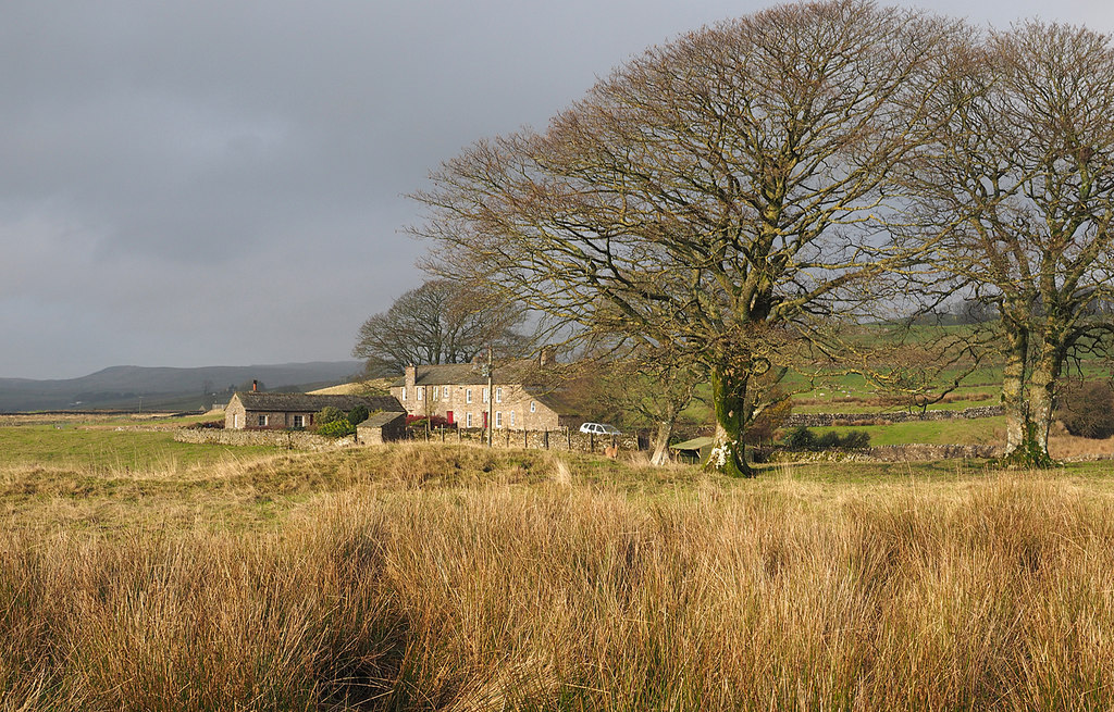
No recent description of the site has been found. Borrowdale House, the farm standing at the museum's grid reference, is shown in a 2014 Geograph photograph among walled fields north of North Stainmore.
No account of surviving surface remains has been located.
Nearby mines
- Cabbish Mine — 0.6 km SE
- Augill Mine — 1.1 km W
- Lunehead Mine — 4.8 km N, County Durham
- Closehouse Mine — 7.1 km N, County Durham
- Force Garth Quarry — 12.9 km N, County Durham
Straight-line distance, within 15 km. Show on the map.
Recorded claims
Individual factual claims, each attached to the source(s) that support it below. Where sources disagree, both are kept.
- The 1880 List of Mines records Borrowdale twice: as Borrowdale (North Stainmoor), Brough, under the North Stainmoor Co., and as Borrowdale, Brough, under the Executors of Thomas Walton. 1,2
- The Borrowdale pits worked the Little Limestone seam in Pendleian (Namurian) strata; the Lists of Mines name the Limestone Series, then 18 Inch, 14 Inch and finally Twelve Inch seams. 2,3
- In 1921 the colliery employed 13 (12 underground, 1 surface) under owner Mrs E. S. Walton, with J. Bouch, uncertificated, as manager. 2,4
- The colliery was abandoned in December 1934, with no one employed that year. 2
- William Steel, aged 26, was killed by a fall of coal from the roof on 6 February 1873. 2
- An undated Herald report describes a half-mile main level with horse-drawn tubs and eight men working by candlelight; the Old Cumbria Gazetteer, which quotes it, dates it only to the 1900s. (uncertain) 5
- The 1888 List of Mines records Borrowdale (North Stainmoor), Brough, under the North Stainmore Mining Co. of Brough, Kirkby Stephen, with W. Deighton as manager. 6
Photographs & further reading
Owners, employment, seams and output by year from the Lists of Mines, with the 1873 fatality.
View sourceShort account of the Stainmore coal outlier and the Little Limestone pits at Borrowdale and Broxty.
View sourceQuotes a newspaper visitor's account of riding a tub into the Borrowdale pit.
View sourceSources
- (secondary) List of coal mines UK 1880 — Coalmining History Resource Centre
- (secondary) Durham Mining Museum - Borrowdale Colliery — Durham Mining Museum
- (secondary) Stainmore Coal — Northern Mine Research Society
- (primary) 1921 List of Mines under the Coal Mines Act - Westmorland — Durham Mining Museum (transcription of the Mines Department list)
- (secondary) Old Cumbria Gazetteer - coal mine, Borrowdale — Lakes Guides (Martin and Jean Norgate)
- (primary) 1888 List of mines under the Coal Mines Act - Durham District — Durham Mining Museum (transcription of the Inspector of Mines' list)
Record created: 12 September 2026 · Last researched: 12 September 2026