 MineArchive
Hebden Mines
| Location | Hebden Moor, Hebden Gill and Bolton Gill, north of Hebden, Wharfedale, North Yorkshire — 54.0840, -1.9520 (approximate) |
|---|---|
| Commodity | Lead |
| Type | Metal |
| Worked | 1810-20 (levels)–1888 |
| Maximum depth | Unknown. |
| Operators | Hebden Moor Mining Company (1850–?) |
Overview
The lead mines of Hebden Moor in Wharfedale, on veins running east from Grassington Moor, worked from early levels at Groove Gill Rigg to the Hebden Moor Mining Company's Bolton Gill engine shaft of the 1850s; the accessible ore was largely gone by 1865.
History
The veins worked at Yarnbury and on Grassington Out Moor run east into the township of Hebden, where some of them carried ore in the Grassington Grit. Some of the earliest mining was on Bycliffe Vein where it crosses Groove Gill Rigg, a name that itself records the old workings, and between 1810 and 1820 a couple of levels were driven onto veins there from Gate Up Gill. The veins at the junction of Bolton and Hebden Gills were known to the old miners, but the ground was badly disturbed, and it was not until the early 1850s that the Hebden Moor Mining Company sank Bolton Gill Engine Shaft and drove Bottle Level to work Cockbur Vein in the Bearing Grit. The shaft was pumped by a waterwheel high on Bolton Haw Side, and the mine used compressed-air rock drills, a rarity in a Yorkshire lead mine. It produced moderate amounts of ore for a time, but the company's other levels lower down the gill found the veins barren, and a deep level driven from the village was abandoned. The mines lifted Hebden into a substantial industrial village and paid for much of its rebuilding through the royalties shared by its Trust Lords. The accessible ore was largely exhausted by 1865, though some work went on until 1888.
Geology
Carboniferous Yoredale and Millstone Grit beds on the Grassington vein system: Bycliffe and Cockbur veins, productive in the Grassington Grit and the Bearing Grit.
Workings
Early levels from Gate Up Gill onto Bycliffe Vein; Bolton Gill Engine Shaft, pumped by a waterwheel on Bolton Haw Side, and Bottle Level to Cockbur Vein; further levels down the gill and an abandoned deep level from Hebden village.
Closure
The accessible ore was largely exhausted by 1865; some activity continued until 1888.
What remains
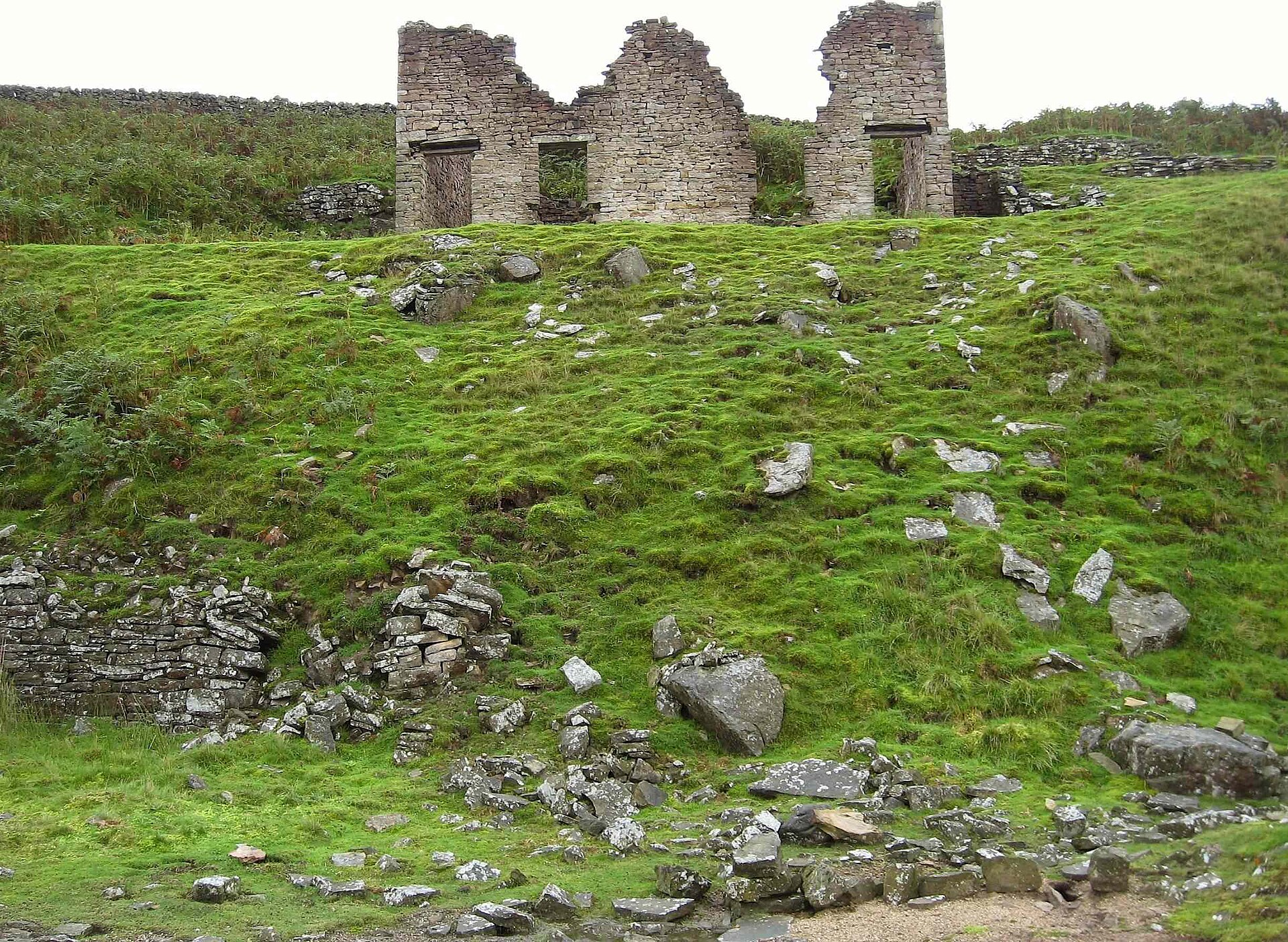
The ruined mine shop stands above the crushing floor of the Bolton Gill mine in Hebden Gill.
Ruined mine shop and crushing floor at Bolton Gill.
Redevelopment
Unknown.
Related mines
- Grassington Moor Mines — The Grassington Moor veins at Yarnbury and Grassington Out Moor run east into Hebden (NMRS).
Nearby mines
- Grassington Moor Mines — 1.0 miles (1.7 km) NW
- Frankland Fold Mine — 1.3 miles (2.0 km) NW
- Red Scar Mine — 1.6 miles (2.6 km) NE
- Beever Mine — 1.8 miles (2.8 km) W
- Appletreewick Mines — 3.7 miles (5.9 km) E
Straight-line distance, within 9 miles (15 km). Show on the map.
Recorded claims
Individual factual claims, each attached to the source(s) that support it below. Where sources disagree, both are kept.
- Between 1810 and 1820 levels were driven onto veins near Groove Gill Rigg from Gate Up Gill. 1
- In the 1850s the Hebden Moor Mining Company sank Bolton Gill Engine Shaft and drove Bottle Level to Cockbur Vein. 1
- Compressed-air rock drills were used, which was rare in a Yorkshire lead mine. 1
- Profitable mines were established north of Hebden in the early 1850s; the accessible ore was largely exhausted by 1865 and some activity continued until 1888. 2
- The mineral royalties shared by the Hebden Trust Lords paid for much of the village's rebuilding. 2
Sources
- (secondary) Hebden Mines — Northern Mine Research Society
- (secondary) Wikipedia: Hebden, North Yorkshire — Wikipedia
Record created: 16 October 2026 · Last researched: 16 October 2026