 MineArchive
Dirtlow Rake Mine
| Location | Castleton, Derbyshire — 53.3444, -1.7686 (approximate) |
|---|---|
| Commodities | Barite, Copper, Fluorspar, Lead, Silver, Zinc |
| Type | Metal |
| Worked | at least 17th century–20th century |
| Maximum depth | Unknown. |
Overview
One of the South Pennines Orefield's important lead veins, worked by numerous small mines along its length — including How Grove, a rare survivor of an exceptionally late lead mine with unusually well-preserved ore-dressing features.
History
Dirtlow Rake was worked by a succession of small mines strung along the vein, including Ashton Grove, Royse Grove, Kirk Grove, How Grove and Hazard Mine, documented in an almost continuous record thanks to the surviving Castleton Barmaster Books. How Grove, a mid-18th to early 20th-century mine on a preserved 'island' of hillocks along the rake, escaped the destruction later mining inflicted elsewhere on the vein — much of Dirtlow Rake's early lead-mining heritage was destroyed by later reworking for fluorspar, barytes and calcite. A 1998-2000 conservation project, run by John Barnatt and the How Grove team for the Peak District Mines Historical Society, recorded and preserved its surviving ore-dressing features.
Geology
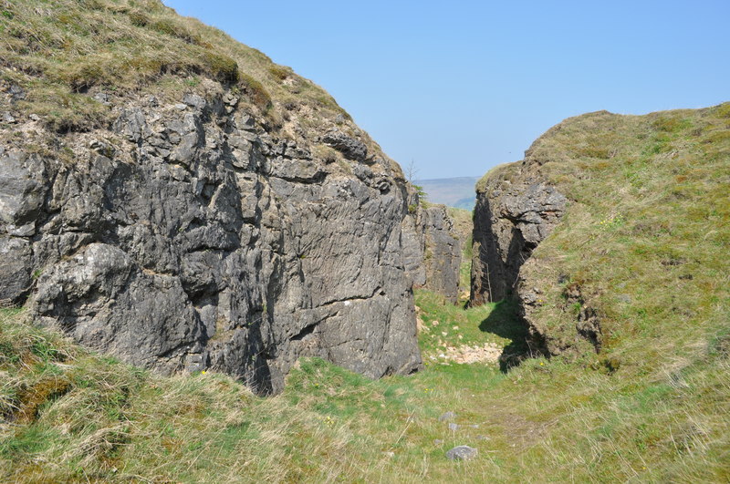
The rake follows a lead-bearing vein in the South Pennines Orefield, exposed along its length in extensive open-cuts that also preserve fossil evidence and visible tool marks left by the miners who worked it.
Workings
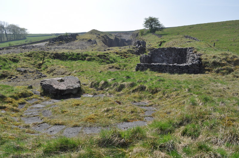
Workings combined open-cut sections with underground levels; How Grove specifically retains a horse-drawn crushing circle and a rare circular buddle used to sort dressed ore, while nearby Hazard Mine preserves a well-preserved gin circle (horse-whim platform) and engine shaft.
Closure
Unknown.
What remains
Much of the lead-mining heritage along the rake was destroyed by later reworking for fluorspar, barytes and calcite, but the How Grove 'island' survived relatively intact and was conserved by a dedicated 1998-2000 project.
How Grove retains a horse-drawn crushing circle and circular buddle; Hazard Mine retains a gin circle and engine shaft; open-cut sections remain visible along much of the rake.
Related mines
- Hazard Mine — Hazard is one of the named lead mines on Dirtlow Rake and is on the same vein; this archive's Dirtlow Rake record names it, which is how it was found.
Nearby mines
- Pin Dale Lead Side Veins — 0.5 miles (0.8 km) SE
- Moss Rake — 1.0 miles (1.5 km) SE
- New Venture Lead Mine — 0.9 miles (1.5 km) E
- Speedwell Cavern — 1.0 miles (1.6 km) W
- Treak Cliff Cavern — 1.2 miles (1.9 km) W
Straight-line distance, within 9 miles (15 km). Show on the map.
Recorded claims
Individual factual claims, each attached to the source(s) that support it below. Where sources disagree, both are kept.
- How Grove Mine's crushing circle and circular buddle were the subject of a dedicated Peak District Mines Historical Society conservation project between 1998 and 2000. 1
- Dirtlow Rake was worked by a succession of small mines strung along the vein, among them Ashton Grove, Royse Grove, Kirk Grove, How Grove and Hazard, their record almost continuous in the surviving Castleton Barmaster Books. 1
- A plan of Dirtlow Rake and Earle's Quarry showing the shafts and opencast workings, from the Peak District Mines Historical Society, is held by the British Geological Survey (MP26794). 2
Photographs & further reading
The Peak District Mines Historical Society's account of the rake, its small mines and the surviving dressing features at How Grove.
View sourceSources
- (secondary) Mining Heritage Walk - Castleton, Pindale and Dirtlow Rake — Peak District Mines Historical Society
- (primary) PLAN OF DIRTLOW RAKE AND EARLES QUARRY SHOWING SHAFTS AND OPENCAST WORKINGS (Mine plan MP26794, BGS mine plans catalogue) — British Geological Survey / Mining Remediation Authority
- (primary) Dirtlow Rake Mine Plan (BGS, MP26794) — British Geological Survey
- (secondary) Dirtlow Rake Mine
Record created: 22 August 2026 · Last researched: 24 September 2026