 MineArchive
Charterhouse Roman Mines
| Location | Charterhouse, Mendip Hills, Somerset — 51.2990, -2.7203 (approximate) |
|---|---|
| Commodities | Lead, Silver |
| Type | Metal |
| Worked | 49 AD–1878 |
| Operators | Mendip Mining Company (1844–1878) |
Overview
Charterhouse, in the Mendip Hills of Somerset, was one of Roman Britain's earliest and most strategically important mining sites — lead and silver extraction here began within six years of the Roman invasion and continued, on and off, for over 1,800 years, ending with a 19th-century phase reworking medieval waste slag.
History
The Romans were mining lead at Charterhouse by AD 49, attested by lead ‘pigs’ (ingots) stamped with the names of the emperors Claudius, Nero and Vespasian found in the area. The Roman military initially controlled extraction directly, building a small fort and a rectangular earthwork settlement around 220 by 200 feet, along with an amphitheatre roughly a kilometre away — the only one known to be associated with a mine anywhere in south-west England. The silver yield proved low, and management was soon contracted out to civilian operators, including Gnaeus Pascius under Nero and Tiberius Claudius Triferna under Vespasian. Mining continued intermittently through the medieval period, reaching its heyday in the 17th and 18th centuries, when numerous shallow shafts were sunk across the area. In 1844 the Mendip Mining Company brought in experienced Cornish miners to chase deeper ore, sinking Stainsby's Shaft to 108 metres in 1846; the deeper veins proved too narrow to be worthwhile, so from 1856 the company instead resmelted lead-rich waste slag and slimes left by centuries of earlier mining, continuing until smelting finally ended in 1878.
Geology
Miners worked galena (lead sulphide) intermixed with calcite veins in the Mendip limestone.
Workings
Numerous shallow shafts across the area in the 17th and 18th centuries, and from 1844 deeper working under the Mendip Mining Company, which sank Stainsby's Shaft to 108 metres in 1846.
Closure
Unknown.
What remains
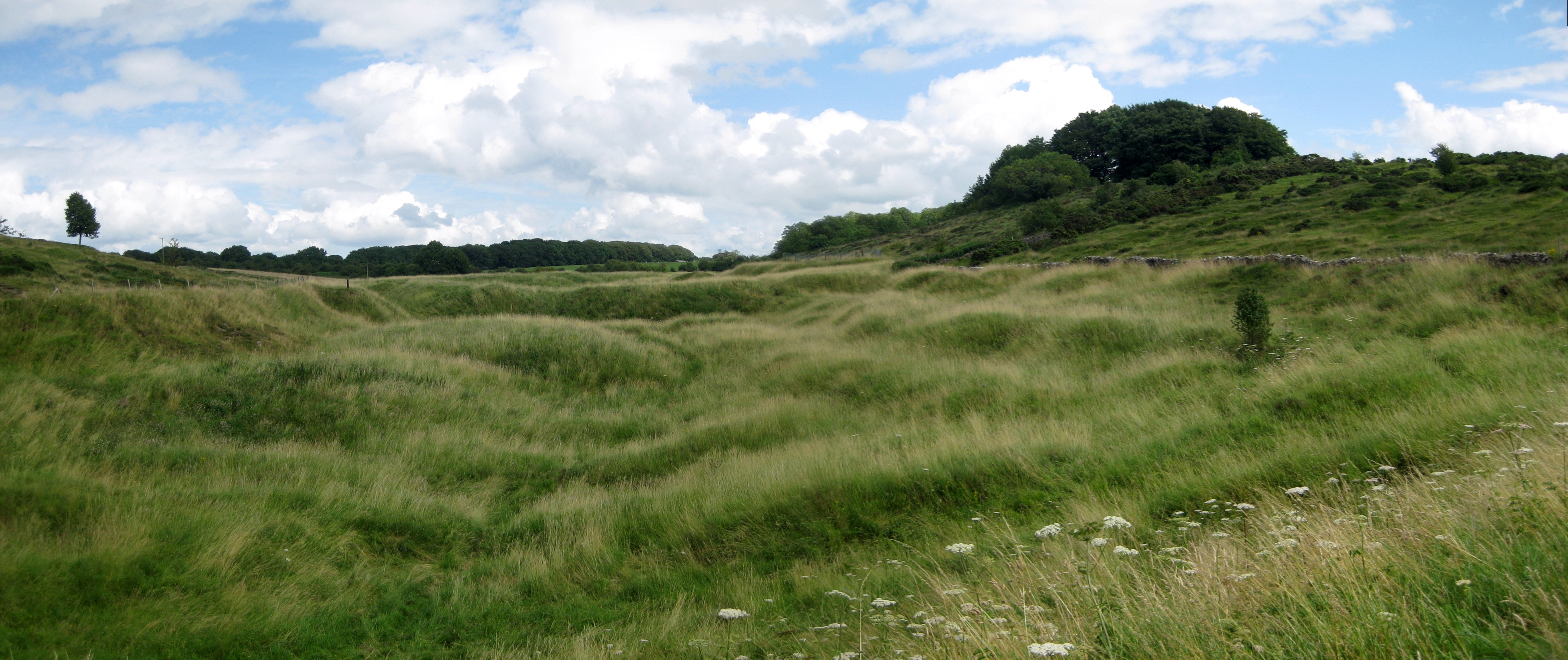
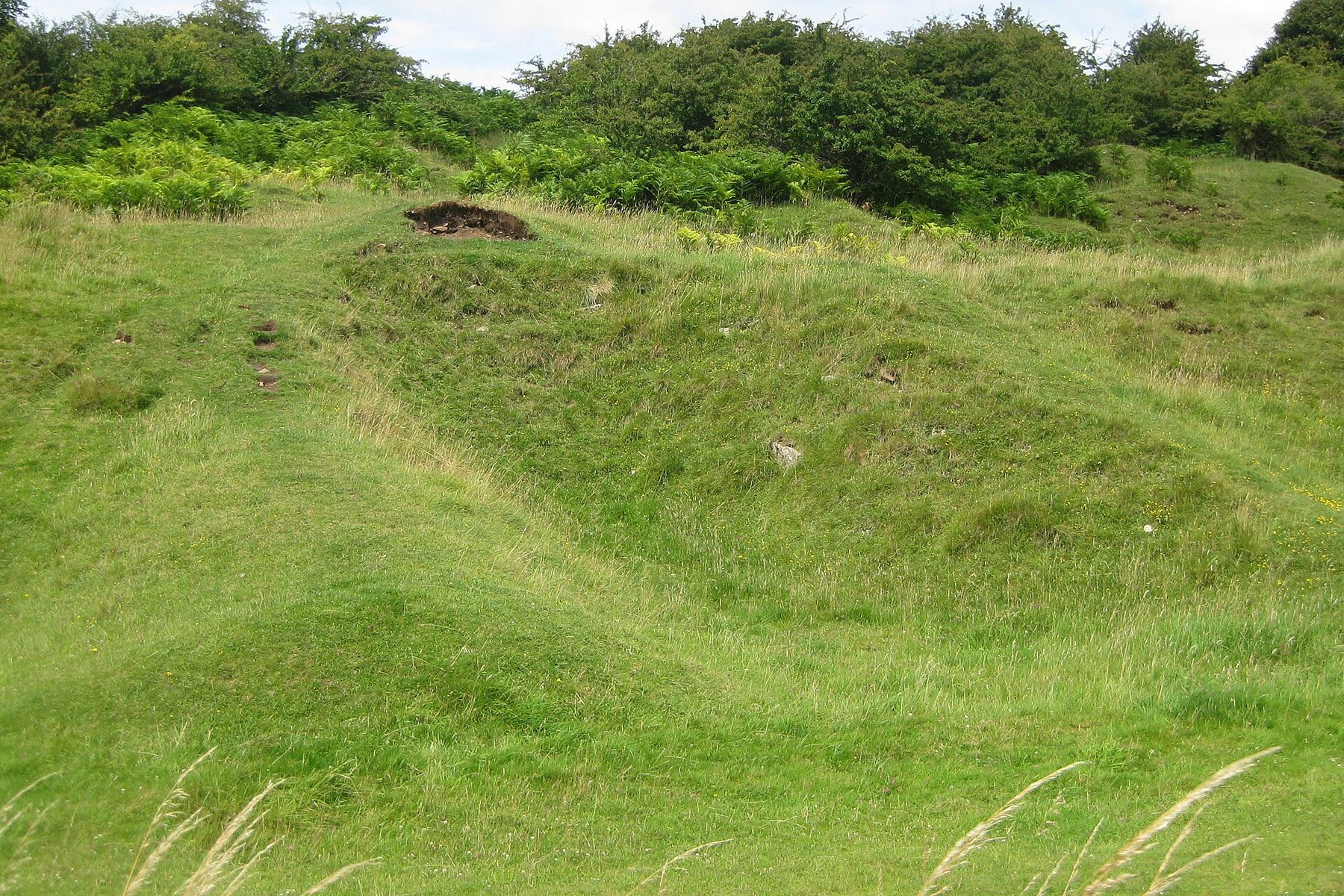
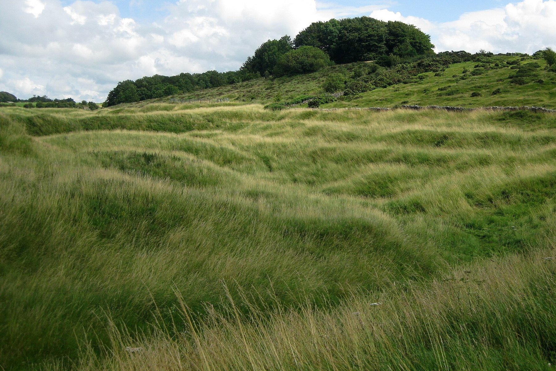
Disturbed, hummocky ‘gruffy ground’ left by centuries of shallow working remains visible nearby at Velvet Bottom and Ubley Warren; Stainsby's Shaft survives, blocked at around 10 metres down. The Roman settlement earthwork and amphitheatre are scheduled monuments.
Related mines
- Blackmoor Rake — Blackmoor Rake is one of the open workings of the same Charterhouse lead field, worked from Roman times and reworked for its slag in the nineteenth-century industrial phase that the Mendip Mining Company carried on here from 1856.
- Grebe Swallet Mine — Grebe Swallet is part of the wider Charterhouse lead-mining area, worked from Roman times and ending with the rest of the district's lead industry in 1885.
- Ubley Rake — Ubley Rake is the other of the pair of major rakes of the Charterhouse lead field, worked since Roman times, whose nineteenth-century operators built settling ponds and a reservoir to rework the district's lead-rich slag — the same reworking this record describes.
Nearby mines
- Grebe Swallet Mine — 0.4 miles (0.6 km) SE
- Ubley Rake — 0.4 miles (0.7 km) E
- Blackmoor Rake — 0.5 miles (0.9 km) E
- Priddy (St Cuthbert's) Lead Works — 4.3 miles (6.9 km) SE
- Higher Pitts Mine — 4.8 miles (7.6 km) SE
Straight-line distance, within 9 miles (15 km). Show on the map.
Recorded claims
Individual factual claims, each attached to the source(s) that support it below. Where sources disagree, both are kept.
- Lead pigs stamped with the names of the emperors Claudius, Nero and Vespasian, found in the area, show the Romans were mining lead at Charterhouse by AD 49, within six years of their invasion of Britain. 1
- Roman-era Charterhouse included an amphitheatre roughly a kilometre from the mining settlement — the only one known to be associated with a mine anywhere in south-west England. 1
- The Roman military initially controlled lead extraction at Charterhouse directly, before contracting the work out to civilian operators such as Gnaeus Pascius under Nero and Tiberius Claudius Triferna under Vespasian. 1
- Stainsby's Shaft, sunk by Cornish miners in 1846 in a failed attempt to reach deeper ore, survives today blocked at around 10 metres down; it originally reached a depth of 108 metres. 2
- From 1856 the Mendip Mining Company resmelted lead-rich waste slag and slimes left by earlier mining, after 1840s attempts to chase deeper ore veins proved unsuccessful; smelting finally ended in 1878. 2
Photographs & further reading
The Survey's account of the Charterhouse orefield: the gruffy ground left by centuries of shallow working, the lead veins in the Carboniferous limestone, and the nineteenth-century reworking of the Roman and mediaeval slag.
View sourceThe Roman settlement and its lead workings: the stamped pigs naming Claudius, Nero and Vespasian, the military control of extraction and the amphitheatre a kilometre from the mining town.
View sourceSources
- (secondary) Charterhouse Mine — Roman Britain
- (primary) Charterhouse — British Geological Survey — Foundations of the Mendips
Record created: 20 August 2026 · Last researched: 10 September 2026