 MineArchive
Chanters Colliery
| Location | Tyldesley Road, Hindsford, Atherton, Greater Manchester — 53.5189, -2.4781 (exact) |
|---|---|
| Commodity | Coal |
| Type | Coal |
| Worked | 1854–1966 |
| Maximum depth | About 600 yards: No.1 shaft reached the Arley Mine at 1,832 feet. |
| Operators | Fletcher, Burrows and Company (1850–1947), Manchester Collieries Ltd (1929–1947), National Coal Board (1947–1966) |
Overview
A Fletcher, Burrows and Company colliery at Hindsford, Atherton, whose 1966 closure ended deep coal mining in the town altogether — a working life marked in its final decade by a fatal gas explosion caused by a single electrician's mistake.
History
Chanters Colliery was sunk in 1854 by Fletcher, Burrows and Company, the Atherton-based family firm (John Fletcher's own family business, joined by the Liverpool entrepreneur Abraham Burrows as a partner in the 1870s) that also sank the nearby Gibfield and Howe Bridge collieries. Both shafts had reached the Trencherbone Mine at about 1,120 feet by the early 1890s and were deepened to the Arley Mine, at about 600 yards, in the late 1890s, No.2 pit in 1896. The site was an old one: coal had been mined there for centuries, and an earlier engine pit, Chanters 'Gold Pit', is said to have stopped work before 1800 and taken its name from a find of Charles I gold coins and the plates they were struck from. Chanters was an early user of electricity, lighting its surface and pit-bottom roadways by direct current from 1892. In 1929 Fletcher, Burrows and Co. Ltd became part of Manchester Collieries Ltd, which extended Chanters' take into areas formerly belonging to Bedford, St George's, Nook and Mosley Common collieries and, between 1938 and 1946, drove some 2.75 miles of roadways through to St George's Colliery. Output was generally about 1,750 tons a day, and 417,125 tons in the company's last year. The colliery was nationalised into the National Coal Board in 1947. Under the Board skip winding came to No.2 pit in 1955, No.1 received an electric winder about 1956, and the Plodder Mine was developed, some of its large coal going to British Railways as locomotive fuel; by 1957 the underground workforce had peaked at 1,066, with 265 on the surface. On 6 March 1957, an electrical fault sparked a gas explosion that killed eight men (see Disasters, below). Chanters continued working for almost another decade afterward, finally closing in 1966 — the closure that ended deep coal mining in Atherton for good.
Geology
The shafts passed through the Crumbouke, Brassey, Six Feet (Rams), Seven Feet (Black and White), Yard (Five Quarters), Four Foot (Hell Hole or Victoria), Trencherbone, Ravine (Plodder), Bone, Smith and Arley mines, the Arley lying at 1,832 feet in No.1 shaft. Working moved over the colliery's life from the Trencherbone, Seven Feet and Five Foot to the Arley and Yard, and after nationalisation to the Five Quarters, Victoria, Yard and Plodder mines.
Workings
Shafts sunk to the Trencherbone Mine and deepened to the Arley at about 600 yards in the late 1890s. No.1, 14 feet in diameter and brick-lined, was the downcast; No.2, originally a furnace-ventilated upcast, was deepened to the Arley and turned over to coal winding in 1896, when a 45-foot Waddle fan replaced the furnace. New pit bottoms were made at 345 yards in No.2 (1941) and 486 yards in No.1 (1938–46). Coal was screened and washed on site, and a colliery railway linked the pits with the Eccles, Tyldesley and Wigan line.
Closure
Closed in 1966, ending deep coal mining in Atherton altogether; in its last years coal was wound from No.2 pit only.
What remains
The surface buildings were demolished soon after closure, though the land was still derelict some twenty years later. The Atherton colliery sites have since been cleared, and little remains to show where the pits stood.
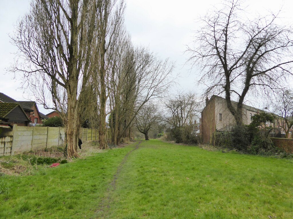
No colliery buildings survive. The course of the railway that linked the Chanters pits with the Eccles, Tyldesley and Wigan line, off Tyldesley Road at Hindsford, survives as a grassy path (photographed 2024).
Related mines
- Astley Green Colliery — Lancashire coalfield pits a few miles apart in the Tyldesley and Atherton district.
- Bedford Colliery — Under Manchester Collieries Chanters' take was extended into Bedford's area, and a power feeder ran down Bedford No.3 shaft and through underground roadways to Chanters.
- Gibfield Colliery — Both sunk and worked by John Fletcher's firm, later Fletcher, Burrows and Co., until 1929.
- Howe Bridge Colliery — Both sunk and worked by John Fletcher's firm, later Fletcher, Burrows and Co., until 1929.
Nearby mines
- Shakerley Colliery — 0.4 miles (0.6 km) E
- St George's Colliery — 0.5 miles (0.9 km) SE
- Peelwood Colliery — 0.8 miles (1.3 km) NE
- Nook Colliery — 0.9 miles (1.4 km) SE
- Cleworth Hall Colliery — 1.0 miles (1.7 km) E
Straight-line distance, within 9 miles (15 km). Show on the map.
Disasters & major incidents
-
Chanters Colliery Explosion, 1957
6 March 1957 · Explosion · 8 fatalities
Gas that had accumulated in Chanters Colliery's No. 2 drift after a roof fall five days earlier was ignited by an electrical arc when an electrician twisted a switch's cover plate onto a live busbar, killing eight men.
Culture
- Atherton Collieries A.F.C. (Sports)
One of the Atherton pits working when miners from the town's six pits founded the club in 1916 (inferred: the sources do not name the six).
What's uncertain
Points where sources disagree or the record could not be settled; both accounts are kept. All open questions in the archive.
- Chanters was commenced on a very old site; its 'Gold Pit', an engine pit, is said to have ceased before 1800 and to be named from a find of Charles I gold coins and their stamping plates. (uncertain) 2
Recorded claims
Individual factual claims, each attached to the source(s) that support it below. Where sources disagree, both are kept.
- Chanters Colliery closed in 1966, ending deep coal mining in Atherton altogether. 1
- Chanters Colliery was nationalised into the National Coal Board in 1947, along with the rest of Fletcher, Burrows and Company's collieries. 1
- Chanters was commenced on a very old site; its 'Gold Pit', an engine pit, is said to have ceased before 1800 and to be named from a find of Charles I gold coins and their stamping plates. (uncertain) 2
- Surface and pit-bottom roadways were lit electrically by direct current by 1892. 3,2
- Under Manchester Collieries Ltd the take was extended into areas formerly allocated to Bedford, St George's, Nook and Mosley Common collieries, with 2.75 miles of roadways driven to St George's by 1946. 2
- Output was generally about 1,750 tons a day; employment was 1,374 in 1947 (DMM), and underground numbers peaked at 1,066 in 1957 with 265 on the surface. 3,2,4
- The surface buildings were quickly demolished after closure, but the land was still derelict some twenty years later. 2
- A former railway off Tyldesley Road at Hindsford, now a path, linked the Chanters pits with the Eccles, Tyldesley and Wigan line. 5
- The BGS / Mining Remediation Authority catalogue holds plans filed under Chanters, including combined plans of Chanters, Howe Bridge and Atherton. 6
- Wigan Archives holds a photograph of pit brow women working on the screens at Chanters Colliery around 1920. 7
- Chanters Colliery was sunk in 1854 by John Fletcher's firm (later Fletcher, Burrows and Company), which also sank the nearby Gibfield and Howe Bridge collieries; its two shafts reached the Trencherbone Mine at about 1,121 feet and were deepened to the Arley at about 1,832 feet in the 1890s, No.2 in 1896. 1,8,3,2
Photographs & further reading
Archive photograph of women working on the colliery screens.
View sourceDetailed account of the shafts, winding engines, fans, electrification, seams and output.
View sourceOwners, employment by pit from 1894 to 1954, seams worked and a roll of men killed.
View sourceThe Atherton collieries on the 1909 map, their owners, and period photographs of Chanters.
View sourceFull account of the 1957 disaster, with named victims and the inspector's findings.
View sourceSources
- (secondary) Chanters Colliery — Wikipedia — Wikipedia
- (secondary) Chanters Colliery (1854-1966) — Northern Mine Research Society
- (secondary) Lancashire OnLine Parish Clerk Project — Atherton Pits — Lancashire OnLine Parish Clerk Project
- (primary) Chanters Colliery — Durham Mining Museum
- (observational) Path on old colliery railway route (Geograph photo 7728188, 2024) — Geograph Britain and Ireland
- (primary) BGS / Mining Remediation Authority mine plans catalogue: Chanters — British Geological Survey
- (primary) PC2010.2200: Pit brow women working on screens at Chanters Colliery, Atherton, circa 1920 — Wigan Archives
- (secondary) Fletcher, Burrows and Company — Wikipedia — Wikipedia
Record created: 2 September 2026 · Last researched: 16 September 2026