 MineArchive
West Holywell Colliery
| Also known as | West Holywell Pit |
|---|---|
| Location | West Holywell, near Earsdon, Tyne and Wear — 55.0578, -1.5336 (approximate) |
| Commodity | Coal |
| Type | Coal |
| Worked | By 1828–1861 |
| Maximum depth | 542 ft 4 in to the Low Main seam, in the sinking of 1856-57. |
| Operators | Plummer, Taylors, Clark & Lamb (1856–1861), Backworth Colliery Company (1861–?) |
Overview
An early colliery hamlet at Holywell in Earsdon parish, older than East Holywell, whose hamlet held about 150 people in 1855 and whose pit heap had become potato ground by 1873.
History
West Holywell Colliery was one of two sets of pits that took the Holywell name, the other being East Holywell, in the township of Holywell in Earsdon parish, Northumberland. It was a separate concern from Backworth Colliery, though several of the Backworth partners, Taylor, Lamb, Clark and Plummer, were in it, and in 1828 a waggonway branch was built to it from the Bell engine on the Backworth line, passing under the Cramlington waggonway by a tunnel. Whellan's 1855 directory lists West Holywell Colliery as a hamlet of about 150 people employed in and about the colliery, worked by the executors of William Clarke, Thomas Taylor, John Buddle and others, with a small Methodist chapel built in 1829, a Blyth and Tyne Railway station with its own station master, a post office and a schoolmaster.
The West Holywell Company sank a new pit at Low Steads in 1853 and laid a line to it, but that venture closed in 1858. The Durham Mining Museum gives a sinking started on 3 August 1856, opening in 1857 and closure in 1861, under the partnership of Plummer, Taylors, Clark and Lamb: this was a fresh sinking at the earlier pit, which reached the Low Main seam at 542 feet on 4 June 1857. The attempt proved futile, the operation closed in 1861, and the royalty was taken over by the Backworth company and worked underground from adjacent collieries. The Newcastle Weekly Chronicle of 22 November 1873 says West Holywell claimed greater antiquity than East Holywell and was so old that the royalty was nearly worked out; mining had stopped there some years earlier.
By 1873 the deserted pit heap had been turned into potato grounds for the men of Backworth, who lived in the houses and workshops once the Holywell owners' property, and the writer judged that the career of West Holywell was finished. The museum records one death, a man killed by a fall of stone on 3 May 1858, and no disaster of five or more.
Geology
The 1856-57 sinking passed through about 34 feet of clay into the Coal Measures and cut the High Main seam, 6 ft 3 in thick, at 181 ft 8 in, the Metal Coal and Stone Coal seams near 270 ft, the Yard at 349 ft, the Bensham, 6 ft 1 in thick, at 445 ft, the Five-Quarter at 488 ft and the Low Main, 5 ft 4 in thick, at 542 ft 4 in.
Workings
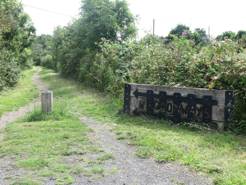
A waggonway branch built in 1828 ran north-east from the Bell engine on the Backworth line to the colliery, passing under the Cramlington waggonway in a brick-arched tunnel that was lengthened by 42 feet when the Seghill line was laid alongside in 1839-40. The West Holywell Company sank a second pit at Low Steads in 1853, with its own line running north beside the Blyth and Tyne Railway; it closed in 1858. A new sinking at the earlier pit, begun on 3 August 1856, reached the Low Main on 4 June 1857. After 1861 the royalty was worked underground from neighbouring Backworth pits.
Closure
Fresh attempts to find coal at the earlier pit failed and the West Holywell operation closed in 1861; the royalty passed to the Backworth company and was worked from adjacent collieries. Mining ceased some years before 1873, when the royalty was nearly worked out, and the pit heap was turned into potato grounds for the men of Backworth.
What remains
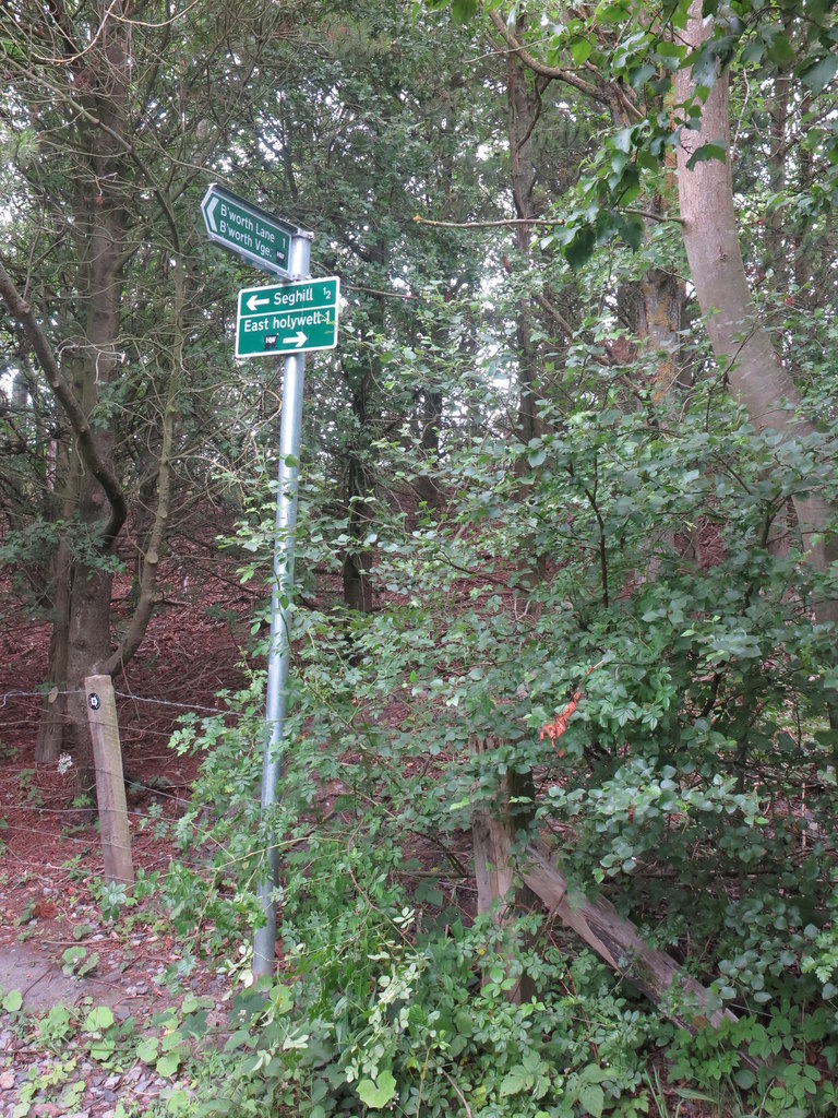
The colliery had gone from the Ordnance Survey map by 1897. Its site, between Seghill and East Holywell, is wooded ground crossed by public footpaths.
The course of the colliery's waggonway survives as a public footpath, part of the North Tyneside waggonway network restored as walking and cycling routes from 2000.
Redevelopment
Unknown.
Related mines
- Backworth Colliery — After West Holywell closed its pit heap was used for potato grounds by the Backworth men living in the former Holywell owners' houses.
- East Holywell Colliery — The two collieries took the Holywell name from the village; West Holywell was the older, and was finished by 1873 while East Holywell was still working.
Nearby mines
- Seghill Colliery — 0.5 miles (0.8 km) N, Northumberland
- East Holywell Colliery — 1.0 miles (1.6 km) SE
- Seaton Delaval Colliery — 1.1 miles (1.8 km) N, Northumberland
- Backworth Colliery — 1.2 miles (2.0 km) S
- Earsdon Colliery — 1.4 miles (2.2 km) SE
Straight-line distance, within 9 miles (15 km). Show on the map.
Recorded claims
Individual factual claims, each attached to the source(s) that support it below. Where sources disagree, both are kept.
- A new sinking at West Holywell began on 3 August 1856 and reached the Low Main seam on 4 June 1857; the colliery closed in 1861. 1
- West Holywell Colliery was a hamlet of about 150 people employed in and about the colliery in 1855, worked by the executors of William Clarke, Thomas Taylor, John Buddle and others. 2
- West Holywell claimed greater antiquity than East Holywell and was so old that its royalty was nearly worked out by 1873. 3
- The hamlet had a small Methodist chapel built in 1829, a Blyth and Tyne Railway station with a station master, a post office and a schoolmaster in 1855. 2
- By 1873 mining had ceased and the deserted pit heap had been turned into potato grounds for the Backworth men, who lived in the houses and workshops once owned by the Holywell owners. 3
- One man was killed by a fall of stone on 3 May 1858. 1
- The owners in the 1850s were Plummer, Taylors, Clark & Lamb. 1
- A waggonway branch was built in 1828 from the Bell engine on the Backworth line to West Holywell Colliery, passing under the Cramlington waggonway by a tunnel that was lengthened by 42 feet around 1839-40. 4
- The West Holywell Company sank a new pit at Low Steads in 1853, with a line beside the Blyth and Tyne Railway; it closed in 1858. 4
- Fresh attempts to find coal at the earlier pit failed and the operation closed in 1861, after which the Backworth company took the royalty and worked it underground from adjacent collieries. 1,4
- The 1856-57 shaft cut the High Main seam at 181 ft 8 in, the Yard at 349 ft, the Bensham at 445 ft, the Five-Quarter at 488 ft and the Low Main at 542 ft 4 in. 5
- The colliery had gone from the Ordnance Survey map by 1897; public footpaths now cross its site and follow the line of its waggonway. 6,7
Photographs & further reading
Dates of sinking, opening and closure, the 1850s owners and the one recorded fatal accident.
View sourceAn eye-witness report in the Newcastle Weekly Chronicle on the Holywell collieries and colliery villages, with the end of West Holywell.
View sourceWhellan's 1855 directory entry for the township, with the West Holywell and East Holywell colliery hamlets.
View sourceHistory of the Backworth collieries and their waggonways, with the 1828 branch to West Holywell, the Low Steads pit of 1853 and the closure of 1861.
View sourceThe strata sunk through from the surface to the Low Main seam in 1856-57, bed by bed with depths.
View sourceSources
- (primary) Durham Mining Museum - West Holywell Colliery — Durham Mining Museum
- (secondary) Holywell, 1855 (Whellan's Directory of Northumberland, via Co-Curate) — Co-Curate (Newcastle University)
- (secondary) Holywell, Northumberland, 1873 (GENUKI; Newcastle Weekly Chronicle, Our Colliery Villages) — GENUKI
- (secondary) Our History (Backworth Miners' Welfare) — Backworth Hall
- (primary) Durham Mining Museum - West Holywell Colliery shaft details — Durham Mining Museum
- (observational) Sign Near Seghill (Geograph 6524183) — Geograph
- (observational) Public Footpath, West Holywell (Geograph 6564101) — Geograph
Record created: 29 September 2026 · Last researched: 1 October 2026