 MineArchive
Tyning Colliery
| Also known as | Tyning Pit |
|---|---|
| Location | Tyning, Radstock, Somerset — 51.2929, -2.4323 (approximate) |
| Commodity | Coal |
| Type | Coal |
| Worked | 1837–1909 |
| Maximum depth | 1,007 ft (307 m); the shaft was 8 ft in diameter |
| Operators | Waldegrave family (1837–1909) |
Overview
One of the Radstock pits of the Waldegrave family, who had been Lords of the Manor since the Civil War and on whose land coal was discovered in 1763. Tyning was sunk in 1837, worked an eight-foot shaft to a maximum depth of 1,007 feet, and closed in 1909; the official 1880 list of collieries at work returns it under the Trustees of the Countess of Waldegrave. It had its own branch, connected to both the Somerset and Dorset and the Bristol and North Somerset railways, which came off the B&NSR, ran through Ludlows Colliery and across the Frome Road, then climbed steeply over the S&D and followed the Tyning Hill road into the colliery. Its two batches went on receiving spoil from Tyning, Middle Pit and Ludlows until 1954.
History
Coal was discovered at Radstock in 1763 on land owned by the Waldegrave family, Lords of the Manor since the English Civil War, and the pits that followed became the core of the Somerset field. Tyning was sunk in 1837, comparatively late in that sequence — after Old Pit and Middle Pit, which were both working before 1801, and Ludlows, working in the late 1790s. Its shaft was eight feet in diameter and reached a maximum depth of 1,007 feet.
The official list of collieries at work in 1880 returns it as "Tyning, Radstock, Countess of Waldegrave, Trustees of", and the mine inspectors’ list of 1896 records the Radstock pits as owned by the Trustee of Frances, late Countess of Waldegrave. Radstock was the terminus of the southern branch of the Somerset Coal Canal, later turned into a tramway, and became the centre of the field’s railway development, with coal depots, washeries, workshops and a gas works; an eight-mile line from Radstock to Frome was built as part of the Wiltshire, Somerset and Weymouth Railway to carry coal, converted from broad to standard gauge in the 1870s and connected to the Bristol and North Somerset Line.
Tyning closed in 1909, but its ground kept working. The two batches beside it went on being built up with spoil from Tyning, Middle Pit and Ludlows for another forty-five years, and tipping ended only in 1954 when Ludlows closed. The branch was demolished soon afterwards.
Geology
The Somerset field’s Coal Measures were tightly folded, fractured and faulted by the Variscan earth movements, and along the Radstock Slide Fault the broken ends of a single seam can be as much as 1,500 feet apart. The coal is of good grade but the seams are thin, so shafts had to go deep for comparatively little: Tyning’s 1,007 feet is modest by Radstock standards, where Middle Pit reached 1,791 feet and Ludlows 1,686.
Geological setting: Faults and Fractures (well documented example), Sedimentary Beds and Seams (well documented example)
Workings
A single shaft eight feet in diameter, 1,007 feet deep at its maximum. What is best recorded is how the coal got out. The colliery branch came off the Bristol and North Somerset line, ran through Ludlows Colliery, crossed the Frome Road and passed through sidings, then took a steep climb over the Somerset and Dorset at the north end of Radstock North station and followed the Tyning Hill road into the colliery. A spur branched off northwards, crossing the Tyning road and becoming an incline railway feeding the two batches on the higher ground. One line ran directly into the mine; the other turned left, crossed the road and climbed to the tips.
Closure
Tyning closed in 1909, one of the earlier casualties among the Waldegrave pits — Middle Pit lasted to 1933 and Ludlows to March 1954. Its batches, however, went on being tipped with spoil from those two collieries until Ludlows closed in 1954, and the branch was demolished soon after that.
What remains
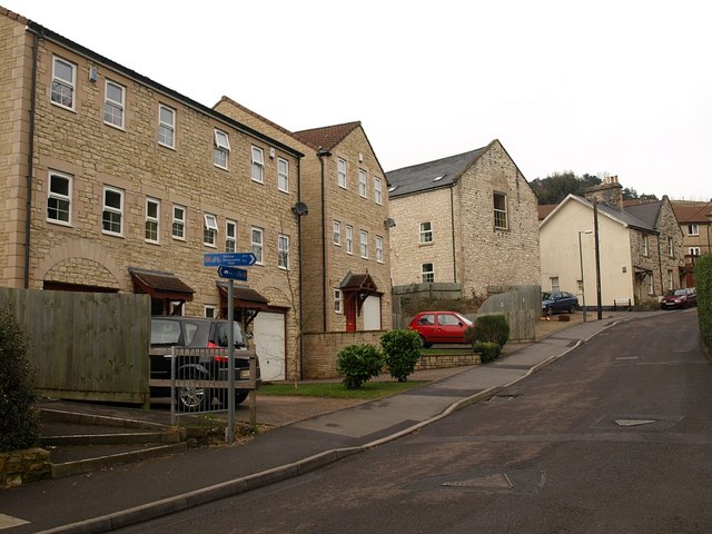
Nothing of the colliery remains. A visitor who walked the branch and the site over two days in September 2020 found the mine ground empty — the tramway route into the pit traceable only by the lie of the land, and the tree line following the contours of the two batches. Vehicles park at the top of Tyning Hill and unofficial footpaths cross both batch sites, which are otherwise rather empty ground. The former Tyning miners’ houses survive at Lower Whitelands at the top of the hill, well kept and with good gardens.
The two Tyning batches, their profile still marked by the tree line, and the ex-colliery entrance where the branch crossed the Tyning road. The Tyning miners’ houses at Lower Whitelands survive in use.
Related mines
- Ludlows Colliery — Waldegrave estate pits at Radstock whose workings appear together on the combined Radstock/Ludlows/Middle/Tyning seam plans (BGS).
- Old Pit Radstock — Both held by the Waldegrave family and named together on the same Mining Remediation Authority abandonment plan group.
Nearby mines
- Huish Colliery — 0.5 miles (0.8 km) SW
- Ludlows Colliery — 0.6 miles (0.9 km) SW
- Old Pit Radstock — 0.6 miles (1.0 km) W
- Braysdown Colliery — 1.3 miles (2.1 km) N
- Clandown Colliery — 1.5 miles (2.4 km) NW
Straight-line distance, within 9 miles (15 km). Show on the map.
Recorded claims
Individual factual claims, each attached to the source(s) that support it below. Where sources disagree, both are kept.
- The official list of collieries at work in 1880 returns the pit as "Tyning, Radstock, Countess of Waldegrave, Trustees of". 1
- Tyning was opened in 1837 and closed in 1909; its shaft was 8 ft in diameter and reached a maximum depth of 1,007 ft. 2,3
- Coal was discovered at Radstock in 1763 on land owned by the Waldegrave family, Lords of the Manor since the English Civil War; in 1896 the pits were owned by the Trustee of Frances, late Countess of Waldegrave. 2
- Tyning was linked to both the Somerset and Dorset and the Bristol and North Somerset railways by a branch that came off the B&NSR, ran through Ludlows Colliery and across the Frome Road, climbed steeply over the S&D at the north end of Radstock North station and followed the Tyning Hill road into the colliery. 3
- A spur branched northwards to two batches built up over many years with spoil from Tyning, Middle Pit and Ludlows collieries; tipping ended in 1954 when Ludlows closed, and the branch was demolished soon afterwards. 3
- A visitor in September 2020 found nothing remaining of the mine: the site is empty ground crossed by unofficial footpaths, with the tree line following the contours of the two batches and the former colliery entrance still visible where the branch crossed the Tyning road. 3
Photographs & further reading
A photographic walk over the colliery site and the whole route of its branch, made over two days in September 2020, with old and modern views compared from the same spots and the miners’ houses at Lower Whitelands. The author notes that no photograph of the branch in use appears to survive.
View sourceSources
- (secondary) List of coal mines UK 1880 — Coalmining History Resource Centre
- (secondary) Somerset Coalfield — Wikipedia
- (observational) Tyning Colliery Branch, Radstock (visited 9 and 17 September 2020) — Ken Hammond, Radstock Collieries
- (secondary) Radstock — Somer Valley Audio Trails — Somer Valley Audio Trails
Record created: 6 September 2026 · Last researched: 6 September 2026