 MineArchive
Titterstone Clee Quarries
| Also known as | Clee Hill Quarries, Dhustone Quarries, Magpie Quarry |
|---|---|
| Location | Titterstone Clee Hill, near Ludlow, Shropshire — 52.3970, -2.5970 (approximate) |
| Commodities | Whinstone, Coal |
| Type | Quarry |
| Worked | Medieval–Still active |
| Maximum depth | The largest quarries have cliffs dropping up to 100 feet. |
| Operators | Midland Quarry Products |
Overview
Quarries on the summit of Titterstone Clee, the third-highest hill in Shropshire, worked for the dolerite known locally as dhustone. The stone was cut into setts for road paving and dock construction — notably the new docks at Newport — and later crushed for concrete aggregate and road surfacing. The hill had been worked long before: ironstone in the medieval period, then coal by bell pits, and on a smaller scale fireclay and limestone. At its height the industry employed more than 2,000 people and had villages built for it. All but one of the quarries have closed; Clee Hill is still worked.
History
The summit of Titterstone Clee has been altered by people for four thousand years — first by Bronze Age cairns and an Iron Age hillfort, then by industry. Ironstone was mined here in the medieval period and coal was worked later, often by bell pits, one of which has since filled with water to form a lake. Over time many quarries were opened for the dolerite. The stone was originally worked into setts for road paving and dock construction, and went notably to the new docks at Newport in south Wales; later it was used as aggregate for concrete and modern road surfaces. Before the Second World War the area was considered industrial for the scale of the quarrying and the work around it, with men travelling in from Bridgnorth and Ludlow, and the villages of Bedlam and Dhustone were built specifically to house quarry workers. At its height the industry employed more than 2,000 people. In the early twentieth century a further large working, Magpie Quarry, opened on the eastern side of Clee Hill, with an aerial ropeway to carry stone down to the railway at Detton Ford. All but one quarry have now closed; quarrying continues at Cleehill under Midland Quarry Products.
Geology
Titterstone Clee stands above the surrounding country because of what caps it: a thick dolerite sill and a band of tough hornfels formed by contact metamorphism, both far more resistant to erosion than the sedimentary rocks beneath. The dark sill is known locally as dhustone, probably from the Welsh du, black. It is an olivine basalt, intruded as a sill between sandstone layers within Middle Westphalian sediments, and it distorted the weaker surrounding rocks, which were still relatively unconsolidated when it arrived. The hill carries a full industrial sequence below that. Most of the lower ground is Old Red Sandstone, overlain unconformably by Carboniferous Limestone, then the Cornbrook Sandstone (the local equivalent of the Millstone Grit), and above that the Lower and Middle Coal Measures, which cover much of the hill and contain the seatearths and coal seams once worked commercially — the most widespread being the Gutter Coal, lying just above the basal sandstone of the Coal Measures.
Workings
Open quarrying on the summit, the largest workings with cliffs dropping up to a hundred feet, alongside earlier bell-pit coal mining and medieval ironstone working. Transport was by incline and ropeway: a three-foot narrow gauge railway incline survives, with a large concrete structure where wagons were loaded with stone; a standard gauge incline on the slopes above Cleehill village carried stone away by rail until the early 1960s; and Magpie Quarry was served by an aerial ropeway to Detton Ford, whose concrete pylon bases still stand near the summit. Many abandoned quarry buildings are of industrial archaeological interest, including some of the earliest known uses of reinforced concrete in Britain.
Closure
All but one of the quarries on the hill are closed; the standard gauge incline above Cleehill went out of use in the early 1960s. Quarrying has not ended — Cleehill continues under Midland Quarry Products — but the sett trade that built the villages is long gone, replaced by aggregate.
What remains
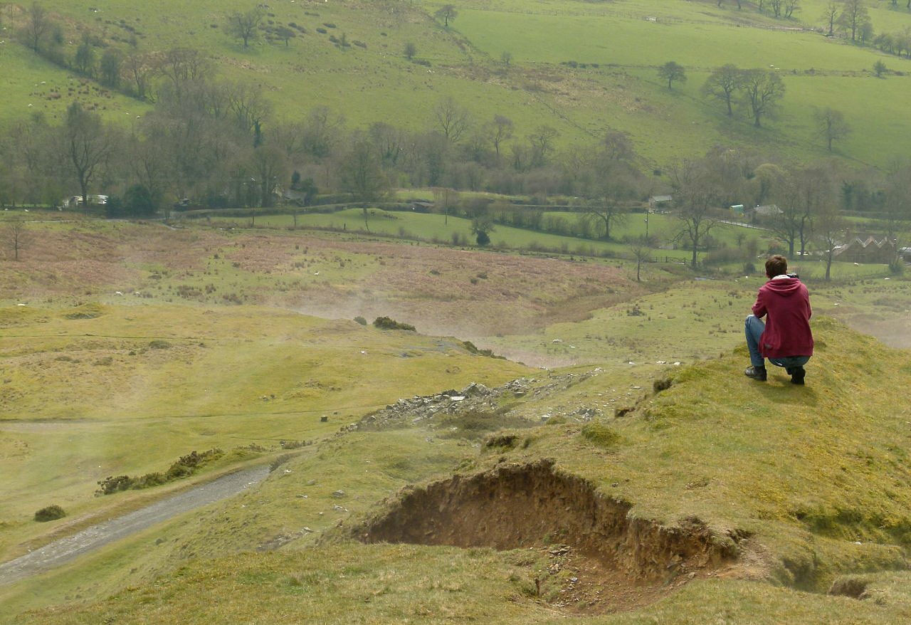
An open, treeless summit shaped by decades of quarrying, mainly common land grazed by sheep and carrying air traffic control installations alongside both active and disused quarries. Remains of quarry buildings lie scattered across the hill, with the narrow gauge incline, the concrete wagon-loading structure by the car park and the ropeway pylon bases all still visible.
Abandoned quarry buildings, several of industrial archaeological interest for their early reinforced concrete; the 3 ft narrow gauge incline and its concrete loading structure; the standard gauge incline above Cleehill; the concrete pylon bases of the Magpie Quarry aerial ropeway; and the water-filled bell pit.
Nearby mines
- Catherton Colliery — 1.5 miles (2.5 km) E
- Bayton Colliery — 7.0 miles (11.2 km) SE, Worcestershire
- Mamble Colliery — 7.1 miles (11.4 km) SE, Worcestershire
- Billingsley Colliery — 8.4 miles (13.5 km) NE
- Kinlet Colliery — 9.2 miles (14.9 km) E
Straight-line distance, within 9 miles (15 km). Show on the map.
Recorded claims
Individual factual claims, each attached to the source(s) that support it below. Where sources disagree, both are kept.
- The summit was first disturbed by Bronze Age cairns and an Iron Age hillfort, and later by mining for coal and the quarrying of dolerite, known locally as dhustone. During the medieval period ironstone was mined, and later coal was worked, often by bell pits, one of which has since filled with water to form a lake. On a smaller scale the quarries have also been worked for coal, fireclay and limestone. 1
- The stone was originally worked into setts for road paving and dock construction, notably at the new docks in Newport, South Wales, and later used as aggregate for concrete and modern road surfaces. 1
- The dark dolerite sill is known locally as Dhustone, probably derived from the Welsh du meaning black. It is an olivine basalt, intruded as a sill between sandstone layers within the Middle Westphalian sediments, which distorted the weaker surrounding rocks that were still relatively unconsolidated at the time. 1
- Before the Second World War the area was considered industrial because of the scale of quarrying and related work; men travelled from Bridgnorth and Ludlow to work in the quarries, the villages of Bedlam and Dhustone were built specifically to house quarry workers, and the industry once employed more than 2,000 people. 1
- A disused 3 ft narrow gauge railway incline can still be seen, along with a large concrete structure where wagons were loaded with stone. On the slopes above Cleehill village a standard gauge incline carried stone away by rail until the early 1960s. Magpie Quarry, opened on the eastern side of Clee Hill in the early 20th century, was served by an aerial ropeway down to the railway at Detton Ford, whose concrete pylon bases can still be seen. 1
- Many abandoned quarry buildings are regarded as being of industrial archaeological interest, including some of the earliest known uses of reinforced concrete in Britain. 1
- Over time many quarries were opened on Titterstone Clee to extract dolerite; all but one, on Clee Hill, are now closed, and the largest have cliffs dropping up to 100 feet. 1
- The dolerite cap that keeps Titterstone Clee the highest ground in Shropshire, at 533 metres, was a hindrance to the miners of the four productive coal seams beneath it before it was split into setts for Victorian streets; a branch line from the main line near Ludlow to Bitterley wharf was built in the 1870s and fed by standard-gauge inclines from Titterstone and Dhustone, and the stone still goes for roads, sea defences and rock-wool insulation. 2
- Bell pits took shallow coal from the thirteenth century and deeper shafts from the 1700s; a borehole of 1920 found coal at about 350 feet, coal mining ceased in the 1920s and the shafts were capped in the 1940s; some 2,000 men worked the quarries in the 1860s, 400,000 tons of rock were taken in 1910, and stone went down an incline to Bitterley for the rail link to Ludlow while Magpie Quarry on Clee Hill sent its stone by overhead cableway to a railhead near Cleobury Mortimer. 3
Photographs & further reading
The hill and its industries: the full geological sequence from Old Red Sandstone to the dhustone sill, the medieval ironstone and bell-pit coal, the sett trade and the villages built for it, and the inclines, ropeway and concrete structures that survive.
View sourceSources
- (secondary) Titterstone Clee Hill — Wikipedia
- (secondary) Titterstone Clee (Shropshire Geological Society) — Shropshire Geological Society
- (secondary) Minerals, Mining and Quarrying on Clee Hill: a brief history (Leintwardine History Society, 30 January 2019) — Leintwardine History Society
- (secondary) Penmaenmawr & Welsh Granite Co. — Wikipedia
Record created: 8 September 2026 · Last researched: 24 September 2026