 MineArchive
Mamble Colliery
| Location | Mamble, Wyre Forest Coalfield, Worcestershire — 52.3380, -2.4590 (approximate) |
|---|---|
| Commodity | Coal |
| Type | Coal |
| Worked | At least 1811–February 1950 |
| Operators | Bayton Colliery Company (1914–1947), National Coal Board (1947–1950) |
Overview
The last working pit of a small, centuries-old coalfield around Mamble in west Worcestershire, whose sulphurous coal was prized for hop-drying and brickmaking rather than the metal trades, and whose Edwardian owners built a two-mile steam-powered aerial ropeway to get it to the nearest railway.
History
Coal has been dug around Mamble, on the western edge of Worcestershire in the Wyre Forest Coalfield, since at least the 14th century, with several small pits worked in the parish over the centuries — Newlands Colliery is recorded there as early as 1811, alongside Mamble Colliery and Buckets Leasow Colliery. From the 1790s the short-lived Leominster Canal carried coal onward to Tenbury Wells and into Herefordshire, but the canal was never profitable and closed in 1859; the arrival of cheap, high-quality Welsh coal by rail further undercut the local trade.
The modern phase of mining began when the Shakenhurst estate's lease was sold in 1895 to William Lawton Viggars, associated with the Highley Mining Company; that partnership dissolved within a year, and Viggars abandoned the workings in 1903 after an underground explosion. James Smallshaw took over the lease in 1904 and had it working profitably by 1907, envisaging (but never building) a branch railway to Cleobury Mortimer. Francis Whitworth Wright, a mining engineer from Halifax, bought the colliery in August 1911 and formed the Bayton Colliery Company in December 1914 with £8,000 of capital and around 70 workers. In 1912 the company built a 2,443-yard steam-powered aerial ropeway to carry coal to the railway at Cleobury Mortimer station, its route deliberately angled to keep its one road crossing inside Worcestershire; reserves at the original Bayton No.1 pit were exhausted around 1923, and working shifted to Winwrick's Wood, with the ropeway itself dismantled in the late 1920s.
A final pit, generally known simply as Mamble Colliery but recorded in official returns as Bayton No.6, opened in 1938 under a reconstituted Bayton Colliery Co. Ltd, passing to the National Coal Board on the 1947 nationalisation of the industry; it was one of only two Worcestershire collieries still working at nationalisation. Bayton No.6 closed in February 1950, ending large-scale coal mining at Mamble, though a separate, later pit at Hunthouse, to the south-east of the village, continued intermittently until 1972.
Geology
Mamble's coal belongs to the small, detached Wyre Forest Coalfield at the southern end of the wider Staffordshire coalfield. Its coal was unusually high in sulphur, making it poorly suited to metalworking or ordinary domestic use, but valued instead for brickmaking and for drying hops, whose flavour the sulphurous smoke was said to distinctively improve.
Workings
The 1912 aerial ropeway, 2,443 yards long and steam-powered, carried coal from the pit to the railway at Cleobury Mortimer station, its single road crossing deliberately sited to stay within Worcestershire; it was dismantled in the late 1920s once Bayton No.1's reserves were exhausted and working moved to Winwrick's Wood. The company also ran its own road haulage using Ford trucks and a Clayton and Shuttleworth steam lorry.
Closure
Bayton No.6, the pit generally known as Mamble Colliery, closed in February 1950, one of only two Worcestershire collieries still working at the industry's 1947 nationalisation; a separate, later pit at Hunthouse continued intermittently until 1972.
What remains
Small spoil heaps survive on the site.
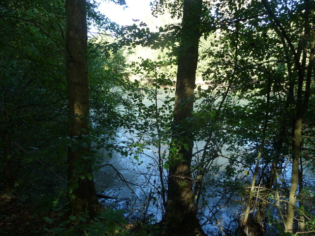
Several small spoil heaps are the main visible surface trace of the colliery.
Related mines
- Bayton Colliery — The Bayton Colliery Company worked pits in and around Mamble as well as at Bayton itself, and both belong to the small southern basin of the Wyre Forest coalfield working the same sulphur coal for hop drying and brickmaking.
Nearby mines
- Bayton Colliery — 1.1 miles (1.8 km) NE
- Catherton Colliery — 6.0 miles (9.6 km) NW, Shropshire
- Kinlet Colliery — 6.9 miles (11.1 km) NE, Shropshire
- Titterstone Clee Quarries — 7.1 miles (11.4 km) NW, Shropshire
- Highley Colliery — 8.2 miles (13.2 km) NE, Shropshire
Straight-line distance, within 9 miles (15 km). Show on the map.
Recorded claims
Individual factual claims, each attached to the source(s) that support it below. Where sources disagree, both are kept.
- Newlands Colliery is recorded in the parish as early as 1811, alongside Mamble Colliery and Buckets Leasow Colliery; from the 1790s the Leominster Canal carried coal to Tenbury Wells and Herefordshire, but it was never profitable and closed in 1859. 1
- The Shakenhurst estate's lease was sold in 1895 to William Lawton Viggars, who abandoned the workings in 1903 after an underground explosion; James Smallshaw took over in 1904, working it profitably by 1907, before Francis Whitworth Wright bought the colliery in 1911 and formed the Bayton Colliery Company in December 1914 with £8,000 capital and around 70 workers. 2
- In 1912 the Bayton Colliery Company built a 2,443-yard steam-powered aerial ropeway to carry coal to the railway at Cleobury Mortimer station, deliberately routed to keep its road crossing within Worcestershire; it was dismantled in the late 1920s after Bayton No.1's reserves were exhausted around 1923 and working moved to Winwrick's Wood. 2
- A final pit, Bayton No.6, generally known as Mamble Colliery, opened in 1938 and passed to the National Coal Board on the 1947 nationalisation of the coal industry, one of only two Worcestershire collieries still working at that point, before closing in February 1950. 3
- Mamble's coal was unusually high in sulphur, unsuitable for metalworking or ordinary domestic use but valued for brickmaking and for drying hops, whose flavour the sulphurous smoke was said to distinctively improve. 2
Sources
- (secondary) Parishes: Mamble (Victoria County History of Worcestershire, vol. 4) — British History Online
- (secondary) Treasures of Worcestershire's Past: 34 - Bayton Colliery — Worcestershire Archive & Archaeology Service
- (secondary) Bayton No.6 Colliery, Malvern Hills, Worcestershire — mindat.org
Record created: 27 August 2026 · Last researched: 27 August 2026