 MineArchive
Catherton Colliery
| Also known as | Catherton Common Colliery |
|---|---|
| Location | Catherton Common, Hopton Wafers, near Cleobury Mortimer, Shropshire — 52.3978, -2.5606 (approximate) |
| Commodity | Coal |
| Type | Coal |
| Worked | Late 18th century–c. 1889 |
| Maximum depth | Unknown. A deep shaft sunk through the dolerite cap, now capped and visible as a depression. |
| Operators | J. Patchett and Co. (1880–?), Summers and Garbett (?–1889) |
Overview
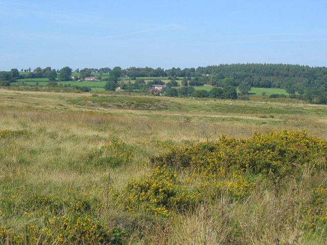
Catherton Colliery stands at the western end of Catherton Common, on the eastern flank of Clee Hill in south Shropshire, in what is now a scheduled monument. Coal was extracted here and on the adjacent Clee Hill from the 13th century to the early 20th, and more than two thousand pits have been identified across the surface. Catherton was one of the last and largest of them: a deep shaft sunk as the scale of mining increased in the late 18th and early 19th century, with a small colliery complex, a reservoir and water channels, its own brickworks and clay pit alongside, and a network of tramways running west to Clee Hill village and east across the common. It was worked by Summers and Garbett until 1889 and is described in the scheduling as one of the earliest deep mines in the area.
History
The Clee Hills coalfield is one of the highest in England and one of the oldest worked. Documentary sources indicate coal being extracted from Catherton Common and the adjacent Clee Hill between the 13th and the early 20th centuries, and the sequence of methods is legible in the ground itself. The outcrops were worked first; then closely-set bell pits, three or four metres apart in places along the coal outcrop; then, once those were exhausted, shafts sunk in the less steeply inclined ground and worked through the medieval period to the early 18th century. As the shallow coal ran out the pits grew larger and deeper, surviving as the big shaft mounds of the early 17th to early 19th century, which spread further apart from one another the further up the hill they go.
In the late 19th century extensive levels or drift mines were driven into the seams from the lower slopes, but ventilation problems and declining coal quality as they went deeper into the hillside led to their abandonment. It was the deep shaft that answered, once 19th-century technology allowed one to be sunk through the hard dolerite capping to reach the larger reserves beneath. Catherton Colliery was the result — a new shaft at the south-western end of what is now the scheduled area, with a small colliery complex built around it. The documentary evidence indicates it was worked until the late 19th century, by Summers and Garbett until 1889, and it is believed to be one of the earliest deep mines in the area. Most of the Clee Hill pits had closed by the end of the 19th century; one or two continued into the 20th, the final closure coming in 1927.
Geology
A significant coal seam underlies the dolerite cap of Hoar Edge and Clee Hill and outcrops on the southern slopes of Titterstone Clee Hill, on the hillside between Cleehill and Doddington and on Catherton Common. That cap is the governing fact of mining here: it protected the coal beneath it from erosion, and it also had to be sunk through, so that these pits were hard won in a way the shallow outcrop workings on the lower slopes were not. The seam’s quality falls off as it runs deeper into the hillside, which is what defeated the 19th-century drift mines before deeper shafts became practicable.
Geological setting: Sedimentary Beds and Seams (well documented example)
Workings
The colliery shaft has been capped but remains visible as a large depression at the centre of a fan-shaped spoil heap. To its north-west are the foundations of several buildings and the earthwork remains of a reservoir 45 m by 25 m with a low retaining bank along its western side, with several water channels traceable running between the buildings and the reservoir. Adjoining the complex on the north-west are the earthworks of a brickworks and its clay pit: a long narrow rectangular building and the stone foundations of a smaller one, thought to be a drying shed and a kiln, and a slight circular depression with an enclosing bank believed to be the site of a horse gin used to hoist clay out of the pit. The mine was served by a network of tramways, one running west to Clee Hill village and another east across Catherton Common; a 19th-century tramway incline associated with the colliery was built diagonally across an earlier drift mine cutting, filling 25 m of its length. The older workings round about show how the smaller pits were wound: at all but three of a group of seventeen late-18th-century mines the uphill side of the shaft carries a circular earthen bank ten to twelve metres across marking the position of a horse gin, and at several the centrally-placed post hole for the gin is still visible.
Closure
Documentary evidence indicates that Catherton Colliery was worked until the late 19th century, with Summers and Garbett operating it until 1889. Most of the Clee Hill pits had closed by the end of that century, defeated by the declining quality of the coal and the cost of working it at that altitude; one or two carried on into the 20th, and the last closed in 1927.
What remains
Exceptionally well preserved, and protected. Because the coalfield sat on top of an isolated hill there was never any development other than the pits themselves, so the remains have continued largely undisturbed. A representative sample, including a core area of about 28 hectares, was scheduled on 21 January 1999. The common is a Site of Special Scientific Interest and a Shropshire Wildlife Trust nature reserve of 213 hectares, open-access land still crossed by the trackways that took the coal away, most of them now rights of way.
Among the fullest surviving early coal-mining landscapes in England. Within the scheduled area are the capped colliery shaft and its fan-shaped spoil heap, the foundations of the colliery buildings and reservoir, the brickworks and clay pit earthworks, a late-18th-century drift mine running 60 m into the hillside below Magpie Hill and 8 m wide at ground level, the closely-set outcrop pits and the large shaft mounds above them, a group of seventeen small late-18th-century mines with the earthen banks of their horse gins, sub-circular banked enclosures at the foot of the spoil heaps thought to have been stock enclosures for packhorses, and sample lengths of the tramways.
Nearby mines
- Titterstone Clee Quarries — 1.5 miles (2.5 km) W
- Bayton Colliery — 5.6 miles (9.1 km) SE, Worcestershire
- Mamble Colliery — 6.0 miles (9.6 km) SE, Worcestershire
- Billingsley Colliery — 7.1 miles (11.4 km) NE
- Kinlet Colliery — 7.7 miles (12.5 km) E
Straight-line distance, within 9 miles (15 km). Show on the map.
What's uncertain
Points where sources disagree or the record could not be settled; both accounts are kept. All open questions in the archive.
- The official 1880 return names J. Patchett and Co. as the owner of Catherton Colliery, while the scheduling text records Summers and Garbett as operating it until 1889. Nothing located reconciles the two. (disputed) 1,2
Recorded claims
Individual factual claims, each attached to the source(s) that support it below. Where sources disagree, both are kept.
- The official list of collieries at work in 1880 returns the pit as "Catherton, Ludlow, J. Patchett and Co." 1
- Coal was extracted from Catherton Common and the adjacent Clee Hill between the 13th and early 20th centuries, and more than 2,000 pits have been identified across the surface remains. 2,3
- A new shaft was sunk at the south-western end of the monument as the scale of mining increased in the late 18th and early 19th century, with a small colliery complex, reservoir and water channels; documentary evidence indicates the colliery was worked until the late 19th century and it is believed to be one of the earliest deep mines in the area. 2
- Summers and Garbett operated Catherton Colliery until 1889. 2
- Adjacent to the north-western side of the colliery are the earthwork remains of a brickworks and its clay pit, with the sites of a drying shed and a kiln and a circular depression believed to be a horse gin used to hoist clay out of the pit. 2
- The Clee Hill pits were hard won because the shafts had to be sunk through the hard dolerite cap of the hill; most had closed by the end of the 19th century, with the final closure in the coalfield coming in 1927. 4
- At all but three of a group of seventeen late-18th-century mines on the slope above the colliery, the uphill side of the shaft carries a circular earthen bank 10–12 m across marking the position of a horse gin, and at several the centrally-placed post hole for the gin remains visible. 2
- A representative sample of the mining remains, including a core area of approximately 28 hectares, was scheduled on 21 January 1999. 2
- The official 1880 return names J. Patchett and Co. as the owner of Catherton Colliery, while the scheduling text records Summers and Garbett as operating it until 1889. Nothing located reconciles the two. (disputed) 1,2
Photographs & further reading
The full National Heritage List description, which reads as a field guide to seven centuries of coal getting on one hillside: outcrop workings, closely-set bell pits, shaft mounds, a late-18th-century drift, seventeen gin-wound shafts, the deep colliery and its brickworks, and the tramways between them.
View sourceAlan Murray-Rust’s summary of the coalfield attached to seven photographs taken in 2016, explaining why the remains survive so completely and pointing to the Archaeology Data Service records for the early and later mining.
View sourceSources
- (secondary) List of coal mines UK 1880 — Coalmining History Resource Centre
- (primary) Coal mining remains and brick works on Catherton Common, Hopton Wafers (scheduled monument 1014869) — Historic England, National Heritage List for England
- (secondary) Catherton Common — Wikipedia
- (observational) Clee Hill coalfield — shared description (2016) — Alan Murray-Rust, Geograph Britain and Ireland
Record created: 6 September 2026 · Last researched: 6 September 2026