 MineArchive
Newmillerdam Colliery
| Also known as | Ninevah Colliery |
|---|---|
| Location | Newmillerdam, on the road to Hall Green, south of Wakefield, West Yorkshire — 53.6382, -1.5077 (approximate) |
| Commodity | Coal |
| Type | Coal |
| Worked | 1929–1981 |
| Operators | National Coal Board (1947–1981) |
A drift mine on the road from Newmillerdam to Hall Green, south of Wakefield, which took over from the Ninevah Colliery in 1929. It sent household coal straight up its drift into the screens until it closed in 1981, its men guaranteed jobs at a new drift mine being developed at West Bretton.
Location
Approximate location. The large pin is this mine; the small round markers are the nearest mines on record. Click one for its page. View on full map
History
The Ninevah Colliery at Crigglestone, worked from 1921, was discontinued in March 1928 and abandoned in February 1929, and in 1929 the mine became Newmillerdam Colliery. It was a drift mine, the coal carried up the drift straight into the screens, and a second, satellite drift carried the men and the return air. It employed 94 people in 1933 and 156 in 1940.
The National Coal Board took it over in 1947, when 185 people raised 49,000 tons of household coal. By 1954 it employed 225 in the Beamshaw seam, whose Top Beamshaw workings were abandoned in April 1967; in the Coal Board's Barnsley Area leaflet of that year 180 men produced 84,000 tons a year from the Kents Thick.
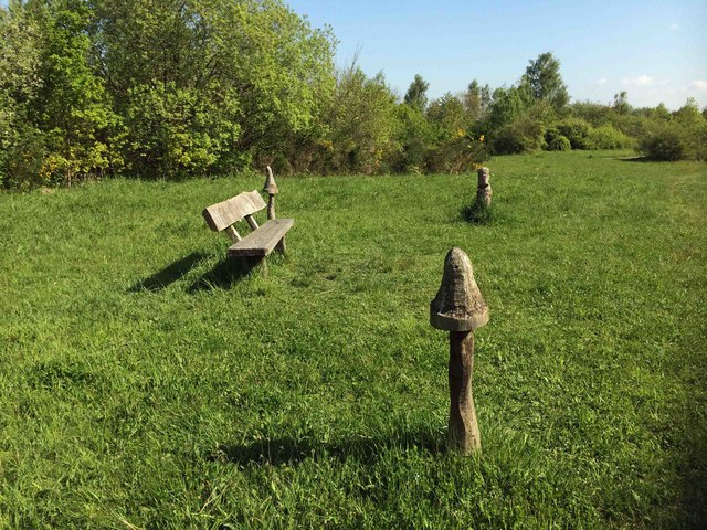
The colliery closed in 1981 on an agreement that its miners could transfer to a newer drift mine: when a £23 million drift was being developed at West Bretton, the men of Newmillerdam and Bullcliffe Wood were given written guarantees of jobs there, and the closure went ahead with the consent of the Yorkshire miners' president, Arthur Scargill. By another account it closed in March, or perhaps December, 1982. A park now covers the site of the colliery, beside the Newmillerdam country park.
Geology
Yorkshire coalfield: the Beamshaw and Kents Thick seams.
Workings
A drift from the surface delivering straight into the screens, and a satellite drift for manriding and return ventilation.
Closure
Closed in 1981 (November 1981 in the NCB list); NMRS gives March or December 1982. The Top Beamshaw plans are dated 9 April 1967.
Redevelopment
A park covers the site of the former colliery.
Nearby mines
- Crigglestone Colliery — 0.8 miles (1.2 km) W
- Walton Colliery — 1.8 miles (2.8 km) NE
- Bullcliffe Wood Colliery — 2.6 miles (4.2 km) W
- Woolley Colliery — 3.1 miles (5.1 km) S, South Yorkshire
- Hostingley Colliery — 3.8 miles (6.1 km) NW
Straight-line distance, within 9 miles (15 km). Show on the map.
Further reading
Employment, output and the Coal Board's 1967 description of the drift.
View sourceThe village, its country park and the colliery's closure.
View sourceSources
- (primary) Newmillerdam Colliery — Durham Mining Museum
- (secondary) Coal Mines in Yorkshire 1854 onwards (N) — Northern Mine Research Society
- (secondary) NCB Collieries - England (Northern Mine Research Society) — Northern Mine Research Society
- (secondary) Newmillerdam — Wikipedia
- (primary) BGS mine plan: Newmillerdam, Top Beamshaw, abandoned 9 April 1967 — BGS / Mining Remediation Authority mine plans
- (observational) Park at Newmillerdam on the site of the former colliery (Geograph 4956239) — Geograph
Record created: 4 October 2026 · Last researched: 4 October 2026