 MineArchive
Nant y Car North Mine
| Also known as | Rhiwnant Mine, Nant y Car Lead Mine |
|---|---|
| Location | South bank of the Claerwen, below Craig y Llysiau, Llanwrthwl, Powys — 52.2443, -3.6259 (exact) |
| Commodities | Copper, Lead |
| Type | Metal |
| Worked | 18th century–1883 |
| Maximum depth | 53 fathoms (about 97 m) |
| Operators | Nantycar Mining Company (1849–1859) — Formed in 1849; sank the 53-fathom engine shaft and built the 50-foot waterwheel. The concern was wound up in 1859. |
Nant y Car North was a copper and lead mine close to the south bank of the Claerwen, in the hills above Rhayader, tried in the eighteenth century. Small-scale mining began again in 1844, and the Nantycar Mining Company developed it properly from 1849, sinking an engine shaft 53 fathoms and putting up a 50-foot waterwheel. The output was small and mostly copper ore. The wheelpits and a line of shafts along the hillside survive.
Location
Recorded location. The large pin is this mine; the small round markers are the nearest mines on record. Click one for its page. View on full map
History
There were probably trials here in the eighteenth century. Mining on a small scale started again in 1844, and in 1849 the Nantycar Mining Company was formed to open the ground out. The next four years, to 1853, were the mine's busy time. An engine shaft was sunk to 53 fathoms, and a waterwheel 50 feet across was built by the river to pump it through a line of rods and to drive the dressing floors. Copper, lead and zinc ores were all raised. The return was small all the same, and mainly copper.
The Nant y Car concern was wound up in 1859. It was taken up again in 1863 and passed through several hands over the next twenty years, though most of the later work went into Nant y Car South, the sister mine a kilometre away on the Rhiwnant. Mining on the Nant y Car setts ended in 1883.
Geology
A lode striking north and south cuts Silurian rocks of the Tarannon and Llandovery series and carries copper and lead ores.
Geological setting: Veins and Lodes (historical documentary reference)
Workings
At least five shafts cross the hillside of Craig y Llysiau, with surface trials and opencuts beside them. A deep adit opens at the northern end of the sett, near the stream below the wheelpit. Short tramway beds run out from the hillside workings onto the tips.
Closure
The mine's main working was from 1849 to 1853; the Nant y Car setts were finally given up in 1883.
What remains
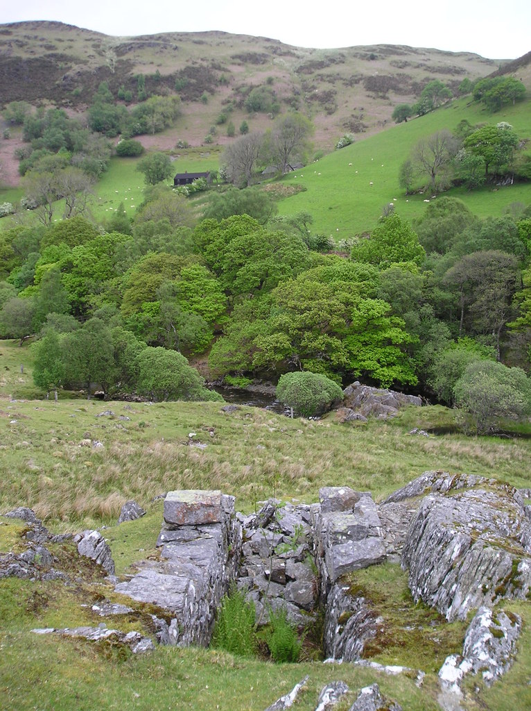
A stone-built wheelpit, part cut into the living rock, stood open on the slope above the river in 2011.
Two wheelpits by the Claerwen, one about seven metres long with its west side cut into the rock; ore bins, a picking floor and the housing of a crusher beside the pumping wheel; a jigger platform; the shafts on the hillside, known as the Cerrig Plwm shafts; and tramway beds.
Related mines
- Nant y Car South Mine — The two mines, a kilometre apart, were worked as parts of the one Nant y Car concern, wound up in 1859 and revived under later owners until 1883.
Nearby mines
- Nant y Car South Mine — 0.7 miles (1.2 km) SW
- Dalrhiw Mine — 0.8 miles (1.4 km) SW
- Nant-y-Garw Lead Mine — 1.3 miles (2.1 km) SW
- Cwm Elan Mine — 2.1 miles (3.4 km) N
- Nantybrain Mine — 8.0 miles (12.9 km) SW
Straight-line distance, within 9 miles (15 km). Show on the map.
Further reading
The archaeological trust's field survey of 1992-93 of the shafts, adit, wheelpit and dressing floor.
View sourceA local history page with the mine's dates, its shaft and waterwheel, and photographs of the wheelpits and the Cerrig Plwm shafts.
View sourceSources
- (secondary) Powys Metal Mines Survey: Nant y Car North (HER 5513) — Clwyd-Powys Archaeological Trust, Powys Metal Mines Survey
- (secondary) Nant y Car North Mine — Elan Valley Past and Present
- (secondary) Historic Landscape Characterisation, The Elan Valley: Dalrhiw (HLCA 1135) — Clwyd-Powys Archaeological Trust
- (primary) Nant y Car Wheel Pit II (NPRN 277112) — Coflein, Royal Commission on the Ancient and Historical Monuments of Wales
- (observational) Wheelpit, Nant y Car Mine (North) (Geograph photograph 2410299, 2011) — Geograph
Record created: 18 November 2026 · Last researched: 18 November 2026