 MineArchive
Milwr Tunnel
| Also known as | Halkyn Tunnel |
|---|---|
| Location | From Bagillt on the Dee Estuary to Cadole, near Loggerheads, Flintshire — 53.2200, -3.1743 (approximate) |
| Commodities | Lead, Zinc |
| Type | Metal |
| Worked | July 1897–1977 |
| Operators | Holywell-Halkyn Mining and Tunnel Company (1896–1928) |
Overview
Not a mine in the ordinary sense but the drain that let a whole district of them keep working — ten miles of tunnel driven from the sea to relieve lead mines that had been drowning in their own lower levels, which grew, over sixty years, into more than sixty miles of interconnected passages beneath two Welsh counties.
History
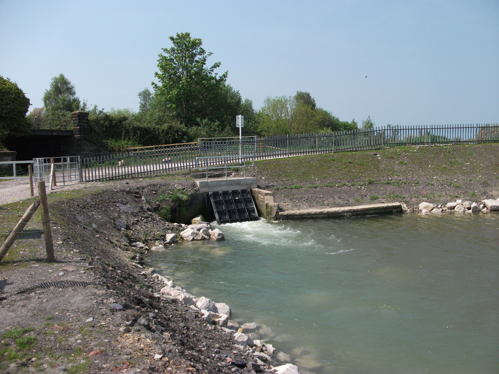
By the late 19th century the lead mines beneath Halkyn Mountain were plagued by flooding in their lower levels, and the Holywell-Halkyn Mining and Tunnel Company was formed in 1896 to solve the problem at a stroke: a single deep drainage adit run from sea level to draw the water off the whole district. Tunnelling began in July 1897 at Boot End, Bagillt, starting nine feet below the high-water mark on the Dee foreshore under the direction of engineer Nathaniel R. Griffith of Wrexham, with self-acting flood doors fitted at the entrance to keep the tide out. By 1908 the tunnel was draining some 1.7 million gallons of water a day and had reached several productive veins, including the Pen-yr-Hwylfa, Dolphin, Drill and Coronation lodes. Legal changes in 1913 allowed the company to keep extending it, and in 1917 the tunnel broke unexpectedly into a flooded underground cavern at the Pant Lode, releasing water at 10,000 gallons a minute — a breach dramatic enough to be felt miles away, where the ancient holy well of St Winefride's Well ran dry as the local water table fell. Halkyn District United Mines Ltd took the tunnel over in 1928 and continued extending it until 1957, by which point it ran some ten miles from Bagillt to Cadole near Loggerheads and had opened up access to new ore that the old, wetter workings could never have reached. From 1939 Pilkington's Glass began quarrying high-quality limestone made accessible by the tunnel, continuing until 1969. The tunnel and its associated mines passed to Courtaulds in 1962; lead mining ended in 1977 and maintenance work on the tunnel itself stopped in 1987.
Geology
The tunnel runs beneath the Halkyn Mountain lead-zinc orefield, a Carboniferous limestone district cut by numerous mineral veins. Its first mile and a half, through coal measures and shale, needed brick lining; beyond that it runs unlined through chert and limestone, at a shallow gradient of about 1 in 1,000, low enough to drain by gravity alone over its whole length.
Workings
Excavated by hand and, later, more mechanised methods over sixty years of intermittent extension, the tunnel eventually drained more than fifty separate mineral veins and connected into a wider network of mines, shafts and natural cave systems extending over sixty miles beneath the Flintshire and Denbighshire countryside — excluding its own branches, the longest single mine drainage tunnel in Britain. Over its working life the mines it drained produced around 200,000 tons of lead ore and 80,000 tons of zinc ore.
Closure
Lead mining in the district it served ended in 1977, and active maintenance of the tunnel itself ceased in 1987; Welsh Water purchased it in 1992 purely for its continuing value as a drainage and water-supply asset.
What remains
The tunnel remains in use today, not as a mine feature but as a drainage and water-supply channel managed by United Utilities, discharging tens of millions of gallons into the Dee Estuary daily. Structural deterioration over more than a century means it can no longer be traversed in its entirety.
The Bagillt portal and its flood-control sluice gear; the wider network of shafts and adits it connects to across the Halkyn district.
Redevelopment
None in the conventional sense — the tunnel remains in active use for water management under United Utilities.
Related mines
- Halkyn Mountain — The Milwr Tunnel was built specifically to drain the lead mines beneath Halkyn Mountain.
- Hendre Mine — The Milwr Tunnel reached Hendre's Olwyn Goch shaft in 1931 and served it as both drain and haulage road until work stopped in 1987.
- Pen-y-Bryn Mine — The Milwr Tunnel reached Pen-y-Bryn Shaft in July 1929, and the shaft then wound ore and men for the mines worked off the tunnel.
Nearby mines
- Pen-y-Bryn Mine — 1.0 miles (1.6 km) NW
- Hendre Mine — 1.5 miles (2.4 km) SW
- Halkyn Mountain — 1.7 miles (2.8 km) NW
- Bryngwiog Lead Mine — 2.1 miles (3.3 km) W
- Bettisfield Colliery — 3.8 miles (6.1 km) N
Straight-line distance, within 9 miles (15 km). Show on the map.
Recorded claims
Individual factual claims, each attached to the source(s) that support it below. Where sources disagree, both are kept.
- The Holywell-Halkyn Mining and Tunnel Company, formed in 1896, began tunnelling in July 1897 at Boot End, Bagillt, nine feet below the high-water mark on the Dee foreshore. 1
- By 1908 the tunnel drained about 1.7 million gallons of water a day and had reached the Pen-yr-Hwylfa, Dolphin, Drill and Coronation veins; in 1917 it broke into a flooded cavern at the Pant Lode, releasing water at 10,000 gallons a minute and causing St Winefride's Well, several miles away, to run dry. 1
- Extended in stages to 1957, the tunnel eventually ran about ten miles from Bagillt to Cadole, drained over fifty veins, and connected into a wider network of more than sixty miles of mines and natural caves — the longest single mine drainage tunnel in Britain. 1,2
- The mines it drained produced around 200,000 tons of lead ore and 80,000 tons of zinc ore over their working life; Pilkington's Glass also quarried high-quality limestone made accessible by the tunnel from 1939 to 1969. 1
- Lead mining ended in 1977 and tunnel maintenance in 1987; Welsh Water bought the tunnel in 1992 and it remains in use today for water drainage and supply under United Utilities. 1
Sources
- (primary) Milwr Tunnel — Wikipedia
- (secondary) Milwr Tunnel — Subterranea Britannica — Subterranea Britannica
Record created: 25 August 2026 · Last researched: 25 August 2026