 MineArchive
Marrick Lead Mines
| Location | Marrick, Swaledale, North Yorkshire — 54.3766, -1.8983 (approximate) |
|---|---|
| Commodity | Lead |
| Type | Metal |
| Worked | At least the Norman period–19th century |
| Maximum depth | Unknown. The surviving remains are shallow shafts and spoil rather than a documented deep working. |
Overview
A lead-mining site above the village of Marrick in Swaledale, worked since at least the Norman period and possibly the Roman, whose income substantially supported a Benedictine priory for nearly four centuries before declining through the 17th to 19th centuries.
History
A lead ingot bearing the name of the Emperor Hadrian, found in the Marrick workings and now held by the British Museum, hints at Roman-era extraction, though documentary evidence for mining here is not confirmed until the reign of Henry VIII. By around 1165 a priory for Benedictine nuns had been founded at Marrick by Roger Aske, substantially supported by income from the local lead mines; a charter of around 1170 confirms further donations to the nuns. Under Henry VIII the priory's own tithe income from the mines was a modest 24 shillings, but the workings had grown considerably by the 1630s: in 1634 William Bulmer paid £750 to the owner of the rectory for the mining tithes alone, indicating substantial extraction underway. The priory itself closed in 1540 under Henry VIII's dissolution of the monasteries, after which the mines passed through a complex history of changing ownership; they belonged to the lord of the manor in both 1689 and 1780. Lead mined at nearby Grinton was brought to Marrick for smelting, and the site supported an ore hearth and later a cupola smelt mill. Production declined through the 19th century, in step with the general collapse of Yorkshire lead mining against cheap foreign imports, and the mines were no longer worked by the early 20th century.
Geology
Lead veins in Marrick Moor, followed by shafts from the surface; the moor also carried the smelt mill that took Grinton's ore.
Workings
Surface and near-surface workings on Marrick Moor, following the lead veins through shafts and associated spoil heaps rather than one large documented deep mine.
Closure
No single closure date is recorded; output declined steadily through the 19th century as Yorkshire's lead industry collapsed generally, and the site was unworked by the early 20th century.
What remains
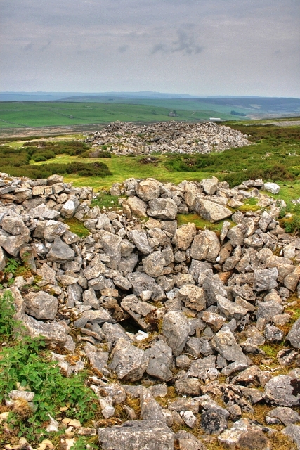
Disused shafts and spoil remain scattered across Marrick Moor, some described as resulting from primitive early mining activity.
Disused mine shafts and spoil tips on Marrick Moor.
Nearby mines
- Grinton Smelt Mill — 1.5 miles (2.3 km) SW
- Whiteside Mine — 1.7 miles (2.8 km) SW
- Fremington Edge Quarry — 2.8 miles (4.5 km) NW
- Surrender Mine — 2.8 miles (4.5 km) W
- Cobscar Mill — 3.1 miles (4.9 km) S
Straight-line distance, within 9 miles (15 km). Show on the map.
Recorded claims
Individual factual claims, each attached to the source(s) that support it below. Where sources disagree, both are kept.
- A lead ingot bearing the name of the Emperor Hadrian was found in the Marrick workings and is now held by the British Museum, suggesting Roman-era extraction even though documentary evidence for mining here only begins under Henry VIII. 1
- A Benedictine priory founded at Marrick around 1165 by Roger Aske was substantially supported by income from the local lead mines; by Henry VIII's reign the priory received 24 shillings from the tithes of the lead ore. 2,1
- In 1634 William Bulmer paid £750 to the owner of the rectory for the mining tithes alone, indicating substantial lead extraction was underway by that date. 1
Photographs & further reading
The University of Leeds Special Collections catalogue for the Marrick Priory estate archive, the primary documentary source for the priory's income from the site's lead mines.
View sourceSources
- (primary) Parishes: Marrick — Victoria County History (British History Online)
- (primary) Marrick Priory, Swaledale, North Yorkshire, Estate Archive — University of Leeds Special Collections
- (observational) Disused Shafts, Marrick Moor — Geograph Britain and Ireland (Mick Garratt)

Record created: 30 August 2026 · Last researched: 30 August 2026