 MineArchive
Magpie Mine
| Location | Sheldon, Derbyshire — 53.2117, -1.7422 (exact) |
|---|---|
| Commodity | Lead |
| Type | Metal |
| Worked | 1740–1958 |
| Maximum depth | main shaft deepened to 208 m (683 ft) |
| Operators | John Taylor (1839–?), Edgar Garlick (1913–1924), Waihi Investment and Development Company (?–1958) |
Overview
Magpie Mine, on the limestone plateau above Sheldon in the Peak District, was the last working lead mine in Derbyshire when it finally closed. Its well-preserved surface buildings, now cared for by the Peak District Mines Historical Society, make it one of the most complete lead-mining surface sites in the area — and it is also notorious for a fatal 1833 dispute with a neighbouring mine (see Disasters, below).
History
Working is first recorded at Magpie in 1740, and the main shaft was sunk in 1823. The mine repeatedly closed and reopened over the following two centuries as disputes, flooding and falling lead prices took their toll — closures are recorded in 1793 and 1835, the latter following a fatal 1833 dispute with the neighbouring Maypitt mine over a shared lead vein (see Disasters, below).
The mine reopened in 1839 under the well-known Cornish mining engineer John Taylor, who deepened the main shaft substantially and installed much of the surface plant that survives today. Later operators included Edgar Garlick, who ran the mine from 1913 until his business entered liquidation in 1924 — after an overly optimistic 1913 report had promised four million tons of ore in reserve — and, after the Second World War, the Waihi Investment and Development Company, which worked the mine until final closure.
Geology
Magpie Mine worked lead-bearing veins in the Derbyshire limestone of the Peak District, on the Great Redsoil vein among others — the same vein whose disputed ownership led to the 1833 incident.
Geological setting: Veins and Lodes (well documented example)
Workings
The main shaft, sunk in 1823, was deepened by John Taylor from 1839 to a final depth of 208 m (683 ft). Drainage was a persistent problem: a sough (drainage tunnel) roughly 2 km long was driven between 1873 and 1881 to carry water away from the lower workings, and still discharges several million litres of water a day.
Closure
Accounts differ on the exact final closure date: most describe the mine finally closing in 1958 after a post-war reopening failed to find significant new ore before the end of the Korean War caused imported lead prices to fall, while at least one account gives 1954. Either way, it was the last working lead mine in Derbyshire.
What remains
The site is well preserved and is managed by the Peak District Mines Historical Society. The drainage sough remains active, still discharging several million litres of water daily.
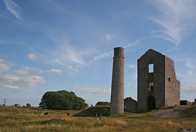
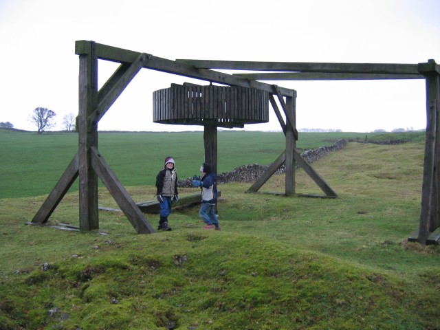
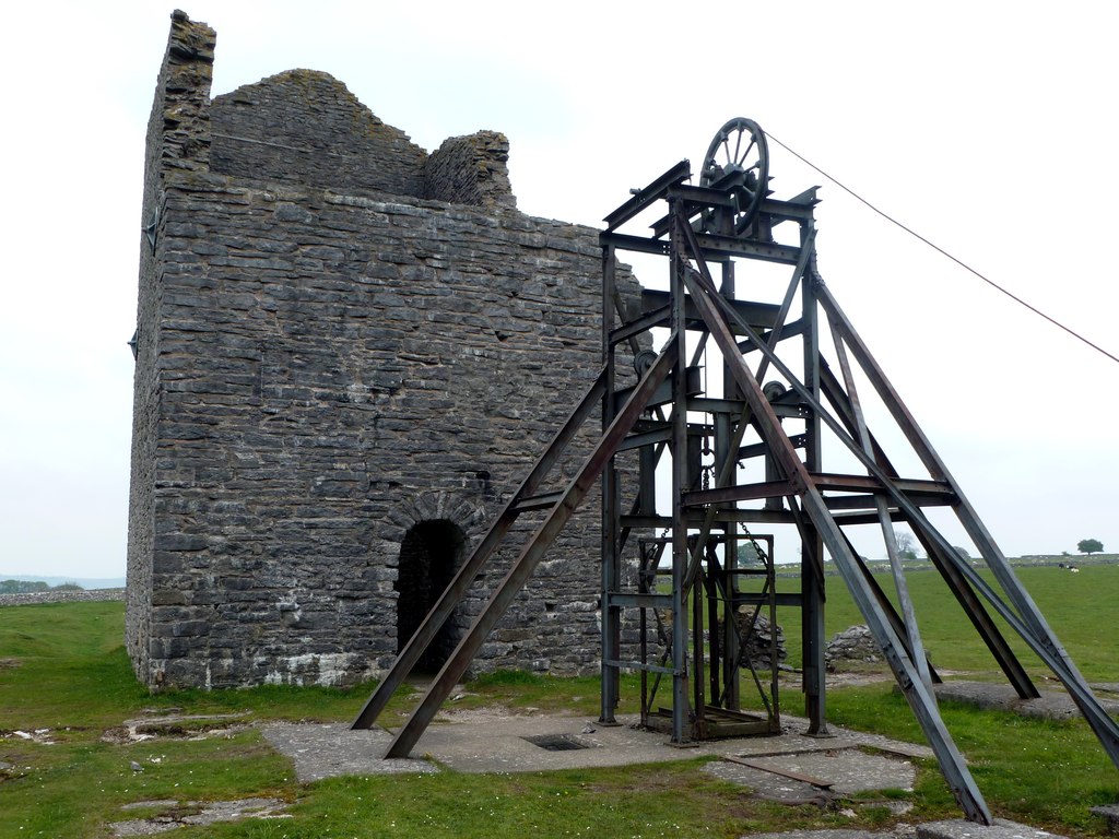
Surviving structures include a circular chimney of 1840, a square chimney of the same date (renovated in 2016), the 1869 Cornish engine house — which replaced an 1840 engine house on the same site — and a reconstructed horse-powered winding gin.
Redevelopment
No major redevelopment has taken place; the site was designated a Scheduled Monument on 15 January 1974 and is maintained as a preserved industrial heritage site rather than redeveloped for other use.
Related mines
- Horsesteps Mine — Shares the scheduled walled enclosure south of Sheldon.
- Hubberdale Mines — Hubberdale's double climbing-and-winding shaft is a design otherwise known in Derbyshire only at Magpie Mine, and the same engineer, John Taylor, reopened both.
- Maypit Mine — The two adjoining mines fought over the same Great Redsoil vein, culminating in the fatal 1833 dispute between them.
- True Blue Mine — Named directly in both sources as historically run by the same company (the Magpie and True Blue United Mining Company, from 1913) and part of the same lead-mining zone.
- Wheal Friendship — The same manager who made his name at Wheal Friendship went on to manage Magpie Mine, Greenside Mine and Coniston Copper Mines.
Nearby mines
- True Blue Mine — 0.4 miles (0.6 km) SE
- Hillocks Mine — 1.9 miles (3.0 km) W
- Knotlow Mine — 1.9 miles (3.1 km) W
- Hubberdale Mines — 2.0 miles (3.2 km) NW
- Lathkill Dale Mine — 2.1 miles (3.3 km) SW
Straight-line distance, within 9 miles (15 km). Show on the map.
Disasters & major incidents
-
Magpie Mine suffocation of three Maypitt miners
1833 · Gas / Asphyxiation · 3 fatalities
Three miners from the neighbouring Maypitt mine suffocated after Magpie miners lit fires underground to smoke them out during a dispute over a shared lead vein — the origin of the mine's 'Widow's Curse' story.
What's uncertain
Points where sources disagree or the record could not be settled; both accounts are kept. All open questions in the archive.
- Most accounts give final closure as 1958; one source instead gives 1954 for the end of the post-war Waihi Investment and Development Company operation. (disputed) 1,2
- Magpie Mine produced 800 tons of lead in 1827, a site record that reportedly stood unbroken until 1871. (uncertain) 1
- A 2018 report on the surface remains notes that Magpie Mine's sough still discharges an estimated four to six million gallons of water a day, and that water is visible roughly 528 feet down the main shaft. (uncertain) 3
Recorded claims
Individual factual claims, each attached to the source(s) that support it below. Where sources disagree, both are kept.
- Most accounts give final closure as 1958; one source instead gives 1954 for the end of the post-war Waihi Investment and Development Company operation. (disputed) 1,2
- The site was designated a Scheduled Monument on 15 January 1974. 2
- Magpie Mine produced 800 tons of lead in 1827, a site record that reportedly stood unbroken until 1871. (uncertain) 1
- A 2018 report on the surface remains notes that Magpie Mine's sough still discharges an estimated four to six million gallons of water a day, and that water is visible roughly 528 feet down the main shaft. (uncertain) 3
- The BGS holds 15 catalogued Magpie plans, several with publicly viewable scans. They include the Wheatcroft plan of the Maypit and Magpie mines as they stood in 1825 — a contemporary survey of both setts eight years before the fatal dispute over the ground between them — along with the Magpie Sough Tail, plans deposited by Waihi Minerals Ltd, a plan of the 52 fathom level on North Bole Vein, and a plan of the eastern part of the property known as the Fair Meer Piece. 4
- The sough was begun in 1873 and took eight years to drive, running about two kilometres from the River Wye; the Peak District Mines Historical Society records it still discharging four to six million gallons of water a day. 1
- John Taylor installed a 40-inch Cornish pumping engine at Magpie after taking the mine on in 1839, alongside deepening the main shaft to 208 m. 1
Photographs & further reading
Over 100 further freely-licensed photographs of the engine house, chimneys and surrounding landscape.
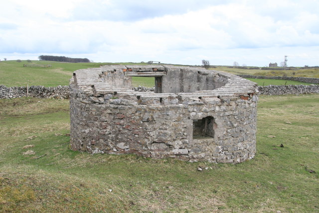
View sourceA surface survey of the scheduled monument, covering the Cornish engine house, the 1840 chimney and flue restored in 2016, the winding house and headgear over the 728ft main shaft, the powder house, replica horse gin and the agents' house.
View sourceSources
- (secondary) Magpie Mine History — Peak District Mines Historical Society
- (secondary) Magpie Mine — Wikipedia
- (observational) Magpie Mine, Derbyshire — October 2018 — 28DaysLater
- (primary) Magpie Mine plans (BGS catalogue) — British Geological Survey
Record created: 19 August 2026 · Last researched: 28 August 2026