 MineArchive
Lathkill Dale Mine
| Also known as | Bateman's House Mine, Lathkill Dale Mining Company's Mine |
|---|---|
| Location | Lathkill Dale, near Over Haddon, Derbyshire — 53.1846, -1.7639 (exact) |
| Commodity | Lead |
| Type | Metal |
| Worked | 1741-42–1841-42 |
| Operators | Lathkill Dale Mining Company (1830–1842) |
Overview
A lead mine worked along the Lathkill Dale Vein in the Peak District, known chiefly for Bateman's House — a manager's dwelling built directly over a 12m-deep pumping shaft that once held an experimental Dakeyne water-powered engine. Worked separately from, but on the same scheduled monument as, the neighbouring Mandale Mine, whose own sough and Cornish engine tell a distinct story further down the same dale.
History
Lead has been worked along the Lathkill Dale Vein since at least the 18th century, drained from 1741-42 by a sough that reached Bateman House by 1764; the London Lead Company extended this drainage level further up the dale to Forefield Shaft by 1774. Portions of the sough were bricked up in 1854 to stop the River Lathkill itself draining away into the workings.
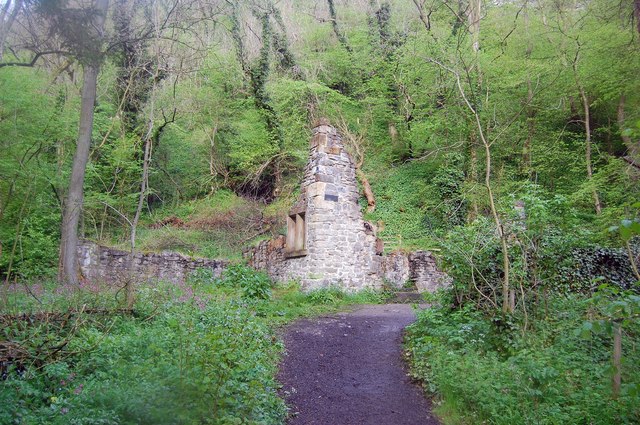
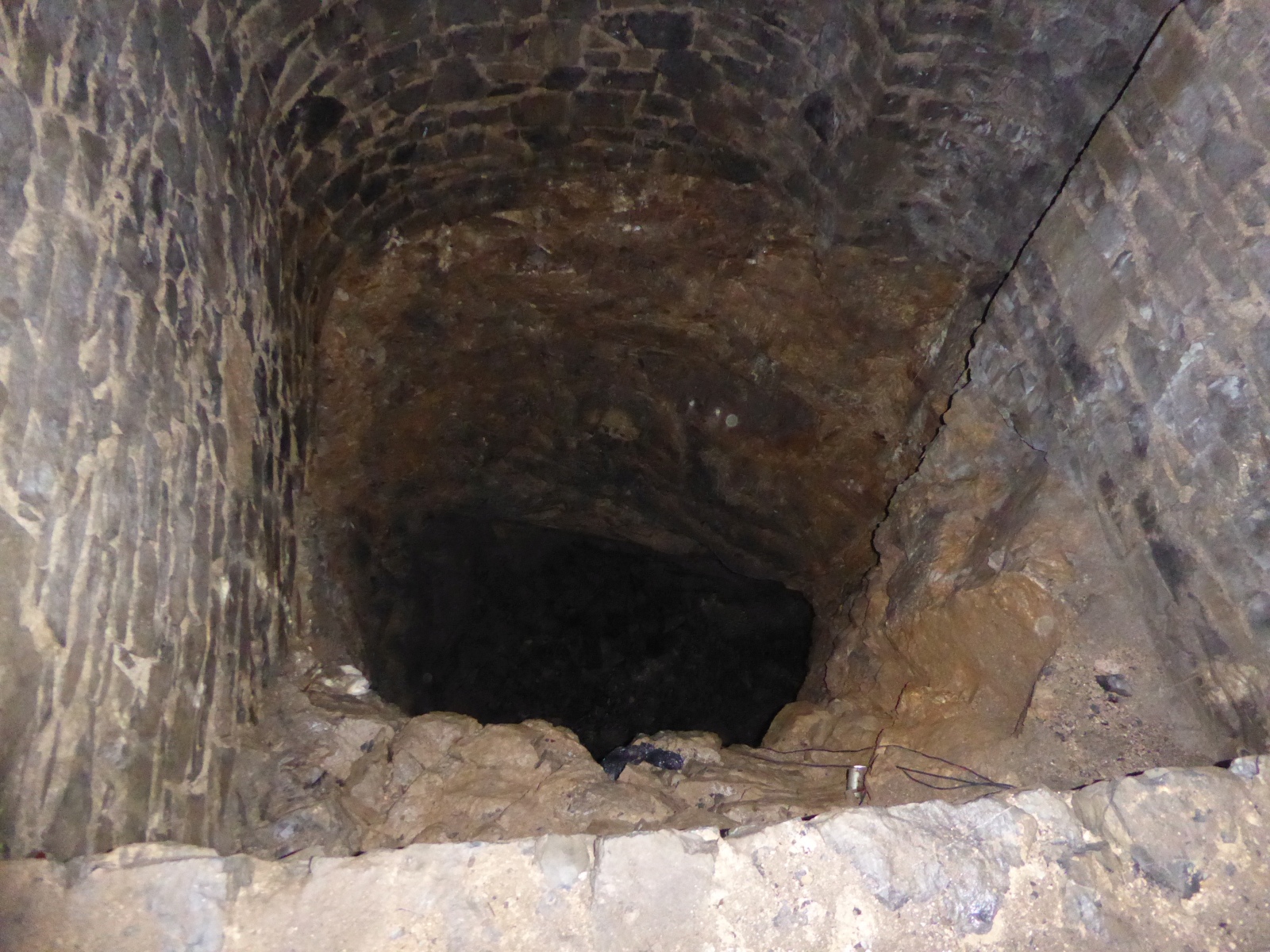
The mine's best-known phase began in 1830, when the Lathkill Dale Mining Company built a distinctive stone building — since known as Bateman's House after the company's agent, James Bateman — directly over a 12m-deep shaft, to house an experimental water-powered pumping engine (one account dates the engine to 1825) of a design patented in 1830 by the Dakeyne brothers, intended as a cheaper alternative to a full steam pumping plant. Whether the Dakeyne engine was ever successfully installed and run is disputed; in 1836 Bateman brought in a large waterwheel as an additional or replacement means of pumping, and an aqueduct with limestone piers was built in 1840 to feed it. Despite this investment the mine could not be kept dry economically, and large-scale working ceased in 1841-42; by 1842 the engine had gone from the shaft house and the building was converted into a residence for Bateman's family, later falling into ruin.
Lathkill Dale Mine and the neighbouring Mandale Mine, worked separately down-dale via its own sough (dug 1797-1820) and its own Cornish pumping engine (installed 1847, mine abandoned 1851), are jointly protected as a single scheduled monument recognised for their unusually well-preserved and multi-phased mining remains.
Geology
The Lathkill Dale Vein, worked since at least the 18th century and drained from 1741-42 by a sough driven up the dale.
Workings
A pumping shaft roughly 12m deep, originally intended for the Dakeyne brothers' patent water-powered engine, housed beneath Bateman's House; a large waterwheel added in 1836, fed via a purpose-built 1840 aqueduct on limestone piers; and the earlier sough system reaching Bateman House by 1764 and later extended toward Forefield Shaft, following the Lathkill Dale Vein.
Closure
The mine was ultimately unable to be kept economically dry despite successive investment in the Dakeyne engine, the 1836 waterwheel and the 1840 aqueduct; large-scale extraction ended in 1841-42.
What remains
Bateman's House survives as a roofless ruin built directly over its shaft, cleared and reopened to public access; the aqueduct's limestone piers, waterwheel pit remains and traces of the sough system can still be traced in the dale. The site forms part of the Lathkill Dale and Mandale Mines scheduled monument, which a 2005 archaeological survey described as an exceptionally well-preserved, multi-phased mining landscape.
Bateman's House as a roofless ruin over its shaft, the aqueduct's limestone piers, the waterwheel pit and traces of the sough.
Related mines
- Mandale Mine — Worked separately down the same dale, but shared the same water-influx problem that eventually forced Mandale's abandonment.
Nearby mines
- Hillocks Mine — 1.5 miles (2.4 km) NW
- Knotlow Mine — 1.6 miles (2.6 km) NW
- Long Rake Spar Mine — 2.1 miles (3.3 km) E
- Magpie Mine — 2.1 miles (3.3 km) NE
- True Blue Mine — 2.1 miles (3.3 km) NE
Straight-line distance, within 9 miles (15 km). Show on the map.
Recorded claims
Individual factual claims, each attached to the source(s) that support it below. Where sources disagree, both are kept.
- The sough draining toward Bateman House was probably started in 1741-42 and had reached it by 1764; the London Lead Company extended it further to Forefield Shaft by 1774. 1
- In 1854 portions of the sough were bricked up to stop the River Lathkill draining into the mine workings. 1
- Bateman's House was built in 1830 by the Lathkill Dale Mining Company over a 12m-deep shaft to house an experimental water-powered pump of a design patented in 1830 by the Dakeyne brothers. 2
- James Bateman, the mine's agent, installed a large waterwheel in 1836, fed by an aqueduct with limestone piers built in 1840. 2
- Large-scale extraction at the Lathkill Dale mine ceased in 1841-42. 2
- Lathkill Dale and Mandale mines and soughs are described as a rare, well-preserved example of mining from the thirteenth century onwards; one account dates Bateman's pumping engine to 1825 and the waterwheel to 1836, and has the Lathkill mine cease in 1842 as unprofitable. 3
- A plan of the mines, veins and soughs of Lathkill Dale in relation to the surface, dated 23 December 1959 (Peak District Mines Historical Society reference C65), is held by the British Geological Survey as MP26708. 4
- Located at about 53.185 N, 1.764 W. 3
Sources
- (primary) MDR3612: Lathkill Sough Tail — Derbyshire Historic Environment Record
- (primary) MDR1301: Lathkill Dale and Mandale Mines — Derbyshire Historic Environment Record
- (secondary) Lathkill Dale (Wikipedia) — Wikipedia
- (primary) Plan showing the positions of the mines in Lathkill Dale, 1959, MP26708 (BGS mine plans catalogue) — British Geological Survey
Record created: 26 August 2026 · Last researched: 24 September 2026