 MineArchive
Herodsfoot Mine
| Also known as | North Herodsfoot Mine |
|---|---|
| Location | Lanreath / St Pinnock, near Liskeard, Cornwall — 50.4386, -4.5453 (approximate) |
| Commodities | Lead, Silver |
| Type | Metal |
| Worked | Early 1700s–1884 |
| Maximum depth | 215 fathoms (1,290 feet) |
Overview
Herodsfoot, straddling the parishes of Lanreath and St Pinnock near Liskeard, was a substantial silver-lead mine best remembered today not for its output but for the exceptional 'cogwheel' bournonite and tetrahedrite crystals its lodes produced between 1850 and 1875 — specimens still sought by mineral collectors worldwide.
History
Lead mining at Herodsfoot was worked intermittently from the early 1700s and again briefly in 1831, but the mine's main working life ran from its reopening in 1845 to final closure in 1884. Over that period the mine reached a depth of 215 fathoms (1,290 feet) and raised more than 19,000 tons of lead ore alongside upwards of 600,000 ounces of silver, recovered from the silver naturally alloyed with the lead. From around 1850 to 1875 Herodsfoot's lodes also produced mineral specimens of exceptional quality, particularly bournonite in the striking twinned crystal habit collectors call 'cogwheel ore', along with fine tetrahedrite — material that made the mine internationally known among mineralogists quite apart from its ordinary lead output.
Geology
The mine worked silver-lead lodes within the Cornubian orefield of south-east Cornwall, the same broad belt of hydrothermal, granite-related mineral veins worked across the county.
Geological setting: Hydrothermal Deposits (well documented example), Veins and Lodes (well documented example)
Workings
Workings reached 215 fathoms (1,290 feet) below surface over the mine's main working period from 1845 to 1884.
Closure
The mine closed in 1884 after nearly four decades of continuous working under its main phase; no later revival is recorded.
What remains
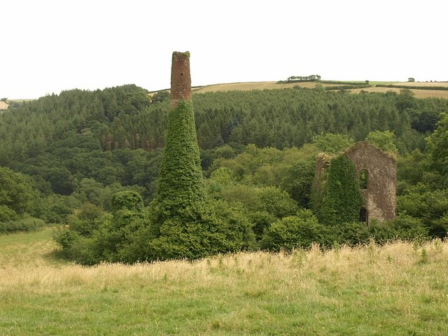
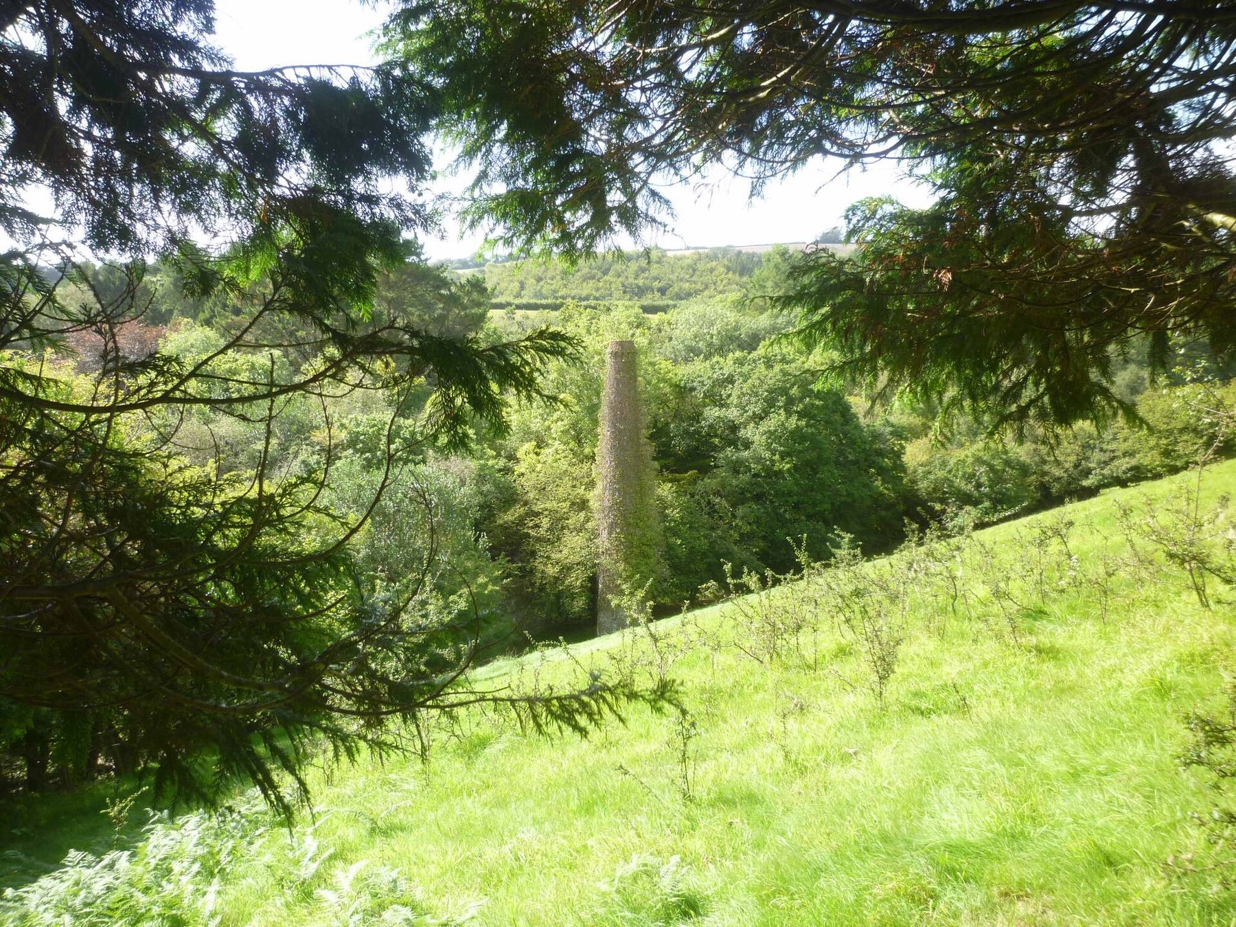
Surface remains include a mine chimney and associated structures, recorded on Geograph and in Historic England's listings for the district.
An engine house of the North Herodsfoot section and a mine chimney stand in the wooded valley.
Nearby mines
- Hobbs Hill Tin Mine — 3.9 miles (6.3 km) N
- Wheal Mary Ann — 4.6 miles (7.4 km) E
- Gonamena — 6.2 miles (10.0 km) NE
- South Caradon Mine — 6.3 miles (10.2 km) NE
- Caradon Hill Medieval and Post-Medieval Mines — 7.1 miles (11.4 km) NE
Straight-line distance, within 9 miles (15 km). Show on the map.
Recorded claims
Individual factual claims, each attached to the source(s) that support it below. Where sources disagree, both are kept.
- The mine reached a depth of 215 fathoms (1,290 feet) and raised more than 19,000 tons of lead ore and upwards of 600,000 ounces of silver during its main working period, 1845-1884. 1
- From around 1850 to 1875 Herodsfoot's lodes produced exceptional 'cogwheel' bournonite and fine tetrahedrite specimens, still prized by mineral collectors internationally. 1
- The Mining Remediation Authority holds abandonment plan OM1830 for Herodsfoot and North Herodsfoot, catalogued for silver-lead ore, with a further set of plans as OMR146. 2
- An engine house of North Herodsfoot Mine and a mine chimney still stand in the wooded valley at Herodsfoot. 3,4
Sources
- (secondary) Herodsfoot Mine (North Herodsfoot Mine), Lanreath, Cornwall, England, UK — Mindat
- (primary) Herodsfoot mine plans (OM1830 / OMR146) — British Geological Survey / The Coal Authority
- (observational) Engine House of North Herodsfoot Mine, Herodsfoot (Geograph, david coombes, 2026) — Geograph Britain and Ireland
- (observational) Herodsfoot Mine chimney (Geograph, david coombes, 2011) — Geograph Britain and Ireland
- (secondary) Herodsfoot — Wikipedia
Record created: 22 August 2026 · Last researched: 24 September 2026