 MineArchive
Wheal Trelawny
| Also known as | Wheal Trelawney, Hony and Trelawny |
|---|---|
| Location | Wheal Honey and Trehane, Menheniot, near Liskeard, Cornwall — 50.4532, -4.4130 (exact) |
| Commodities | Lead, Arsenic, Silver |
| Type | Metal |
| Worked | 1840 or 1845–1902 |
| Maximum depth | Unknown. |
Overview
A silver-lead mine of the Menheniot boom that paid £9,880 in dividends in 1853-55; its listed brick-topped stack at Wheal Honey is a landmark south of Liskeard.
History
Lead seams were discovered around Menheniot in the 1840s, and the parish became the centre of a lead-mining boom that lasted until the 1870s and doubled its population. Wheal Trelawny was one of its mines, worked for lead with arsenic. By one account it was worked from 1840 to 1890 and again in 1900-02; the listing of its chimney gives work beginning in 1845 and continuing as Wheal Trelawny until 1871, then in 1883-84 as Hony and Trelawny. In 1856 the mine, entered under Liskeard parish, belonged to 520 shareholders and had paid £9,880 in dividends in 1853, 1854 and 1855; its purser was J. Philp of Liskeard and its captains W. Bryant and W. Jenkins.
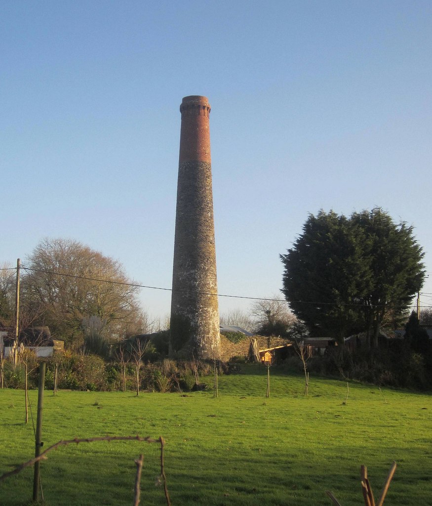
Its abandonment plans in silver-lead ore are dated December 1874 and August 1902, matching the two ends of its working life. At Wheal Honey, part of the sett near Trehane, a tall tapering mid-19th-century stack survives, of rubblestone with its upper third in red brick under a corbelled brick cornice; it is listed and stands as a noticeable landmark.
Geology
Lead lodes with silver and arsenic.
Workings
Unknown.
Closure
Worked to 1871 as Wheal Trelawny, in 1883-84 as Hony and Trelawny, and again in 1900-02.
What remains
The Wheal Honey stack stands in fields near houses.
A listed mid-19th-century stack of rubblestone and brick.
Redevelopment
Unknown.
Related mines
- Wheal Mary Ann — Fellow mine of the Menheniot lead boom of the 1840s-1870s.
Nearby mines
- Wheal Wrey — 1.4 miles (2.3 km) N
- Wheal Mary Ann — 2.4 miles (3.8 km) SW
- South Caradon Mine — 3.7 miles (5.9 km) N
- East Caradon Mine — 3.7 miles (6.0 km) N
- Glasgow Caradon Consols — 3.7 miles (6.0 km) N
Straight-line distance, within 9 miles (15 km). Show on the map.
What's uncertain
Points where sources disagree or the record could not be settled; both accounts are kept. All open questions in the archive.
- Wheal Trelawney was a lead and arsenic mine worked from 1840 to 1890 and again in 1900-02. (disputed) 1
- Work at the mine commenced in 1845 and continued until 1871 as Wheal Trelawny, and in 1883-84 as Hony and Trelawny. (disputed) 2
Recorded claims
Individual factual claims, each attached to the source(s) that support it below. Where sources disagree, both are kept.
- Lead seams were discovered at Menheniot in the 1840s and the parish became the centre of a mining boom lasting until the 1870s. 1
- Wheal Trelawney was a lead and arsenic mine worked from 1840 to 1890 and again in 1900-02. (disputed) 1
- Work at the mine commenced in 1845 and continued until 1871 as Wheal Trelawny, and in 1883-84 as Hony and Trelawny. (disputed) 2
- In 1856 the mine had 520 shareholders and had paid £9,880 in dividends in 1853, 1854 and 1855. 3
- Abandonment plans of Trelawny in silver-lead ore are dated 19 December 1874 and 1 August 1902. 4,5
- The Wheal Honey stack is a tall tapering mid-19th-century chimney of rubblestone with its upper third in red brick and a corbelled brick cornice. 2,6
Sources
- (secondary) Menheniot — Wikipedia
- (secondary) Wheal Honey Stack, Menheniot (Historic England list entry 1140023) — British Listed Buildings
- (secondary) 1856 Mines in Devon and Cornwall — Grace's Guide
- (primary) BGS mine plan: Trelawny, silver-lead ore, 1874 — British Geological Survey / Mining Remediation Authority
- (primary) BGS mine plan: Trelawny, silver-lead ore, 1902 — British Geological Survey / Mining Remediation Authority
- (observational) Wheal Honey Stack, Trehane (Geograph 4281889) — Geograph
Record created: 18 October 2026 · Last researched: 18 October 2026