 MineArchive
Great Carnon Stream Works
| Also known as | Carnon Stream Works, Carnon Stream |
|---|---|
| Location | Restronguet Creek, between Carnon Downs and Devoran, Cornwall — 50.2150, -5.0950 (approximate) |
| Commodities | Tin, Gold |
| Type | Metal |
| Worked | By 1785–1812 |
| Maximum depth | Unknown. |
Overview
The most important tin-streaming operation in Cornwall in its day, working the tin-rich alluvial gravels of the Carnon Valley and Restronguet Creek by damming back the tidal water and working the exposed streambed beneath. Around 150 men and boys worked the site at its peak in 1797, recovering both tin and, as a valued by-product, small grains and occasional nuggets of alluvial gold, before a severe gale and exceptionally high tide breached the dam in 1812 and ended the operation for good.
History
The Carnon Valley's tin-bearing gravels have been worked since prehistory: tin and gold from the valley have been identified, through modern isotope analysis, in the Nebra Sky Disc, a Bronze Age artefact found in Germany, and an antler pick recovered from the valley in 1790 was later dated to the Early Bronze Age. In the medieval and early modern periods, streamers here and along the wider Restronguet Creek and Helford catchment routinely recovered small amounts of alluvial gold alongside their tin, and petitions were made to Henry VIII drawing attention to the effect tin-streaming was having on the depth of water available to shipping. By the eighteenth century the lower Carnon Valley and Restronguet Creek had become the site of the most important stream works in Cornwall, worked in five successive attempts: the first two by embankment, damming back the tidal water to expose the streambed beneath, and the last three — including the later Carnon Mine of 1824 — by mining under the water itself. The Great Carnon Stream Works was the more intensive of the two embankment operations, at its height in 1797, when around 150 men and boys were employed there; the 1805 Ordnance Survey preliminary map shows workings running from a bridge near Carnon Downs downstream as far as the later Old Carnon Mine. Dykes were cut into the rocky shore on the Carclew side and a smaller channel on the Devoran side, the spoil used to build the dams that held back the tide while the exposed ground was worked down under a strong central dam; experienced tinners assessed the ore while boys wheeled material away in barrows. Small grains of gold, known locally as prill and usually no bigger than a pinhead, turned up regularly in the workings and were treated as a customary worker's perquisite rather than the operator's property; the largest single nugget recorded from the site weighed around 18 grams. The operation ended in 1812, when a severe gale combined with an exceptionally high tide breached the dam and flooded the works; it was not reopened, and the site's tin-bearing ground was instead worked from 1824 by the very different, underwater method of the new Carnon Mine.
Geology
Alluvial tin in the bed of a tidal creek, dammed back to expose the ground, with alluvial gold in the same gravels. Henwood's sections of the deposits give river mud seven to nine feet thick over nine feet of mud and sand, then nine feet of blue mud with oyster, cockle and other shells, and beneath that the tin ground - six inches to six feet of subangular granite, slate, elvan, quartz and quartzose slate carrying tin ore in large masses and in dispersed grains - resting on clay-slate bedrock. The Carnon valley drains the heavily mineralised ground around St Day, and the detrital deposits were richest below Higher Carnon where the valley takes its tributaries. The bedrock under the workings at the Perranwell confluence was crossed by a north-south lead-bearing vein, worked across the width of the alluvial ground and twelve to fifteen fathoms below the tin, though the silver-lead it gave was not worth having.
Workings
An embanked, open working: dykes cut into the shore on both the Carclew and Devoran sides of the creek, with a strong central dam holding back the tidal water while the exposed streambed beneath was dug out and the tin- and gold-bearing gravel washed and sorted.
Closure
Ended in 1812 when a severe gale and an exceptionally high tide breached the dam and flooded the works; not reopened as an embanked operation, though the same tin-bearing ground was later worked from 1824 by the shaft-mining Carnon Mine, using a different method to reach beneath the water rather than exclude it.
What remains
No structure survives above ground from the embankment operation itself; the creek has long since reclaimed the site, and the valley's tin-bearing history is instead marked today by the surviving engine house of the later Carnon Mine nearby.
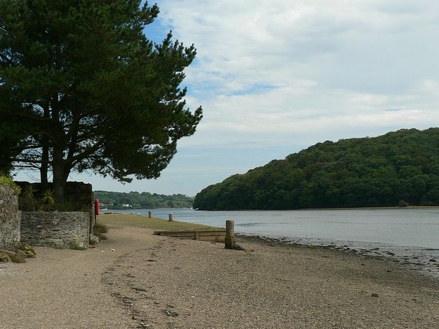
None. The embankments and dykes were earth and spoil thrown up against the tide, and the creek took the ground back after the breach; nothing of the working stands above ground. What a visitor sees on this shore belongs to the later Carnon Mine of 1824 - one wall of its engine house, among the oldest in Cornwall.
Related mines
- Carnon Mine — Carnon Mine (1824) worked the same tin ground as the earlier Great Carnon Stream Works, by the very different method of mining beneath the water rather than excluding it.
Nearby mines
- Carnon Mine — 0.8 miles (1.3 km) SE
- Wheal Jane — 2.3 miles (3.7 km) NW
- Nangiles Mine — 2.3 miles (3.8 km) NW
- Great County Adit — 2.4 miles (3.9 km) NW
- Mount Wellington Mine — 2.6 miles (4.2 km) NW
Straight-line distance, within 9 miles (15 km). Show on the map.
What's uncertain
Points where sources disagree or the record could not be settled; both accounts are kept. All open questions in the archive.
- The Survey's account has the deposits worked before 1800 by embanking certain areas to hold back the tidal water, and the tide breaking through about that year, at which point the works were abandoned. (disputed) 4
- The local accounts have the Great Carnon works at their height in 1797 and ended in 1812, when a severe gale combined with an exceptionally high tide breached the dam. (disputed) 5
- One nugget from the Carnon Valley is recorded as weighing 1 ounce 18 pennyweight and 8.6 grains - about 60 grams - which is more than three times the figure of around 18 grams given for the largest single nugget from the Great Carnon works itself. The two may not describe the same find or the same working. (disputed) 4
Recorded claims
Individual factual claims, each attached to the source(s) that support it below. Where sources disagree, both are kept.
- Tin and gold from the Carnon Valley have been identified through isotope analysis in the Nebra Sky Disc, a Bronze Age artefact found in Germany; an antler pick recovered from the valley in 1790 was later dated to the Early Bronze Age. 1
- Streamers in the Carnon Valley and wider Restronguet Creek and Helford catchment routinely recovered small amounts of alluvial gold alongside tin from the medieval period onward; petitions were made to Henry VIII about the effect of tin-streaming on shipping draught. 2
- By 1797 around 150 men and boys were employed at the Great Carnon Stream Works, the more intensive of two successive embankment operations in the lower Carnon Valley; an 1805 Ordnance Survey preliminary map shows workings from a bridge near Carnon Downs downstream to the later Old Carnon Mine. 3
- Small grains of gold, called prill and usually no larger than a pinhead, were recovered regularly and treated as a customary worker's perquisite; the largest recorded nugget weighed around 18 grams. 3
- The works ended in 1812 when a severe gale combined with an exceptionally high tide breached the dam and flooded the site. 3
- Henwood's sections of the ground under Restronguet Creek give river mud seven to nine feet thick over nine feet of mud and sand, then nine feet of blue mud with oyster, cockle and other shells, and beneath that the tin ground, six inches to six feet thick, on a bedrock of clay slate. The tin ground is made of subangular masses of granite, slate, elvan, quartz and quartzose slate, with tin ore in both large masses and plentifully dispersed smaller grains. 4
- The Survey's account has the deposits worked before 1800 by embanking certain areas to hold back the tidal water, and the tide breaking through about that year, at which point the works were abandoned. (disputed) 4
- The local accounts have the Great Carnon works at their height in 1797 and ended in 1812, when a severe gale combined with an exceptionally high tide breached the dam. (disputed) 5
- The bedrock beneath the alluvial workings at the Perranwell confluence was crossed by a north-south lead-bearing vein, which was wrought across the width of the workings and to twelve or fifteen fathoms below the tin ground; the yield of silver-lead was not remunerative. 4
- Where the same ground was worked by shaft rather than embankment, in the Ponsanooth and Perran Wharf valley about half a mile west of Devoran, an artificial mound was raised above high-water level and a shaft sunk through it to bedrock. Ventilation was imperfect, inflammable gas gathered in the workings, and more than once miners using naked lights were scorched by its explosion. 4
- One nugget from the Carnon Valley is recorded as weighing 1 ounce 18 pennyweight and 8.6 grains - about 60 grams - which is more than three times the figure of around 18 grams given for the largest single nugget from the Great Carnon works itself. The two may not describe the same find or the same working. (disputed) 4
- From 1822 to 1843 the tin-bearing gravels were worked in two areas by mining under the mud layers, and in 1871 the Restronguet Creek Tin Steam Works was begun to exploit the ground between those two mines - so the creek was worked three more times after the embankments failed. 4
- Production records for these alluvial workings are very few. About 120 tons of black tin were sold from the Carnon Stream in 1814-17, after the embanked works had ended, and 122 tons from Restronguet Creek in 1837 with 60 tons in 1873-74 and a further 8 tons in 1876. 4
- The Buddlepit database records the working as Carnon Stream Works, also known as Restronguet Creek, a tin mine at SW 8080 3850 worked from the 1700s and specifically from 1785 to 1812, citing Dines's memoir at pages 30 and 273-275 and Skillen's Nobody Likes the Captain (British Mining No. 45, 1992) at page 51. 5
Photographs & further reading
Dines's economic memoir of 1956, online in full; its Carnon Valley and Restronguet Creek section gives the section of the deposits, the embankment working and its end, and the recorded sales of black tin.
View sourceSite record for the working, with its position, its dates and the two published sources behind them.
View sourceSources
- (secondary) Carnon River — Wikipedia
- (secondary) Later Mineral Workings — Feock Parish Council
- (secondary) The Great Carnon Stream Works — Feock Parish Council
- (primary) The Metalliferous Mining Region of South-West England (Dines, BGS economic memoir, 1956) — British Geological Survey
- (secondary) Carnon Stream Works — Buddlepit Mine Database — Buddlepit Mine Database
- (observational) Carnon Mine — Explore Cornwall
Record created: 26 August 2026 · Last researched: 28 September 2026