 MineArchive
Eagle Crag Mine
| Location | Eagle Crag, upper Grisedale, below Nethermost Pike, Patterdale, Cumbria — 54.5190, -2.9933 (approximate) |
|---|---|
| Commodities | Lead, Zinc |
| Type | Metal |
| Worked | By 1784–1876 |
| Maximum depth | Unknown. |
Overview
A lead mine on the east face of Eagle Crag at the head of Grisedale, below Nethermost Pike, where nine levels were cut into an east-west vein that splits into a great Y between the crag's buttresses 600 metres up. Leased by the lord of the manor of Patterdale in 1784 and worked on and off until 1876, it sent its ore down chutes to the valley floor and by pony track and cart to Glenridding, then by boat to Pooley Bridge.
History
There are signs of probable Elizabethan workings at the top level, but the first documentary record of the mine is a lease issued in May 1784 by William Hasell, lord of the manor of Patterdale. The vein was worked through nine separate levels on the east face of Eagle Crag; ore was dug out by hand, tumbled down chutes and broken up on the valley floor, where the mine had a smithy for sharpening drills and repairs, settling ponds, a store house, a gunpowder store and a primitive smelter. A pony track along Grisedale Beck carried the ore out; it went by cart to Glenridding and on by boat to Pooley Bridge, and the path up the valley was built up to take its weight. Some of the people at Elmhow, across the beck, worked in the mine. Working stopped and started through the mid-1800s. Between 1872 and 1876 Edward William Hasell of Dalemain made two major attempts to find zinc and lead, driving 160 metres into solid rock in one direction and 135 metres in another, then stopped, and mining in Grisedale ended. Local tradition adds that two brothers named Watson, miners from Deepdale, later found silver-bearing quartz on the shoulder of St Sunday Crag, covered it over and could never find it again when they brought their captain from Greenside, so that the vein has been known ever since as Watson's Loss.
Geology
The main vein runs east to west across the east face of Eagle Crag and carries copper, zinc and lead, the lead giving about 16 ounces of silver to the tonne. It splits into two between the crag's twin buttresses, and is thought to run west as far as the south end of Thirlmere and east across Grisedale Beck, St Sunday Crag and Arnison Crag to Patterdale. A second vein, the Clay Vein, also carrying galena, runs north-east to south-west across the south face of Nethermost Pike. The fell is Borrowdale Volcanic Group.
Geological setting: Veins and Lodes (well documented example)
Workings
Nine levels cut into the vein up the east face of Eagle Crag, the highest at about 600 metres, with probable Elizabethan workings at the top; chutes to the valley floor; the worked-out vein, about a metre wide, where it crosses Grisedale Beck; and trials along its course on the slopes of St Sunday Crag. The 1870s levels ran 160 and 135 metres into solid rock. Postlethwaite described the Patterdale mines as worked chiefly by adit levels with extensive excavations above and between them.
Closure
Work ended in 1876 after Edward William Hasell's two attempts of 1872 to 1876 found nothing worth following, and mining in the Grisedale valley stopped.
What remains
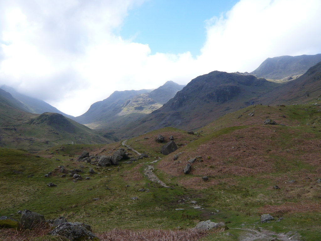
The workings lie in upper Grisedale, on the eastern slopes of Nethermost Pike, which are protected as part of a Site of Special Scientific Interest. The mineral vein is plainly visible on the crag, mine tailings lie below it, and the worked-out vein can be seen where it crosses Grisedale Beck near a sheepfold, with trial diggings along its line up the far side of the valley.
The line of nine levels and the vein on Eagle Crag, tailings on the valley floor, the worked-out vein at Grisedale Beck, and the built-up ore path along the valley.
Redevelopment
None: the site is open fell and valley in upper Grisedale.
Nearby mines
- Wythburn Mine — 3.0 km W
- Greenside Mine — 4.0 km NE
- Hartsop Hall Mine — 4.3 km SE
- Greenhead Gill Mine — 5.6 km S
- Myers Head Mine — 6.0 km E
Straight-line distance, within 15 km. Show on the map.
People
- Edward William Hasell · owner, 1872–1876 — Of Dalemain; made two major attempts on the mine between 1872 and 1876, driving 160 m and 135 m into solid rock before giving up.
- William Hasell · landowner, from 1784 — Lord of the manor of Patterdale, who issued the first recorded lease of the mine in May 1784.
What's uncertain
Points where sources disagree or the record could not be settled; both accounts are kept. All open questions in the archive.
- The Watson brothers of Deepdale are said to have found and then lost a silver-bearing vein on St Sunday Crag, known since as Watson's Loss. (uncertain) 1
Recorded claims
Individual factual claims, each attached to the source(s) that support it below. Where sources disagree, both are kept.
- The first documentary record of workings is a lease issued in May 1784 by William Hasell, lord of the manor of Patterdale; there are signs of probable Elizabethan workings at the top level. 1
- The Eagle Crag mine operated from 1784 to 1876. 1,2
- Ore was tumbled down chutes, broken on the valley floor and carried by pony track and cart to Glenridding, then by boat to Pooley Bridge. 1,2
- Between 1872 and 1876 Edward William Hasell of Dalemain drove levels 160 m and 135 m into solid rock looking for zinc and lead, then stopped. 1
- The main east-west vein carries copper, zinc and lead, with about 16 oz of silver per tonne of lead, and was worked through nine levels. 1
- The Watson brothers of Deepdale are said to have found and then lost a silver-bearing vein on St Sunday Crag, known since as Watson's Loss. (uncertain) 1
- The Patterdale mines, Eagle Crag among them, were worked chiefly by adit levels, and considerable quantities of lead ore were raised. 3
Photographs & further reading
The valley's history, with the Eagle Crag vein, the ore path and the miners of Elmhow.
View sourceSources
- (secondary) Mines and Quarries in the Ullswater Valley — Friends of the Ullswater Way
- (secondary) Grisedale — Friends of the Ullswater Way
- (secondary) Eagle Crag Mine, Grisedale — Old Cumbria Gazetteer (quoting Postlethwaite, 1877)
- (observational) Upper Grisedale, looking towards the Helvellyn group (photograph, 2012) — Geograph Britain and Ireland
- (secondary) Nethermost Pike — Wikipedia
Record created: 18 September 2026 · Last researched: 18 September 2026