 MineArchive
Wythburn Mine
| Also known as | Helvellyn Mine, Wheal Henry |
|---|---|
| Location | Mines Gill, Helvellyn, above Thirlmere, near Wythburn, Cumbria — 54.5248, -3.0387 (approximate) |
| Commodity | Lead |
| Type | Metal |
| Worked | 1839–1880 |
| Maximum depth | Unknown. |
| Operators | Wythburn Lead Mining Company (1861–?) |
Overview
A lead mine high on the Thirlmere side of Helvellyn, in the gill between Whelp Side and the Helvellyn Screes, worked from 1839 to 1880 under the names Wheal Henry, Helvellyn Mine and Wythburn Mine. Its levels climbed to about 2,300 feet, the highest of them perhaps the highest mineral working in England, but it raised only a few hundred tons of galena, and it closed when Manchester Corporation bought the valley for the Thirlmere reservoir.
History
The mine opened in 1839 beside the gill below Helvellyn's summit, and over its forty-year life it went by three names: Wheal Henry first, then Helvellyn Mine, then Wythburn Mine. It passed through a succession of owners, who drove five levels, mostly through barren rock, to explore three mineral veins. Around 1861 a crushing mill was built lower down the gill, powered by a 30-horsepower turbine on water fed under pressure from a dam in a cleft of the gill, and shortly afterwards the Wythburn Lead Mining Company built a self-acting inclined railway to let tubs of high-grade galena and lower-grade mixed ore down to the mill, under the direction of its mine captain, John Muse, a Wesleyan from Matterdale. Muse brought miners and their families to the dale, among them John Arnison of Yanwath, who lived at Pinfold How at the foot of the gill and drove the highest levels, which bear his name; the twins born to him and his wife Isabella died within thirteen days of each other in March 1863 and lie in Wythburn churchyard, with Muse and a handful of miners. A leat was cut to divert the water of Brownrigg Well, a spring near the summit, into the gill to serve the mine. The mill was abandoned in 1877 and its turbine removed to help cover costs, and the mine closed in 1880, when Manchester Corporation acquired the land for Thirlmere.
Geology
Three mineral veins carrying argentiferous galena, explored through five levels that ran mostly through barren rock.
Workings
Levels up the course of the gill, No. 2 Level being the main tunnel and No. 1 about 150 feet above it, with Arnison's Low Level and Arnison's Top Level higher still at about 2,300 feet; internal shafts connected them. A self-acting inclined railway of about 1861 lowered ore to a crushing and separating mill driven by a 30-horsepower turbine, and a drum house stood at its head. The mine had an office and smithy, a powder house in the woods below, and a leat from Brownrigg Well near the summit.
Closure
The mine closed in 1880 when Manchester Corporation acquired the land for the Thirlmere reservoir, and its level entrances were blown in with explosives. It had raised only a few hundred tons of galena, probably not enough to cover its costs, although one account calls it profitable; the mill had already been abandoned in 1877.
What remains
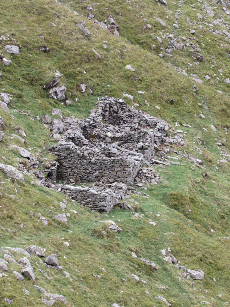
Spoil heaps remain, one of them across the gill, with the miners' zigzag path, the trackbed of the self-acting incline, the ruined drum house, the ruins of the count house, office and smithy, and the stone powder house in the plantation below. The level entrances were destroyed at closure; members of the Cumbria Amenity Trust dug some open again in the early 1980s, but most have been lost under scree. Storms in December 2015 and January 2016 ripped out large sections of the incline, and the mill was demolished after Thirlmere was flooded. The Brownrigg Well leat is still visible high on the fellside.
Spoil heaps, the incline trackbed and drum house, ruins of the count house, office and smithy, the powder house, the site of the crushing mill, and the Brownrigg Well leat.
Redevelopment
The land was bought by Manchester Corporation for the Thirlmere reservoir; the lower slopes are now conifer plantation around the reservoir.
Nearby mines
- Eagle Crag Mine — 3.0 km E
- Greenside Mine — 6.1 km E
- Greenhead Gill Mine — 6.6 km S
- Hartsop Hall Mine — 7.2 km SE
- Seathwaite Wad Mine — 8.1 km W
Straight-line distance, within 15 km. Show on the map.
People
- John Arnison · worker, from 1861 — A lead miner from Yanwath who lived at Pinfold How and drove the highest levels, Arnison's Low and Top Levels; his infant twins died in March 1863.
- John Muse · manager, from 1861 — Mine captain for the Wythburn Lead Mining Company, who directed the building of the incline and brought miners' families to the dale; a Wesleyan from Matterdale, buried at Wythburn.
What's uncertain
Points where sources disagree or the record could not be settled; both accounts are kept. All open questions in the archive.
- Only a few hundred tons of galena came out of the mine, probably insufficient to cover its costs. (disputed) 1
- The mine was a profitable one when Manchester Corporation closed it. (disputed) 2
Recorded claims
Individual factual claims, each attached to the source(s) that support it below. Where sources disagree, both are kept.
- Helvellyn or Wythburn Mine opened in 1839 and closed in 1880 when Manchester Corporation acquired the land for the Thirlmere reservoir. 1,2
- Over its forty-year life the mine was called Wheal Henry, then Helvellyn Mine, then Wythburn Mine. 2
- Only a few hundred tons of galena came out of the mine, probably insufficient to cover its costs. (disputed) 1
- The mine was a profitable one when Manchester Corporation closed it. (disputed) 2
- A self-acting incline was built shortly after the crushing mill of about 1861 to lower tubs of ore to the mill; storms in 2015-16 destroyed large sections of it. 2,3
- The crushing mill was driven by a 30 hp water turbine; it was abandoned in 1877 and the turbine removed to cover costs. 4
- The levels were blown in with explosives when the mine closed; some were reopened by Cumbria Amenity Trust members in the early 1980s. 1,2
Photographs & further reading
A walk up the mine by the author of a 1987 history of it, with the incline, the levels and the miners' families.
View sourceSources
- (secondary) Helvellyn — Wikipedia
- (observational) Helvellyn with Ghosts (Part 1: Wythburn Mine), by Alen McFadzean, 23 December 2010 — Because They're There (blog)
- (observational) Wythburn Mine Waggonway (photograph, 2018) — Geograph Britain and Ireland
- (observational) Remains of Wythburn Crushing and Separating Mill (photograph, 2018) — Geograph Britain and Ireland
- (observational) Ruins of Wythburn Mine Count House (photograph, 2018) — Geograph Britain and Ireland
- (secondary) Wythburn/Helvellyn No.4 (Lead Ore) — Durham Mining Museum
Record created: 18 September 2026 · Last researched: 18 September 2026