 MineArchive
Crystal Mine, Marston
| Also known as | Fletcher's Marston Mine, Thompson's Mine, Crystal Mine, Albert Salt Works, Johnson Fletcher's Mine |
|---|---|
| Location | Marston, near Northwich, Cheshire — 53.2755, -2.4968 (approximate, low confidence) |
| Commodity | Salt |
| Type | Mineral |
| Worked | c. 1850–By 1888 (last worked) |
| Maximum depth | Unknown. |
| Operators | James Platt and Son (?–1888), John Thompson and Sons (?–1888), Salt Union Ltd (1888–1920) |
Overview
A two-acre rock-salt mine at Marston, near Northwich, sunk about 1850 beside what became the Lion Salt Works and worked with the Albert Salt Works until the Salt Union bought it in 1888. Left dry and disused, it was used in the First World War to store surplus shell explosive, and when it flooded in 1920 more than ten thousand boxes of picric acid were lost in it. They are still there.
History
The Crystal Mine was a small rock-salt mine at Marston, immediately west of the site of the later Lion Salt Works, covering only about two acres. A stone dated 1850 in the wall of its engine house gives the date of sinking. It was first known as Fletcher's Marston Mine, or Johnson Fletcher's. By the 1870s it was James Platt and Son's Albert Salt Works, with three open pans and a warehouse beside the mine, a coal yard and wharf, railway sidings and a small gas works. It later came into the hands of the Thompson family and was also called Thompson's Mine.
It was sold to the Salt Union on 21 July 1888 in a lot with the neighbouring New Zealand Mine, the purchase of the Albert works, at £6,700, being dated 6 October. By then it was known as the Crystal Mine. The Salt Union never worked it: its inventory of 1908 found the mine and shaft in good order but the buildings unworkable, the pans and warehouse dismantled and the gas works out of date.
During the First World War the dry, disused mine was used, with others at Marston, to store unwanted shell explosive, lyddite. It was still there in 1920 when water broke in and flooded the mine. All 10,418 boxes of picric acid, 520,884 pounds of explosive, were lost and remain in the workings. The shafts were filled on 26 July and 11 November 1920, and the engine house was pulled down in February 1925.
Geology
The mine worked the bottom bed of rock salt, the lower of the two beds of the Northwich Halite beneath Marston.
Geological setting: Evaporite Deposits (historical documentary reference)
Workings
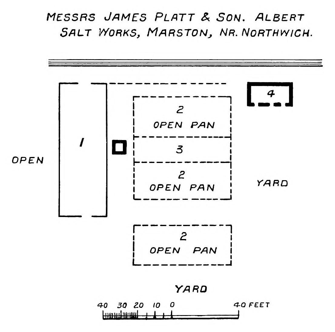
A small mine of about two acres (0.8 hectares), with an engine house and rock house at the surface. Beside it stood the Albert Salt Works: three open pans, a warehouse and office, a coal yard and wharf, railway sidings and a small gas works.
Closure
The mine was not worked after the Salt Union was formed in 1888, though the mine and shaft were still in good order in 1908. Water broke in and flooded it in 1920, with the wartime store of explosive still underground, and the shafts were filled on 26 July and 11 November that year.
What remains
Nothing of the salt works or the mine is visible, and the ground, now pasture and gardens, has partly subsided. The shafts are filled but the workings remain open underground, with the picric acid still in them; one modern table puts it at 260 tons.
Crystal Cottage, the mine manager's house, which was renovated in the late 1990s and is still lived in, and a small brick shed that was probably the mine's weighbridge house.
Related mines
- Lion Salt Works — The Crystal Mine came into the Thompson family's hands and stood immediately west of the plot where Henry Ingram Thompson built the Lion Salt Works in 1894.
- Marston Pool Mine — Both Thompson family mines at Marston, sold to the Salt Union in 1888 and both later used to store explosives.
- New Zealand Mine, Marston — Sold to the Salt Union together in one lot on 21 July 1888; both had been Fletcher mines.
Nearby mines
- Lion Salt Works — 0.1 miles (0.1 km) E
- Adelaide Mine — 0.1 miles (0.2 km) NE
- New Zealand Mine, Marston — 0.1 miles (0.2 km) SE
- Marston Old Mine — 0.2 miles (0.3 km) NW
- Marston Pool Mine — 0.4 miles (0.6 km) NW
Straight-line distance, within 9 miles (15 km). Show on the map.
What's uncertain
Points where sources disagree or the record could not be settled; both accounts are kept. All open questions in the archive.
- 260 tons of picric acid remain in the mine. (disputed) 2
Recorded claims
Individual factual claims, each attached to the source(s) that support it below. Where sources disagree, both are kept.
- The mine operated from about 1850, the date on a stone in the wall of its engine house; it was only about 2 acres in extent. 1
- Started in 1850 and abandoned, flooded, in 1920, with workings of 0.8 hectares; the shafts are filled and open workings remain. 2
- Originally Fletcher's Marston Mine, it was James Platt and Son's Albert Salt Works by the 1870s and later came into the possession of the Thompson family. 1
- Sold to the Salt Union on 21 July 1888 in a lot with the New Zealand Mine; the Albert Salt Works of James Platt was bought for £6,700 on 6 October 1888. 1
- In 1908 the mine and shaft were in good order but had not been operated since the Salt Union was formed in 1888. 1
- The mine was used to store unwanted shell explosive, lyddite, during the First World War; when it flooded in 1920 all 10,418 boxes of picric acid, 520,884 lb of explosive, were lost and remain there. 1
- 260 tons of picric acid remain in the mine. (disputed) 2
- The shafts were filled in on 26 July and 11 November 1920 and the engine house was pulled down in February 1925. 1
- The mine is named on a combined Salt Union abandonment plan of the Northwich rock-salt mines. 3
- A sketch plan printed in 1915 shows James Platt and Son's Albert Salt Works with three open pans. 4
Photographs & further reading
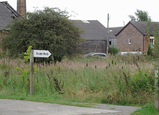
A 2011 photograph of vacant land beside the then derelict Lion Salt Works.
View sourceCouncil archaeological assessment of the Marston salt sites, with the Crystal Mine's history, a sketch plan of the Albert Salt Works and a photograph of Crystal Cottage.
View sourceA 2012 paper on twenty years of surveying the sinking canal at Marston, with a table and plan of the seven rock-salt mines beside it.
View sourceSources
- (primary) Saltscape Project, Northwich, Cheshire: assessment of sites for archaeological fieldwork (Project A8, report 2015-001) — Cheshire West and Chester Council (Chris Hewitson)
- (secondary) Long-term time-lapse microgravity and geotechnical monitoring of relict salt mines, Marston, Cheshire, U.K. (Geophysics 77(6), B287-B294, 2012) — Pringle, Styles, Howell, Branston, Furner and Toon; Keele University repository
- (primary) Mine plan: Salt Union combined plan naming Adelaide, Albert (Old and New), Crystal and other Northwich mines (feature 21861668) — British Geological Survey / Mining Remediation Authority mine plans catalogue
- (secondary) Salt in Cheshire (1915) — Albert F. Calvert (E. and F. N. Spon, London); Internet Archive
- (observational) Derelict canalside land at Marston, Cheshire (photograph and description, 2011) — Geograph (Roger D Kidd)
Record created: 1 October 2026 · Last researched: 1 October 2026