 MineArchive
Marston Pool Mine
| Also known as | Pool Mine, Poole Mine, John Thompson's Marston Mine, Marston Pool rock salt mine, J. Thompson and Sons' Mine |
|---|---|
| Location | Marston, near Northwich, Cheshire — 53.2795, -2.5036 (approximate, low confidence) |
| Commodity | Salt |
| Type | Mineral |
| Worked | 1846 or 1850–1929 (shafts sealed) |
| Maximum depth | 324 ft |
| Operators | John Thompson and Sons (1846–1888), Salt Union Ltd (1888–1929) |
Overview
A small rock-salt mine at Marston, near Northwich, opened by the Thompson family in 1846 and sold to the Salt Union in 1888. It had no salt works of its own. During and after the First World War it was kept pumped dry as an explosives store, until the cost led to its shafts being sealed in 1929.
History
Marston Pool Mine was a small rock-salt mine on the Trent and Mersey Canal north-west of the later Lion Salt Works, opened in 1846 and belonging to the Thompsons, the Northwich salt family; it was also known as John Thompson's Marston Mine and as J. Thompson and Sons. It was held by John Thompson junior and his son Henry Ingram Thompson. The Ordnance Survey map of 1875 shows no salt pans at the surface: it was a mine and nothing else, loading its rock salt at its own arm of the canal.
The Thompsons sold most of their salt business to the Salt Union in 1888, and the Pool Mine went with it; the Salt Union's inventory of 1908 lists it with the neighbouring Marston Hall Mine. During and after the First World War the mine was used to store explosives, which had to be kept dry, so it was pumped every week to hold back the water from the flooded workings of the adjoining mines. By 1925 that had become a costly business, and in January 1929 the decision was taken to seal the shafts.
Geology
The mine worked the bottom bed of rock salt, the lower of the two beds of the Northwich Halite beneath Marston.
Geological setting: Evaporite Deposits (historical documentary reference)
Workings
A small mine of about six acres, given in a modern table as two hectares, with no salt pans at the surface in 1875. Rock salt left by a short arm of the Trent and Mersey Canal with its own dock, the towing path crossing the entrance on a bridge. In its last years the workings were pumped once a week, six hours' pumping after three hours raising steam, on seven tons of coal. In 1881 the mine was reached by a pair of shafts 324 feet deep and stood on two shaft pillars about eight yards square and others seven yards square and 25 yards apart; it was narrow enough for the boundary ribs to help carry the roof.
Closure
The date the last salt was raised is not recorded. The mine was kept open as an explosives store and pumped weekly until January 1929, when the decision was taken to seal the shafts; the weekly cost in 1925 was put at seven tons of coal, two men for half a day and an engine driver, with carting, boiler insurance, flue cleaning and repairs. A table of the Marston mines gives it as abandoned, flooded, in 1939.
What remains
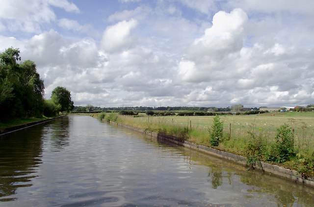
The shafts have been filled but the workings remain open underground. The mine stood on the old course of the canal, which was bypassed by the new cut of 1958.
Part of the canal arm can still be made out, with the ramps up to the bridge that carried the towing path over the entrance to the dock. A survey in 1993 recorded the stone and timber remains of the canal arm and its sluice, and linear earthwork banks up to two metres high thought to be the remains of a series of pools.
Related mines
- Crystal Mine, Marston — Both Thompson family mines at Marston, sold to the Salt Union in 1888 and both later used to store explosives.
- Lion Salt Works — Both Thompson family properties: Henry Ingram Thompson held the Pool Mine before the 1888 sale and built the Lion Salt Works in 1894.
- Marston Hall Mine — Bought by the Salt Union in 1888 and inventoried in 1908 as one property; the Pool Mine was later pumped to hold back water from its flooded neighbours.
Nearby mines
- Marston Hall Mine — 0.2 miles (0.3 km) NW
- Marston Old Mine — 0.2 miles (0.3 km) SE
- Adelaide Mine — 0.4 miles (0.6 km) SE
- Crystal Mine, Marston — 0.4 miles (0.6 km) SE
- Lion Salt Works — 0.5 miles (0.7 km) SE
Straight-line distance, within 9 miles (15 km). Show on the map.
What's uncertain
Points where sources disagree or the record could not be settled; both accounts are kept. All open questions in the archive.
- Opened in 1846, one of the properties of John Thompson junior and Henry Ingram Thompson; a small mine of about 6 acres. (disputed) 1
- Started in 1850 and abandoned, flooded, in 1939, with workings of 2 hectares; the shafts are filled but open workings remain. (disputed) 2
Recorded claims
Individual factual claims, each attached to the source(s) that support it below. Where sources disagree, both are kept.
- Opened in 1846, one of the properties of John Thompson junior and Henry Ingram Thompson; a small mine of about 6 acres. (disputed) 1
- Started in 1850 and abandoned, flooded, in 1939, with workings of 2 hectares; the shafts are filled but open workings remain. (disputed) 2
- The Ordnance Survey map of 1875 shows no salt pans at the surface; it operated simply as a salt mine. 1
- Sold to the Salt Union in 1888 and listed with Marston Hall Mine in the Salt Union's report of 1908. 1
- The mine was used to store explosives during and after the First World War and was pumped weekly to keep it dry and to hold back water from adjoining mines. 1
- In January 1929, as the cost of pumping rose, the decision was taken to seal up the shafts. 1
- A 1993 survey recorded stone and timber remains of a canal arm and sluice and earthwork banks up to 2 metres high. 1
- In 1888 the majority of the Thompson family's salt business was sold to the Salt Union. 3
- In 1881 the mine had a pair of shafts 324 feet deep and six acres of workings, on pillars seven yards square and 25 yards apart. 4
Photographs & further reading
A 2011 photograph of the 1958 canal cut, noting that the original line runs behind the trees beside it.
View sourceCouncil archaeological assessment of the Marston salt sites, with the Pool Mine's history, a photograph of the mine and the 1993 survey of its canal arm.
View sourceA 2012 paper on twenty years of surveying the sinking canal at Marston, with a table and plan of the seven rock-salt mines beside it.
View sourceSources
- (primary) Saltscape Project, Northwich, Cheshire: assessment of sites for archaeological fieldwork (Project A8, report 2015-001) — Cheshire West and Chester Council (Chris Hewitson)
- (secondary) Long-term time-lapse microgravity and geotechnical monitoring of relict salt mines, Marston, Cheshire, U.K. (Geophysics 77(6), B287-B294, 2012) — Pringle, Styles, Howell, Branston, Furner and Toon; Keele University repository
- (secondary) Lion Salt Works — Wikipedia
- (secondary) Salt in Cheshire (1915) — Albert F. Calvert (E. and F. N. Spon, London); Internet Archive
- (observational) Trent and Mersey Canal near Marston, Cheshire (photograph and description, 2011) — Geograph (Roger D Kidd)
Record created: 1 October 2026 · Last researched: 1 October 2026