 MineArchive
Cronton Colliery
| Location | Cronton, Widnes, Merseyside — 53.3986, -2.7927 (approximate) |
|---|---|
| Commodity | Coal |
| Type | Coal |
| Worked | 1913 (sinking)–2 March 1984 |
| Maximum depth | 475 m (1,558 ft) |
| Operators | Hulton Colliery Company (1913–1947), National Coal Board (1947–1984) |
Overview
A St Helens Coalfield colliery on Merseyside's eastern edge, sunk from 1913 to supply coal to Cunard and other Mersey shipping lines, remembered for pioneering retreat mining at a British colliery and for a fatal explosion in 1917. The site is now part of the Halsnead Garden Village redevelopment.
History
Cronton Colliery was sunk by the Hulton Colliery Company from 1913 on the old Halsnead estate near Prescot, in what is now the Metropolitan Borough of Knowsley, to meet growing coal demand from Merseyside shipping including Cunard. The coal-winding shaft reached a depth of 475 m in 1916, and the colliery went on to work at least fifteen seams over its life, including the Plodder, Wigan Four Feet, Higher and Lower Florida, Pigeon House, Rushy Park and Pasture (Crombouke) seams, with the London Delph seam becoming the mainstay after 1975. The colliery was linked to the national rail network by a mineral branch built in 1913, which connected into lines that had earlier served the neighbouring Whiston and Halsnead collieries. Nationalised into the National Coal Board on 1 January 1947, Cronton became a demonstration site for a new working method in 1966, when it pioneered retreat mining — already used on the Continent but not previously tried at a British colliery — which roughly doubled output. Underground employment fell from 901 in 1960 to 460 by 1980 as production concentrated on fewer, more productive faces; the colliery produced 355,913 tons in 1970–71 and 298,500 tonnes in 1980–81. The NCB placed Cronton under review in November 1983, and the colliery closed on 2 March 1984, shortly before the start of the 1984–85 miners' strike.
Geology
The colliery worked Carboniferous Coal Measures seams of the St Helens Coalfield, on the deeper, eastern part of the Lancashire Coalfield adjoining the Cheshire basin.
Workings
Underground layout followed conventional Lancashire longwall practice until 1966, when Cronton adopted retreat mining — driving roadways to the panel boundary first and extracting the coal as the face retreated back towards the shaft — a method already established on the Continent but new to a British colliery, and one that roughly doubled the pit's output.
Closure
Placed under review by the NCB in November 1983, Cronton ceased coal production on 2 March 1984, a matter of months before the start of the national miners' strike of 1984–85.
What remains
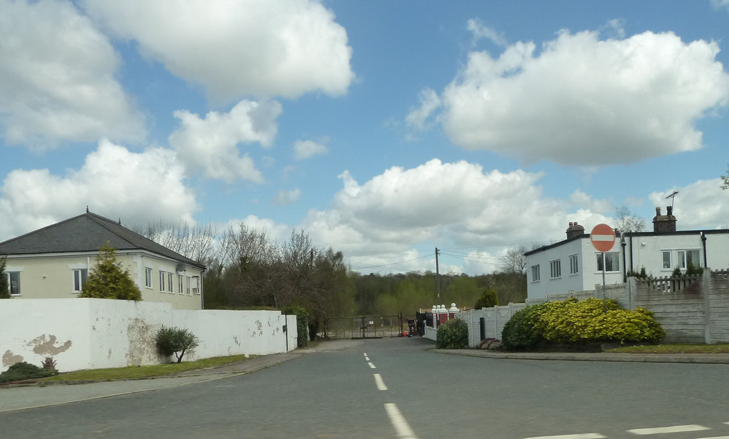
No colliery structures survive. The site has been redeveloped as Symmetry Park, an employment area within the wider Halsnead Garden Village scheme; logistics company Yodel opened the first completed unit, a 161,900 sq ft distribution facility, in March 2024, and further warehouse units were approved by Knowsley Council in December 2024.
Redevelopment
Halsnead Garden Village is a mixed-use scheme on the former colliery and adjoining land delivering around 1,600 homes alongside at least 22.5 hectares of employment land, 33 hectares of new greenspace and a 28-hectare country park; part of the former colliery railway trackbed, including the bridge carrying Windy Arbor Road, remains walkable.
Related mines
- Pretoria Pit (Hulton Colliery Bank Pit) — Cronton was sunk by the Hulton Colliery Company -- the same company behind Pretoria Pit (Hulton Colliery).
Nearby mines
- Whiston Colliery — 1.0 miles (1.6 km) NW
- Clock Face Colliery — 3.2 miles (5.2 km) NE
- Alexandra Colliery — 3.4 miles (5.4 km) NE
- Ravenhead Colliery — 4.0 miles (6.4 km) NE
- Sherdley Colliery — 4.0 miles (6.4 km) NE
Straight-line distance, within 9 miles (15 km). Show on the map.
Disasters & major incidents
-
Cronton Colliery explosion
11 December 1917 · Explosion · 8 fatalities
An explosion in the Pasture (Crombouke) seam during the morning shift killed eight men after two shots were fired simultaneously at adjoining stalls, likely igniting firedamp released by a roof fall.
Recorded claims
Individual factual claims, each attached to the source(s) that support it below. Where sources disagree, both are kept.
- Cronton Colliery was sunk by the Hulton Colliery Company from 1913, on the old Halsnead estate near Prescot. 1
- The coal-winding shaft reached a depth of 475 m (1,558 ft) in 1916. 1,2
- In 1966 Cronton pioneered retreat mining at a British colliery — a method already used on the Continent — which roughly doubled the pit's output. 1
- Cronton Colliery closed on 2 March 1984, shortly before the start of the 1984–85 miners' strike. 1,3
- An explosion in the Pasture (Crombouke) seam on 11 December 1917 killed eight men after two shots were fired simultaneously at adjoining stalls, likely igniting firedamp released by a roof fall; the inquest returned a verdict of death by misadventure. 4
- The former colliery site now forms Symmetry Park within the Halsnead Garden Village scheme; logistics company Yodel opened the first completed distribution unit there in March 2024. 5
Sources
- (secondary) Cronton Colliery (1913-1984) — Northern Mine Research Society
- (primary) BGS/Coal Authority mine plans catalogue: Cronton — British Geological Survey / Mining Remediation Authority
- (observational) The Willis Branch & Cronton Colliery — 8D Association
- (secondary) Cronton Colliery Explosion, Widnes, 1917 — Northern Mine Research Society
- (secondary) Halsnead Garden Village employment site progresses as final plans approved for next phase — Halsnead Garden Village
Record created: 26 August 2026 · Last researched: 26 August 2026