 MineArchive
Cape Cornwall Mine
| Location | Cape Cornwall, 1.9km west of St Just, Cornwall — 50.1269, -5.7092 (exact) |
|---|---|
| Commodity | Tin |
| Type | Metal |
| Worked | 1838–1883 |
| Maximum depth | Unknown. |
| Operators | St Just Consolidated Mines (1864–1869), St Just United (1879–1883) |
Overview
A tin mine worked in three separate phases at the westernmost point of mainland Cornwall, whose 1864 engine-house chimney survives as a landmark and navigation aid on the cape itself.
History
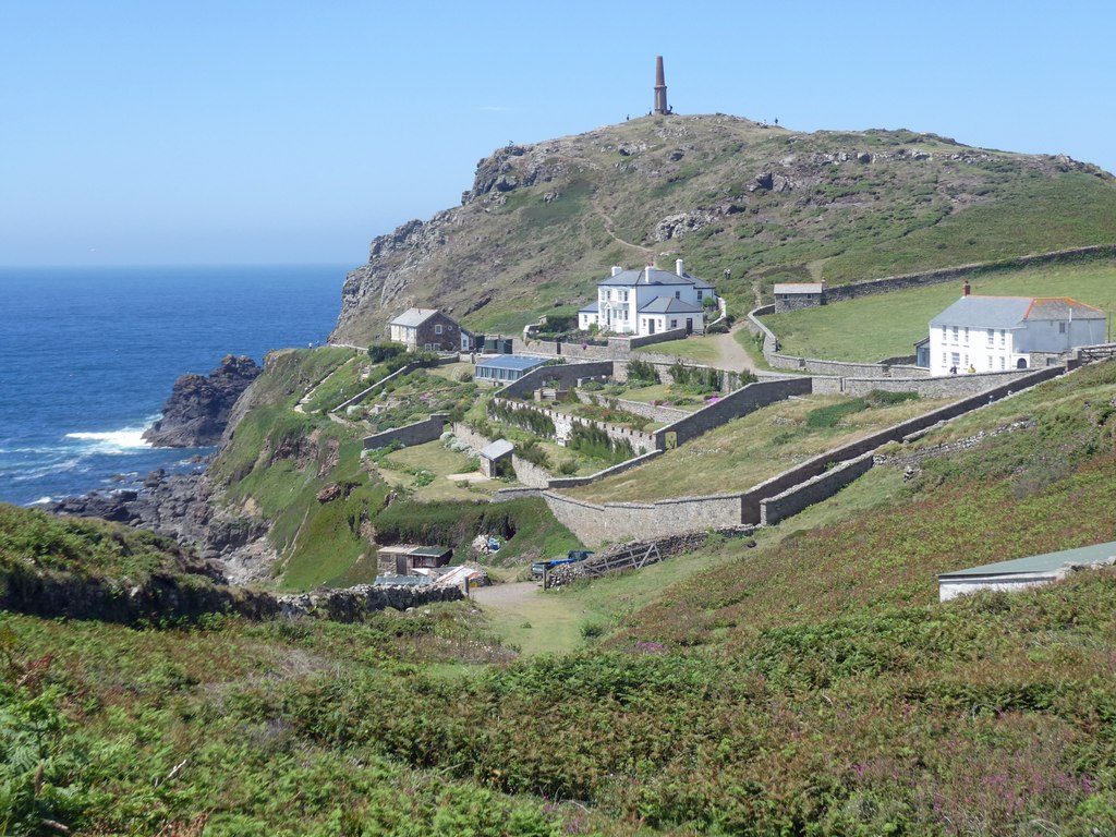
Cape Cornwall Mine was worked at Cape Cornwall, 1.9 km west of St Just, across three distinct phases: 1838-1849, 1864-1875 and 1879-1883. In 1841, during its first phase, the mine employed 100 men, 2 women and 26 boys, but development was hampered by the erratic quality of the lode and an apparent lack of investment, and it closed as a small and relatively unremarkable working in 1849. It reopened in 1864 under St Just Consolidated Mines, which built an engine house near the peak of the cape to serve the boiler of the mine's whim, connected by a stone flue running up the hillside; a tall octagonal chimney with round-headed blind arches and a corbelled cornice survives from this phase and was deliberately retained afterwards as an aid to navigation. St Just Consolidated Mines abandoned the workings in 1869, though the mine continued to operate independently until 1875. A final phase, 1879-1883, was worked under St Just United. The mine's own vertical plan survives in the British Geological Survey's collection, passed on by Pendeen Community Heritage at Geevor.
Geology
Tin at Cape Cornwall in the St Just district, on a lode of erratic quality — which, with a want of investment, is what hampered the first phase of working.
Workings
Worked in three phases (1838-49, 1864-75, 1879-83); the mine's whim was served by a boiler house connected via a stone flue to an 1864 engine house near the cape's peak.
Closure
Closed for the final time in 1883, after three separate working phases going back to 1838.
What remains
The 1864 chimney survives as a landmark on Cape Cornwall, deliberately retained after mining ended as an aid to navigation for shipping; the site is now owned by the National Trust as part of its Tin Coast holdings.
The octagonal 1864 engine-house chimney, with round-headed blind arches and a corbelled cornice.
Nearby mines
- St Just Amalgamated Mines — 0.4 miles (0.6 km) SE
- Wheal Bellan — 0.5 miles (0.8 km) SE
- Boswedden Mine — 0.6 miles (1.0 km) E
- Wheal Cunning — 0.8 miles (1.2 km) E
- Wheal Hermon — 0.9 miles (1.4 km) SE
Straight-line distance, within 9 miles (15 km). Show on the map.
Recorded claims
Individual factual claims, each attached to the source(s) that support it below. Where sources disagree, both are kept.
- Cape Cornwall Mine worked in three phases: 1838-1849, 1864-1875 (reopened by St Just Consolidated Mines, which abandoned it in 1869 though it continued independently) and 1879-1883 under St Just United. 1
- In 1841 the mine employed 100 men, 2 women and 26 boys; development was hampered by the erratic quality of the lode and a lack of investment. 2
- A vertical plan of Cape Cornwall Mine, given to the British Geological Survey by Pendeen Community Heritage at Geevor Tin Mine (MP24644), can be viewed online; a horizontal section and North Lode sections are catalogued beside it. 3
- The mine's chimney stands on the headland of Cape Cornwall at 50.1269, -5.7092. 1
Photographs & further reading
A fuller history of the mine's three working phases.
View sourceThe scanned vertical plan of the mine from Pendeen Community Heritage, viewable online.
View sourceSources
- (secondary) Cape Cornwall Mine — Wikipedia
- (secondary) Cape Cornwall Mine — Northern Mine Research Society
- (primary) A VERTICAL PLAN CAPE CORNWALL MINE (Mine plan MP24644, BGS mine plans catalogue) — British Geological Survey / Mining Remediation Authority
Record created: 1 September 2026 · Last researched: 24 September 2026