 MineArchive
Boswedden Mine
| Also known as | Wheal Call, Wheal Castle |
|---|---|
| Location | Kenidjack Valley, St Just, Cornwall — 50.1280, -5.6950 (approximate) |
| Commodities | Tin, Copper |
| Type | Metal |
| Worked | 1808–1876 |
| Maximum depth | Unknown. |
| Operators | Boswedden and Wheal Castle (1836–1872), Wheal Cunning United (1872–1876) |
Overview
A tin and copper mine on the south side of Kenidjack Valley, also known as Wheal Call, worked through most of the 19th century and powered by a 65-foot waterwheel reputedly the second largest in Britain.
History
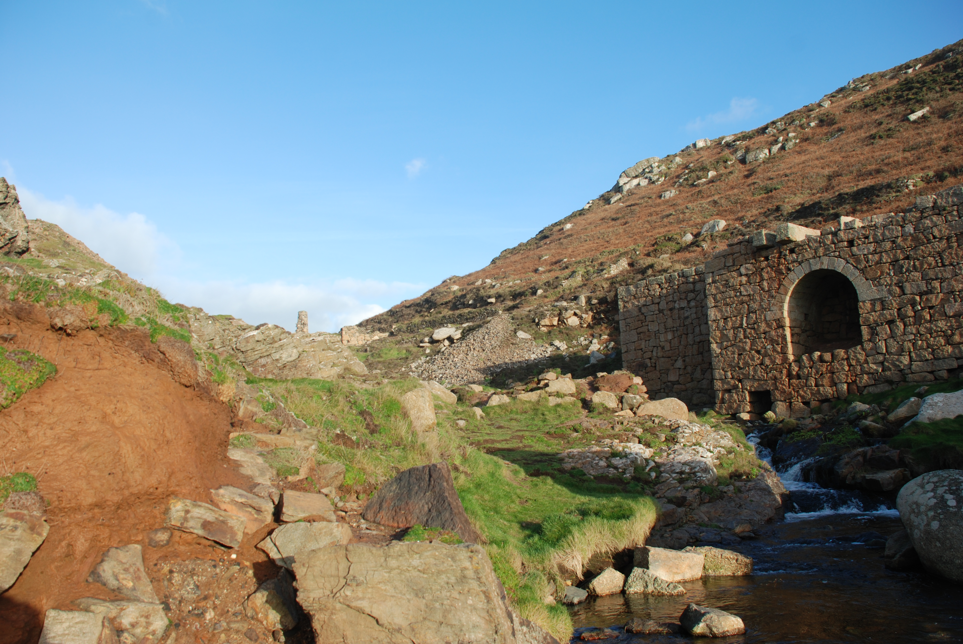
Boswedden Mine -- also known as Wheal Call -- worked the south side of Kenidjack Valley for tin throughout the 1800s, and absorbed the neighbouring Wheal Castle sett, whose own bounds were first recorded in 1737 though production was only documented from 1808, before 1841. Between 1837 and 1876 the combined mine produced some 1,375 tons of tin and 200 tons of copper. Its wheel house held what was reputedly the second-largest waterwheel in Britain, some 65 feet in diameter, turned by the Tregeseal River and said to be the largest wheel in Cornwall.
Geology
Tin and copper of the St Just district in west Cornwall; the lodes worked are not named on the record.
Workings
Worked tin (and, more modestly, copper) via the absorbed Wheal Castle sett, powered by a 65-foot waterwheel on the Tregeseal River.
Closure
Boswedden and Wheal Castle amalgamated into Wheal Cunning United in 1872; within two years only Wheal Cunning itself remained working, and plant was advertised for sale before the venture closed in 1876. A brief, limited revival at Wheal Castle between 1883 and 1886 achieved little. The Great Freeze of 1892 destroyed several of the valley's buildings, and what survived was used for demolition practice by the military during the Second World War.
What remains
The remains of the engine house for the 65-foot waterwheel -- reputedly the second largest in Cornwall -- survive at the base of Kenidjack Valley, along with the ruins of a 28-inch stamps engine, consolidated by the National Trust after wartime demolition damage.
Related mines
- Wheal Cunning — Boswedden, itself an amalgamation styled Boswedden and Wheal Castle from 1836, was brought in with Wheal Cunning to work as Wheal Cunning United in 1872.
Nearby mines
- Wheal Cunning — 0.2 miles (0.3 km) SE
- Boscean Mine — 0.3 miles (0.5 km) NE
- Wheal Bellan — 0.5 miles (0.7 km) SW
- St Just Amalgamated Mines — 0.5 miles (0.8 km) SW
- Wheal Drea — 0.5 miles (0.8 km) NE
Straight-line distance, within 9 miles (15 km). Show on the map.
Recorded claims
Individual factual claims, each attached to the source(s) that support it below. Where sources disagree, both are kept.
- Wheal Castle Bounds, first recorded in 1737 with production documented from 1808, was incorporated into Boswedden before 1841; between 1837 and 1876 the combined mine produced some 1,375 tons of tin and 200 tons of copper. 1
- Boswedden's wheel house held what was reputedly the second-largest waterwheel in Britain, some 65 feet in diameter, turned by the Tregeseal River and said to be the largest in Cornwall. 1,2
- Boswedden's plant was amalgamated into Wheal Cunning United in 1872, sold off by 1874 and closed in 1876; a limited 1883-86 revival at Wheal Castle achieved little, and the Great Freeze of 1892 destroyed several valley buildings, with survivors used for military demolition practice in the Second World War. 1,3
Sources
- (secondary) Boswedden Mine — Wikipedia
- (secondary) Kenidjack Valley — Wikipedia
- (secondary) Boswedden Mine — Explore Cornwall
Record created: 31 August 2026 · Last researched: 31 August 2026