 MineArchive
Burngrange Oil Shale Mine
| Location | West Calder, Midlothian — 55.8425, -3.5606 (approximate) |
|---|---|
| Commodity | Oil Shale |
| Type | Mineral |
| Worked | 1936–1962 |
| Operators | Young's Paraffin Light and Mineral Oil Company (1936–1962) |
Overview
A relatively new Scottish oil-shale mine whose 1947 explosion and fire killed fifteen men, by far the greatest single loss of life anywhere in the shale oil industry's history.
History
Burngrange Mine, near West Calder, was owned by Young's Paraffin Light and Mineral Oil Company Ltd, a subsidiary of Scottish Oils Ltd, and was a relatively new mine, having only begun production in 1936, worked within a shale oil industry that had operated in the surrounding district since 1858. On the evening of 10 January 1947, an open acetylene cap lamp ignited a pocket of firedamp underground; the resulting explosion and fire spread rapidly through the workings, and of the 53 men underground that shift, only 38 came out alive, with a further body recovered alongside the survivors — 14 men remained trapped behind debris and fire, and all were later confirmed dead, mostly from afterdamp. The mine continued in production for a further fifteen years before closing in 1962, as Scotland's wider shale oil industry wound down in the face of cheaper imported petroleum.
Geology
Burngrange worked the oil-bearing shale beds of the Lothian (or cannel) shales, part of the wider West Lothian shale oil field that had been worked since 1858.
Geological setting: Sedimentary Beds and Seams (well documented example)
Workings
Oil shale was worked underground and brought to the surface for retorting — heating the rock to drive off a petroleum-like oil — at the extensive processing works the wider industry operated across the district.
Closure
Burngrange closed in 1962 as Scotland's shale oil industry as a whole declined in the face of cheaper imported crude oil.
What remains
The site forms part of the wider West Lothian shale-mining landscape, now largely reverted to open ground alongside the area's distinctive shale bings.
Little survives of the mine's own surface plant; the wider district retains the large red shale-waste bings characteristic of the Scottish shale oil industry.
Related mines
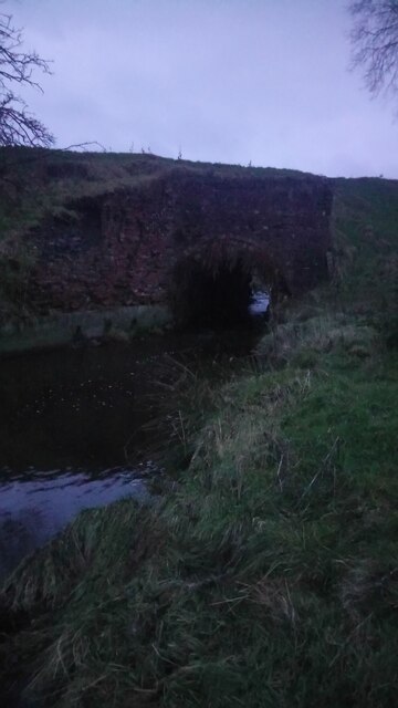
- Addiewell Oil Works — Burngrange shale went by rail to the Addiewell works to be retorted; the bridge that carried it over the West Calder Burn still stands.
- Baads Colliery — Neighbouring Young's Company workings near West Calder, shale at Burngrange and coal at Baads.
- Tarbrax Oil Shale Mine — West Lothian shale mines about six kilometres apart, working the same oil shale field.
Nearby mines
- Baads Colliery — 1.5 miles (2.4 km) SW, West Lothian
- Addiewell Oil Works — 2.1 miles (3.3 km) W, West Lothian
- Foulshiels Colliery — 3.0 miles (4.8 km) W, West Lothian
- Loganlea Colliery — 3.0 miles (4.9 km) W, West Lothian
- Woodmuir Colliery — 3.3 miles (5.3 km) W, West Lothian
Straight-line distance, within 9 miles (15 km). Show on the map.
Disasters & major incidents
-
Burngrange Oil Shale Mine explosion and fire, 1947
10 January 1947 · Explosion · 15 fatalities
An open acetylene cap lamp ignited firedamp underground at Burngrange Oil Shale Mine on the evening of 10 January 1947, triggering an explosion and fire that killed 15 of the 53 men underground that shift — the greatest single loss of life in the history of Scotland's shale oil industry.
Recorded claims
Individual factual claims, each attached to the source(s) that support it below. Where sources disagree, both are kept.
- Burngrange began production in 1936, within a shale oil industry that had operated in the surrounding West Calder district since 1858. 1
- An explosion and fire on 10 January 1947, caused by an open acetylene lamp igniting firedamp, killed 15 of the 53 men underground that shift — the greatest single loss of life in the history of the Scottish shale oil industry. 2,3
- The mine closed in 1962 as the wider Scottish shale oil industry declined in the face of cheaper imported petroleum. 1
Photographs & further reading
The Museum of the Scottish Shale Oil Industry on the mine: the sinking, the workings, the 1947 disaster and what became of the site.
View sourceThe Gazetteer for Scotland on the explosion and fire of 10 January 1947, the worst single loss of life in the Scottish shale oil industry.
View sourceSources
- (secondary) Burngrange No. 1 & 2 pits — Scottish Shale
- (secondary) Burngrange mining disaster — Wikipedia
- (secondary) Burngrange Mining Disaster — Scottish Places
- (observational) Former shale railway bridge over West Calder Burn (Geograph 6713598) — Geograph Britain and Ireland, Ian Dodds
Record created: 21 August 2026 · Last researched: 11 September 2026